













September 15, 2020
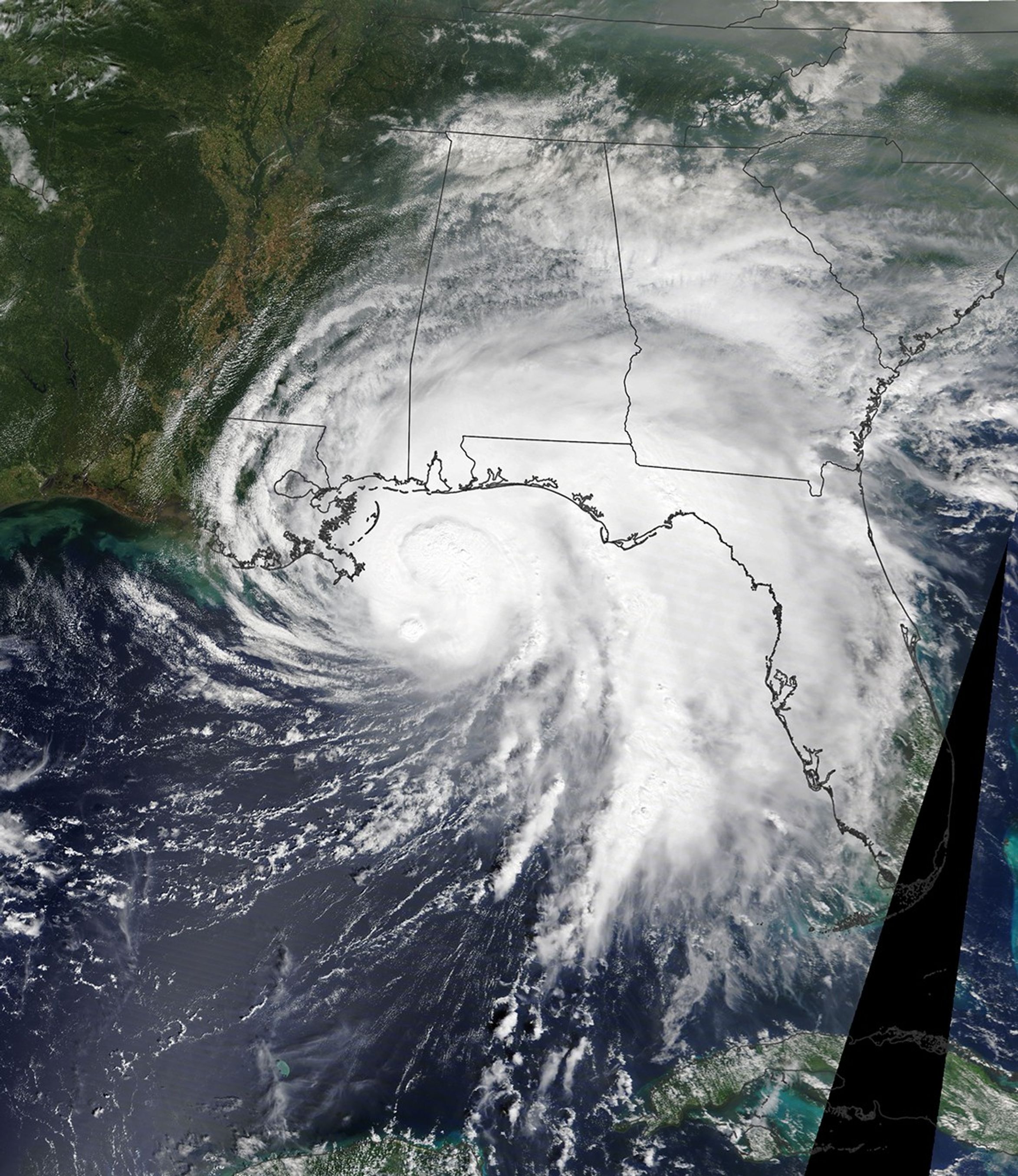
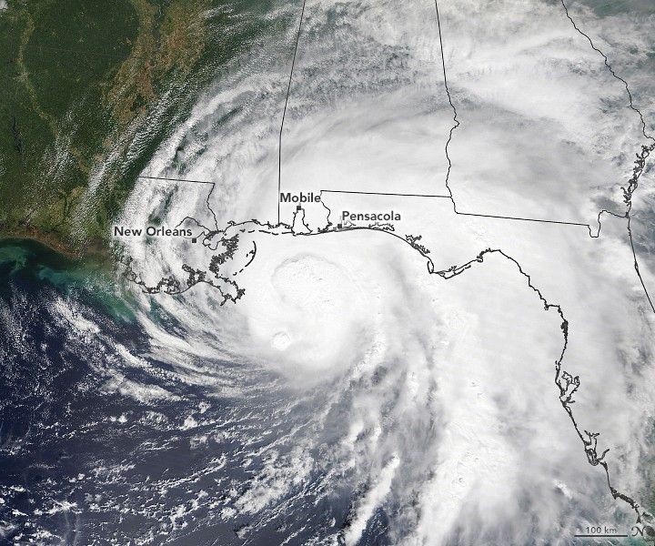
On September 15, 2020, the Moderate Resolution Imaging Spectroradiometer (MODIS) on NASA’s Terra satellite captured this midday image as the slow-moving, category 2 hurricane inched closer to the U.S. Gulf Coast. The National Hurricane Center warned of life-threatening flash floods and storm surges through September 16. Sally could drop 10-20 inches (25-50 centimeters) of rain on parts of the Gulf Coast between Mississippi and the Florida panhandle.
References & Resources
- AccuWeather (2020, September 15) Hurricane Sally could dump 30 inches of rain on parts of Gulf Coast. Accessed September 15, 2020.
- National Hurricane Center Hurricane Sally. Accessed September 15, 2020.
NASA Earth Observatory image by Lauren Dauphin, using MODIS data from NASA EOSDIS/LANCE and GIBS/Worldview . Caption by Kasha Patel .