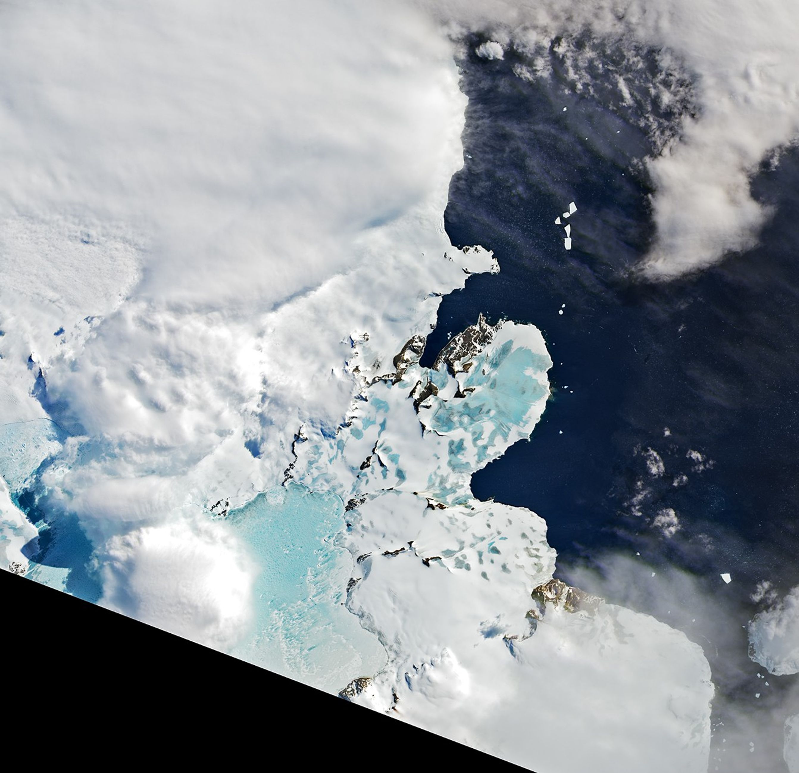


In mid-November, about a month before the start of summer in the southern hemisphere, the Antarctic melting season is usually just starting. By that time this year, vast areas along the Antarctic Peninsula were already painted blue with meltwater.
This natural-color image was acquired on November 21, 2020, by the Moderate Resolution Imaging Spectroradiometer (MODIS) on NASA’s Terra satellite. The sea ice anchored to the peninsula’s coast appears light blue where the surface ice has melted. The white ice farther off the coast is a mixture of broken sea ice and small icebergs. Dark areas indicate open water.
By the end of November 2020, much of the meltwater on the ice had refrozen. But scientists want to know if this event was similar to a strong early season melt that launched the 2019-2020 melt season. Last year, unusually warm air and water led to record-breaking melting across the Larsen C Ice Shelf. It is the largest remaining ice shelf along the Antarctic Peninsula, even though it lost a Delaware-sized iceberg in 2017.
Widespread melting on Larsen C, located just south of this image, was not apparent in natural-color satellite images. But scientists are watching how this season progresses. The ice shelf surface on the Larsen A was full of ponded meltwater just before its complete collapse in 1995; the same thing occurred before the near-complete collapse of Larsen B in 2002.
Only a small remnant of the Larsen B Ice Shelf remains today, stabilized by fast ice in front of the shelf. Loss of the fast ice can destabilize the floating shelf ice, which in turn would allow glacial ice on land to flow unimpeded into the ocean. The effect has already been observed in the Larsen A and upper Larsen B embayments.
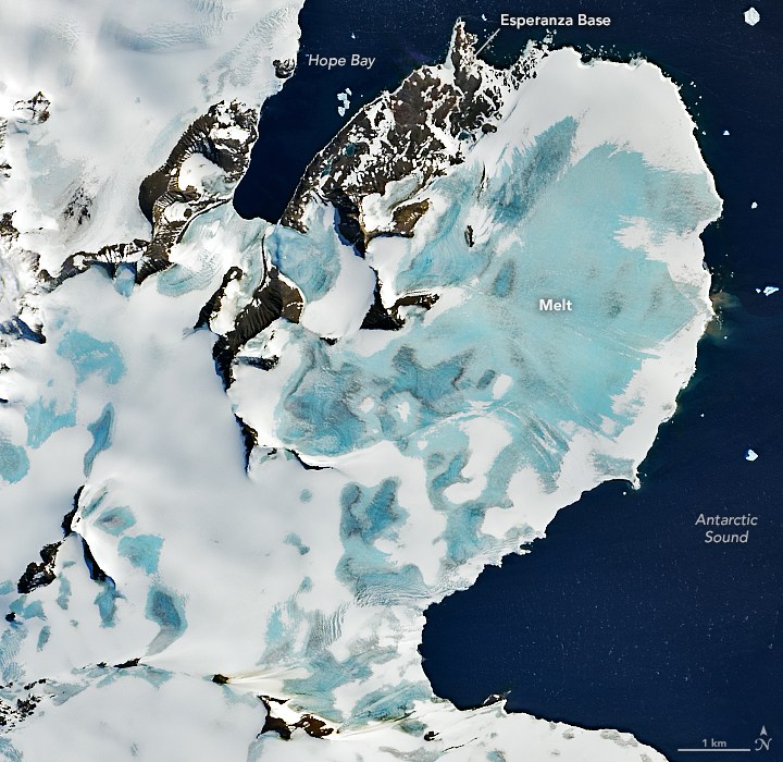
The second image, acquired on November 11, 2020, by the Operational Land Imager (OLI) on the Landsat 8 satellite, offers a detailed view of melting near the northernmost end of the Peninsula. The high temperature recorded that day at Esperanza Base measured 8°C (47°F). That was warmer than average for November, but not nearly as hot as the record-breaking 18.3°C (64.9°F) reached on February 6, 2020. Time will tell if temperatures this melt season will continue to climb and how the ice will respond.
References & Resources
- Eos (2020, November 12) Antarctica in a Changing Climate. Accessed December 2, 2020.
- Khazendar, A. et al. (2015) The evolving instability of the remnant Larsen B Ice Shelf and its tributary glaciers. Earth and Planetary Science Letters, 419 (2015), 199â210.
- NASA Earth Observatory (2017, February 7) Antarcticaâs Changing Larsen Ice Shelf.
- Scott, R. C. et al. (2019) Meteorological Drivers and Large-Scale Climate Forcing of West Antarctic Surface Melt. Journal of Climate, 32 (3), 665â684.
NASA Earth Observatory images by Lauren Dauphin, using Landsat data from the U.S. Geological Survey and MODIS data from NASA EOSDIS/LANCE and GIBS/Worldview . Story by Kathryn Hansen , with image interpretation from Christopher Shuman (NASA/UMBC).