![Request for Information – Potential [Placeholder for Prize]](https://assets.science.nasa.gov/dynamicimage/assets/science/psd/solar/2023/09/s/solarsystem_0.jpg?w=1024)


Today’s story is the answer to the Earth Observatory December puzzler.
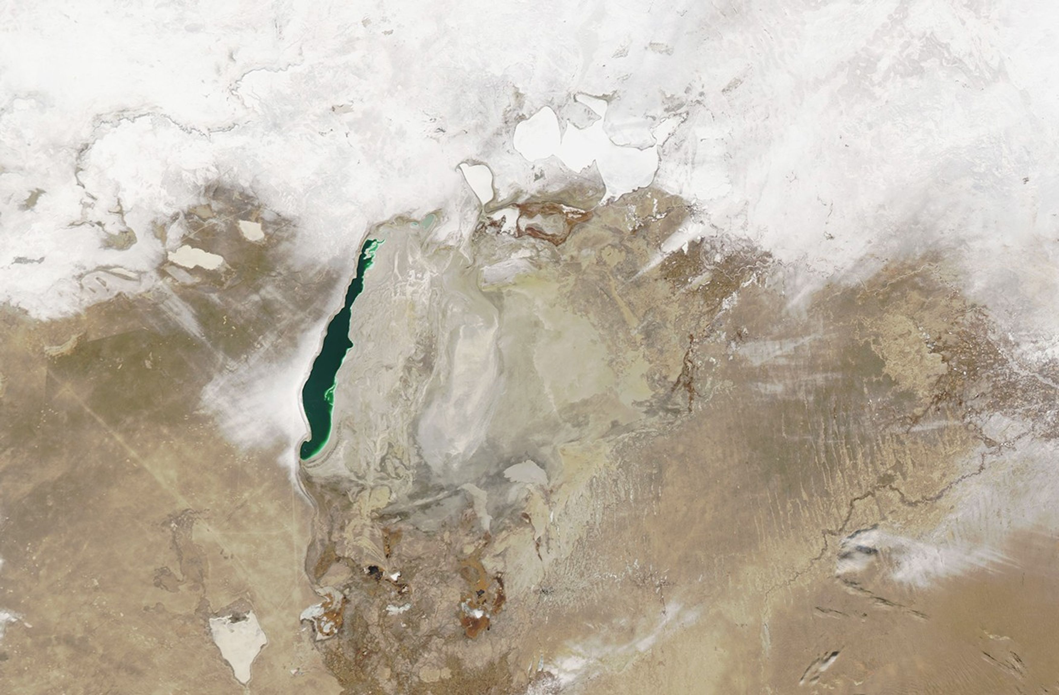
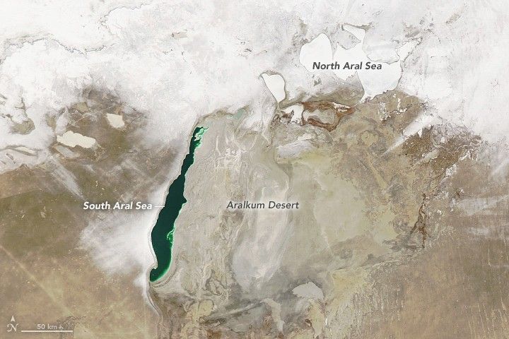
Transformation is common around the Aral Sea. Perhaps the most obvious shift has been the shrinking of the inland lake since the 1960s and its separation in 2007 into three distinct basins. But this region of Central Asia transforms in other ways, too: from hot and dry in the summer to cold and snowy in the winter.
Winter was under way when the Moderate Resolution Imaging Spectroradiometer (MODIS) on NASA’s Aqua satellite acquired this image on December 27, 2020. Snow blanketed the ground around the North Aral Sea in Kazakhstan and areas west of the South Aral Sea in Uzbekistan.
Notice that the North Aral Sea appears entirely frozen over. Fishermen in the small town of Tastubek, Kazakhstan, on the lake’s north side, endure winters with sub-zero temperatures, yet they continue to fish on the lake through holes dug in the ice. (For comparison, summertime temperatures rise above 40°C (110°F). On the day this image was acquired, the high temperature in Tastubek was -9°C (15°F).
The western basin of the South Aral Sea remained mostly ice free, with jade-green water contrasting with the stark tan landscape. In some years, when winter temperatures are exceptionally low, ice can cover a large expanse of the lake. (It did so in February 2006 and February 2012.) But more often than not it looks similar to the image above.
There is one hallmark of winter visible near the southern portions of the Aral Sea: the band of white fanning out from the lake’s western shore is likely snow cover. The prevailing winds in wintertime blow from east to west, which can produce “lake-effect snow” similar to what occurs around the Great Lakes of North America.
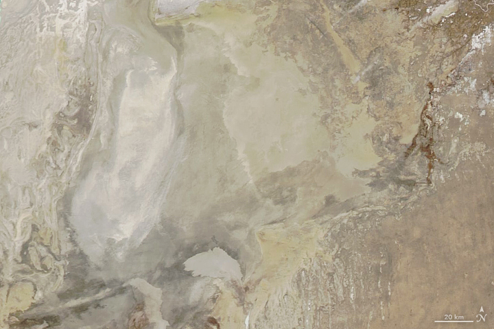
Toward the east, the dry bed of the Aral Sea’s eastern basin is now sometimes referred to as the Aralkum Desert (detailed image, above). Recent research has shown that in wintertime, the lake’s desiccation could cause precipitation in the immediate area to fall as snow as opposed to rain because the dry surface is colder than a wet one. In contrast, the dry surface is thought to lead to substantial regional warming in summer.
References & Resources
- Sharma, A. et al. (2017) Impact of Desiccation of Aral Sea on the Regional Climate of Central Asia Using WRF Model. Pure and Applied Geophysics 175 (2018), 465â478.
- University of Greifswald What are temperate deserts? Accessed December 31, 2020.
- The Weather Channel (2017, April 28) Winter on the Frigid Aral Sea (PHOTOS). Accessed December 31, 2020.
- The Weather Channel (2020, December) Tastubek, Kazakhstan Monthly Weather. Accessed December 31, 2020.
NASA Earth Observatory images by Lauren Dauphin, using MODIS data from NASA EOSDIS/LANCE and GIBS/Worldview . Story by Kathryn Hansen .