Several potent storms stirred over the Pacific Ocean in late July 2023. While Tropical Storm Calvin moved closer to the Hawaiian Islands in the Central Pacific basin, Typhoon Talim closed in on China in the Western Pacific.
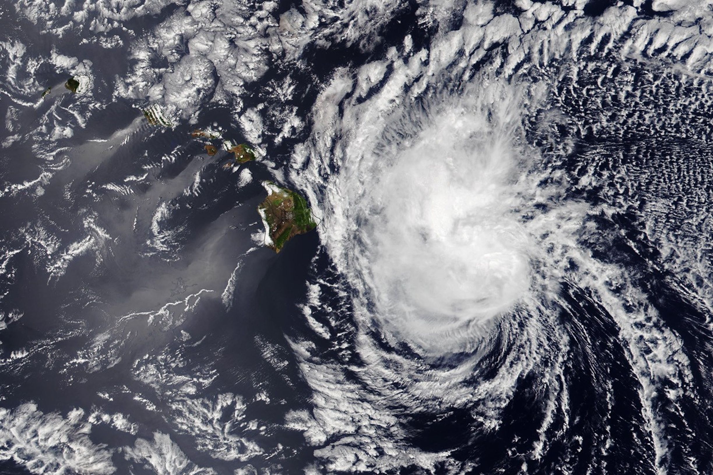
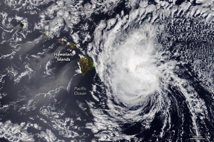
This image shows Tropical Storm Calvin at 1:40 p.m. local time (23:40 Universal Time) on July 18, 2023. It was acquired with the Visible Infrared Imaging Radiometer Suite (VIIRS) on the NOAA-20 satellite.
At the time of this image, Calvin was a tropical storm centered about 220 miles (355 kilometers) east-southeast of Hilo, Hawai’i. Winds measured 60 miles (95 kilometers) per hour, having weakened substantially since July 14 when Calvin was a category 3 hurricane. Forecasters expected additional weakening as the storm moves westward.
Although Calvin’s center remained south of the island chain, forecasters noted that tropical-storm force winds extended up to 140 miles from its center on the afternoon of July 18. Tropical storm conditions were expected to reach Hawaii County that evening. Officials declared a state of emergency on the island of Hawai’i, where some businesses, schools, and parks were closed on July 19.
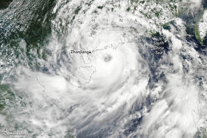
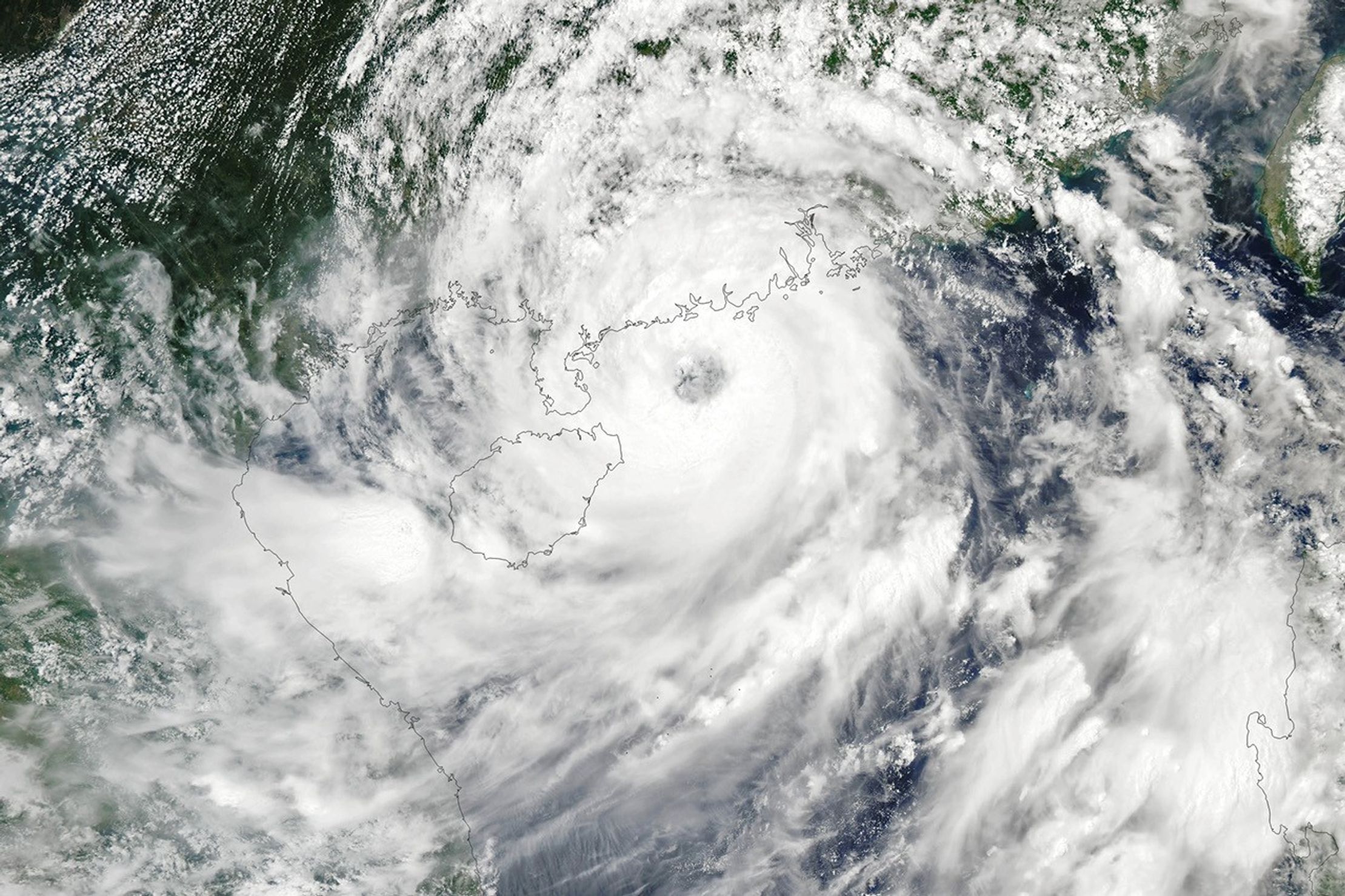
That same week, Typhoon Talim in the Western Pacific struck China. The Moderate Resolution Imaging Spectroradiometer (MODIS) on NASA’s Aqua satellite acquired this image at about 2 p.m. local time (06:00 Universal Time) on July 17, 2023, about eight hours before the storm made landfall in Zhanjiang, a port city in China’s Guangdong province.
At the time of landfall, the typhoon had maximum winds of 85 miles (137 kilometers) per hour, according to news reports. The storm displaced more than 200,000 people in Guangdong province, flooded roads, and disrupted train and air transportation.
Talim was the fourth typhoon of the year, but the first to hit China. The Western Pacific typhoon season stretches across the entire year, but most storms usually form between May and October.
References & Resources
- National Hurricane Center (2023, July 18) Tropical Storm CALVIN. Accessed July 19, 2023.
- Reuters (2023, July 18) Typhoon Talim leaves behind crushed vehicles, beached whale in southern China. Accessed July 19, 2023.
- Reuters (2023, July 17) Typhoon Talim lands in southern China, flights and trains cancelled. Accessed July 19, 2023.
NASA Earth Observatory images by Wanmei Liang , using MODIS data from NASA EOSDIS LANCE and GIBS/Worldview and VIIRS data from NASA EOSDIS LANCE , GIBS/Worldview , and the Joint Polar Satellite System (JPSS). Story by Kathryn Hansen .