

September 10, 2023
Torrential Rain Wreaks Havoc in Libya
On September 10, 2023, a low-pressure storm brought heavy rains to northeastern Libya, causing deadly flooding and devastation in cities along the Mediterranean coast.
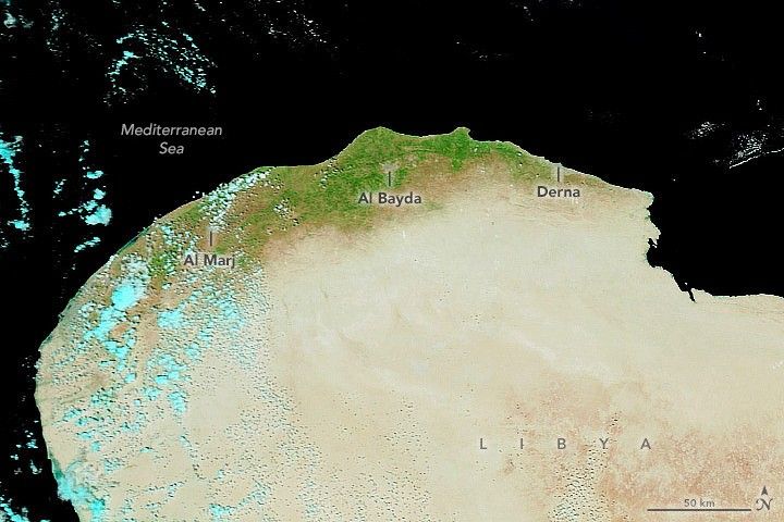
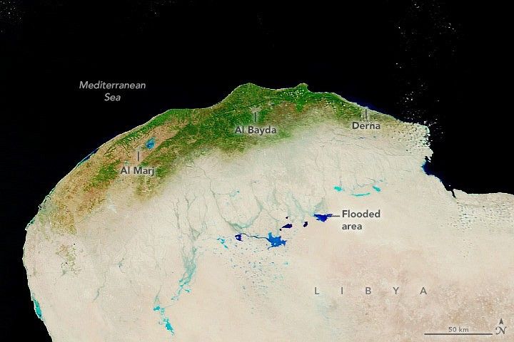
On the coast of Libya’s Cyrenaica region, Al Bayda recorded 414 millimeters (16 inches) of rain in one day. Nearby, the port city of Derna received more than 100 millimeters (4 inches) over the course of the storm—far exceeding the city’s average monthly rainfall for September of less than 1.5 millimeters (0.1 inches).
Derna lies at the end of a long, narrow valley, called a wadi, which is dry for most of the year. Floods triggered two dams along Wadi Derna to collapse, sending floodwater and mud to the city. According to news reports, floodwater swept away roads and entire neighborhoods.
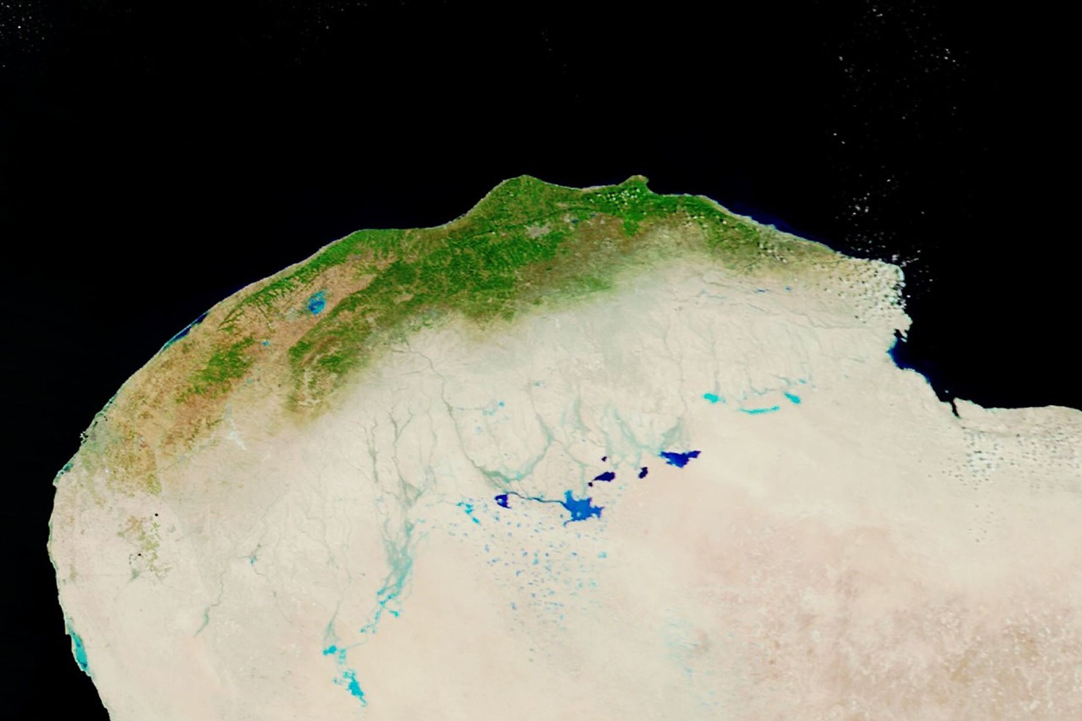
The images above show the Cyrenaica region before and after the storm. They are false color, which makes water (blue) stand out from the surroundings. The image on the right, acquired on September 13, shows water filling low-lying areas and wadis inland from the coast. The image on the left shows the same area on September 7. Both images were acquired with the Moderate Resolution Imaging Spectroradiometer (MODIS) on NASA’s Terra satellite. The flooding and damage in Derna is difficult to see at this resolution, although sediment flowing into the Mediterranean is visible in natural color images.
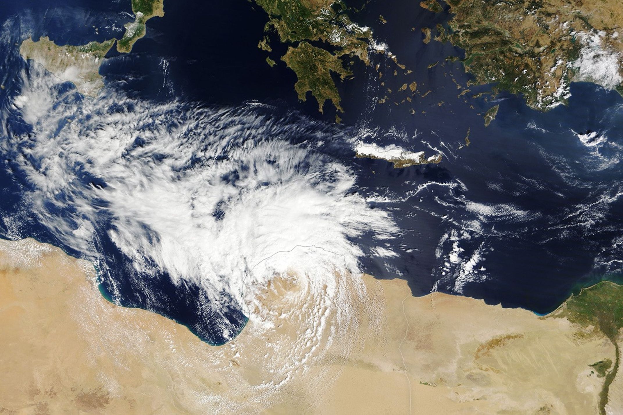
In the days prior to making landfall in Libya, the same low-pressure storm (named Storm Daniel by the Hellenic National Meteorological Service) swamped parts of Greece, Turkey, and Bulgaria. As the storm approached Libya, it developed characteristics of a tropical-like cyclone, or “medicane,” with winds measuring around 70 to 80 kilometers (43 to 50 miles) per hour.

The natural-color image above, acquired with MODIS on NASA’s Terra satellite, shows the storm on September 10 as it made landfall in northeastern Libya. Only one or two medicanes typically develop in a year, according to NOAA.
As of September 13, authorities were still conducting search and rescue operations in the region. Derna was still largely inaccessible on that day, making it difficult to assess the full impact of the flood.
References & Resources
- European Commission, Emergency Response Coordination Centre (2023, September 13) European Civil Protection and Humanitarian Aid Operations (ECHO) Daily Flash: Libya—Floods, update. Accessed September 13, 2023.
- The Guardian (2023, September 12) Destruction in Derna: how floods ravaged Libyan port city. Accessed September 13, 2023.
- International Charter Space and Major Disasters Flooding in Libya. Accessed September 13, 2023.
- NASA Earth Observatory (2023, September 9) A Deluge in Greece. Accessed September 13, 2023.
- The New York Times (2023, September 13) What We Know About the Deadly Floods in Libya. Accessed September 13, 2023.
- The New York Times (2023, September 12) More Than 5,000 Dead in Libya as Collapsed Dams Worsen Flood Disaster. Accessed September 13, 2023.
- REACH, via ReliefWeb (2023, September 12) Libya Floods/Storm Daniel: accumulated rainfall and potentially exposed population. Accessed September 13, 2023.
- World Meteorological Organization (2023, September 12) Storm Daniel leads to extreme rain and floods in Mediterranean, heavy loss of life in Libya. Accessed September 13, 2023.
- Yale Climate Connections (2023, September 13) The Libya floods: a climate and infrastructure catastrophe. Accessed September 13, 2023.
NASA Earth Observatory images by Wanmei Liang , using MODIS data from NASA EOSDIS LANCE and GIBS/Worldview . Story by Emily Cassidy .