


February 2-14, 2023
Fires Scar the Chilean Landscape
In early February 2023, wildland fires raged across central and southern Chile. The blazes killed dozens, injured thousands, and left many people homeless. The smoke that previously poured over the Pacific Ocean has since lessened, but the scars on the landscape remain.
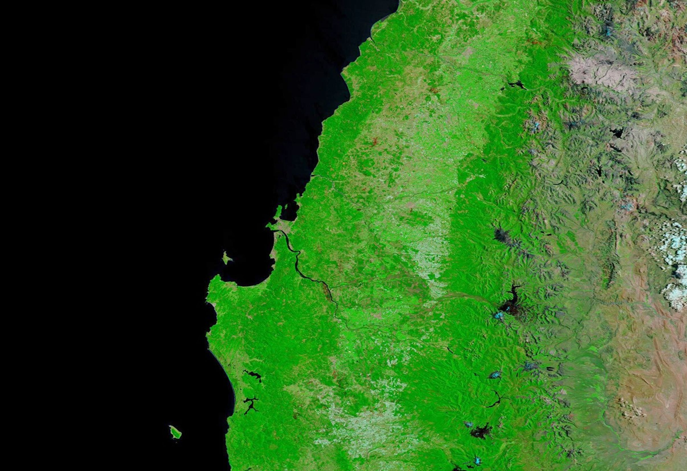
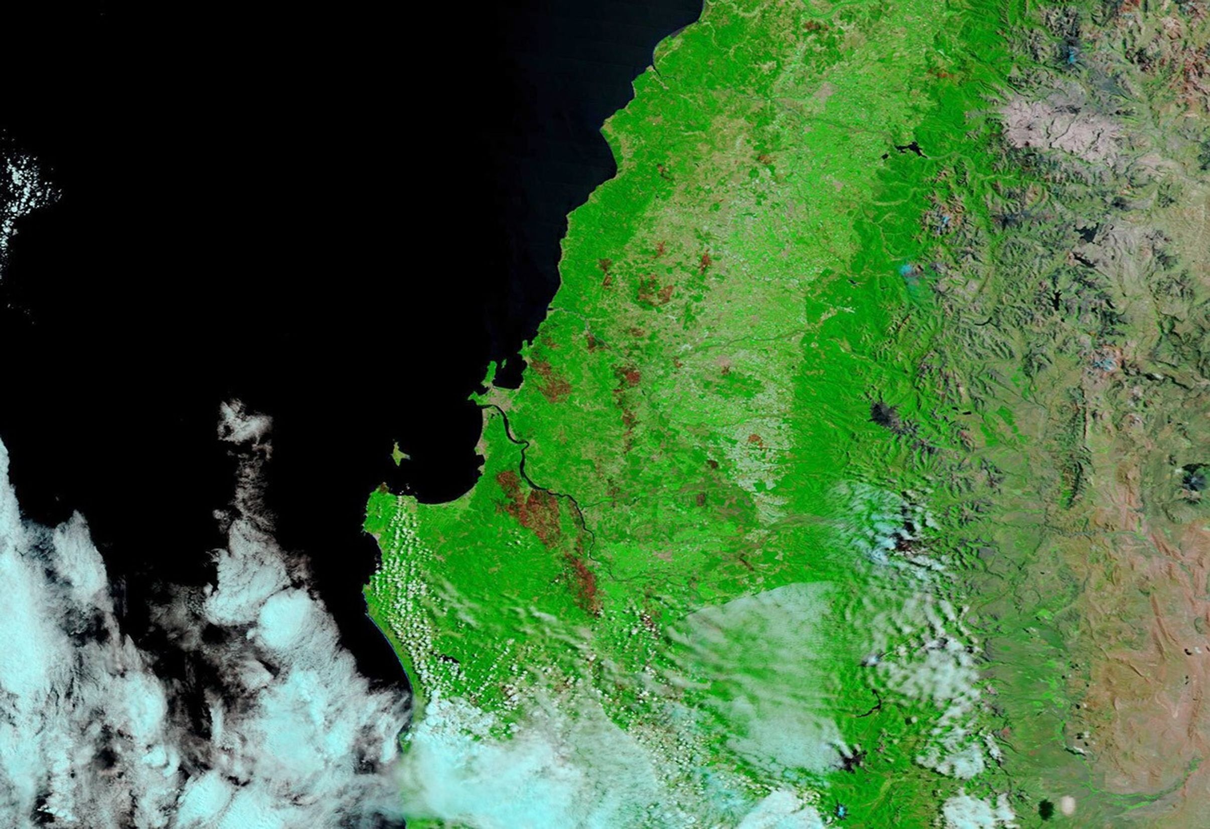
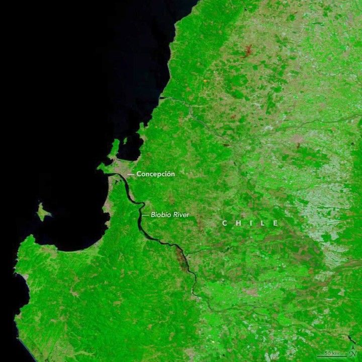
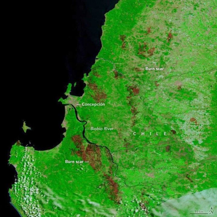
The Moderate Resolution Imaging Spectroradiometer (MODIS) on NASA’s Terra satellite acquired these images before and after the outbreak of fires. The images are false-color, composed from a combination of shortwave infrared and visible light (MODIS bands 7-2-1), which makes it easier to distinguish the burn scar on the landscape.
The left image, acquired on the morning of February 2, 2023, shows a lush green landscape with only a few distinct burn scars, including one along the Biobío River from a fire in December 2022. By the afternoon of February 2, smoke streamed from fires that had started burning in the region. By February 14, 2023 (right), numerous additional fires had scarred the landscape. Most of the burn scars pictured here were in the Biobío and Ñuble regions.
Though fire numbers decreased by February 13, some activity continued in the Biobío, Ñuble, Araucanía, and Maule regions, and a state of emergency declared by the Chilean government on February 3 remained in place. Favorable fire conditions persisted amid low humidity, high temperatures, and winds.
As of February 17, 2023, the Biobío province had seen 197,973 hectares burn so far in the 2022-2023 fire season, which began on July 1, according to Chile’s National Forest Corporation (CONAF). That’s about 22 times the five-year average. Ñuble has seen 69,478 hectares burn, or about 34 times the five-year average.
References & Resources
- CONAF (2023, February 17) Number of forest fires and area affected to date. Accessed February 17, 2023.
- MODIS Image of the Day (2023, February 13) Burn Scars in Chile. Accessed February 17, 2023.
- NASA Earth Observatory (2023, February 8) Fires Blaze Through South-Central Chile. Accessed February 17, 2023.
- Reliefweb (2023, February 13) Chile: Forest Fires, 2023 - United Nations System, Situation Report No. 2. Accessed February 17, 2023.
NASA Earth Observatory images by Kathryn Hansen , using MODIS data from NASA EOSDIS LANCE and GIBS/Worldview . Story by Kathryn Hansen .