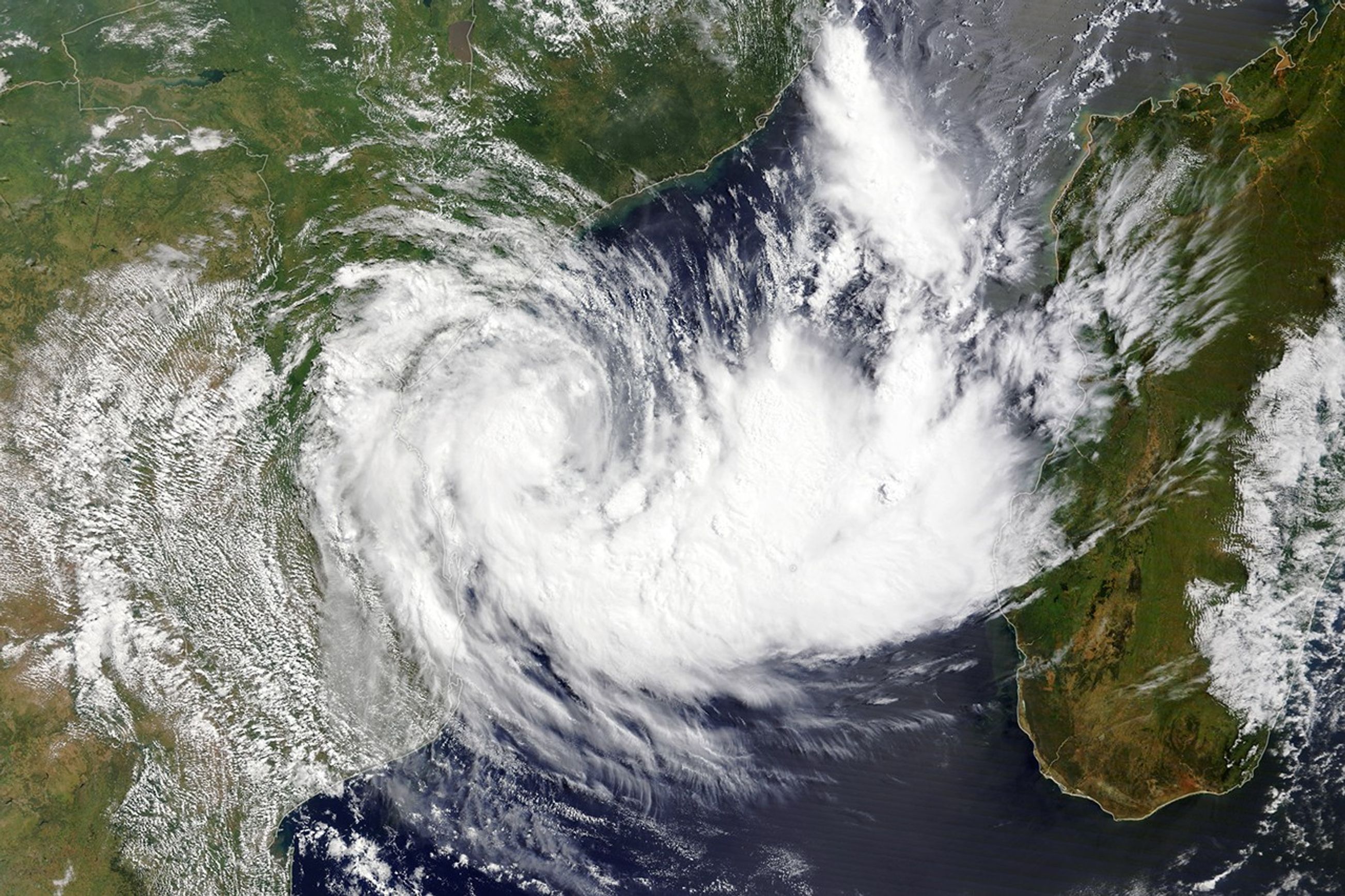


In March 2024, low wind shear in the Mozambique Channel allowed Tropical Cyclone Filipo to strengthen off the coast of southeast Africa. The MODIS (Moderate Resolution Imaging Spectroradiometer) on NASA’s Terra satellite acquired this image at around 9 a.m. local time (07:00 Universal Time) on March 11, 2024, as the storm neared Mozambique.
Around the time of this image, Filipo carried maximum wind speeds of about 80 kilometers (50 miles) per hour—equivalent to a tropical storm on the Saffir-Simpson wind scale. The storm, centered several hundred kilometers off the south-central coast of Mozambique, was moving southwest and ultimately made landfall on March 12 at about 5 a.m. local time near the coastal town of Inhassoro, according to Météo-France.
Filipo weakened as it moved across land on March 12, but it continued to deliver strong winds and heavy rain in the Inhambane and Gaza provinces. According to ReliefWeb, more than half a million people live in areas considered to be at risk from the storm. Risks included the potential for flooding and damage to crops and infrastructure.
Forecasts called for as much as 250 millimeters (10 inches) of rain in parts of Inhambane, Gaza, and Sofala provinces on March 12, and up to 100 millimeters (4 inches) in parts of Gaza and Maputo provinces on March 13. Filipo was expected to turn southeast and move back over the Indian Ocean by March 14.
Cyclone season in the southwest Indian Ocean runs from around late-October to May, with activity peaking in mid-January and again from mid-February to early March. In 2023, Tropical Cyclone Freddy wandered in the Indian Ocean for more than a month, causing destruction in Madagascar, Malawi, and Mozambique.
References & Resources
- Bloomberg (2024, March 12) Severe Storm Filipo Hits Mozambique, Threatening 525,000 People. Accessed March 12, 2024.
- Météo-France (2024, March 12) Daily Hurricane Activity Bulletin. Accessed March 12, 2024.
- ReliefWeb (2024, March 12) Mozambique: Flood - 03-2024 - TS Filipo Flooding. Accessed March 12, 2024.
- ReliefWeb (2024, March 11) Mozambique - Tropical Storm Filipo - Flash Update No. 1. Accessed March 12, 2024.
- World Meteorological Organization (2024, March 12) Severe Weather Information Centre 2.0 (Beta). Accessed March 12, 2024.
NASA Earth Observatory image by Lauren Dauphin, using MODIS data from NASA EOSDIS LANCE and GIBS/Worldview . Story by Kathryn Hansen.