![Request for Information – Potential [Placeholder for Prize]](https://assets.science.nasa.gov/dynamicimage/assets/science/psd/solar/2023/09/s/solarsystem_0.jpg?w=1024)


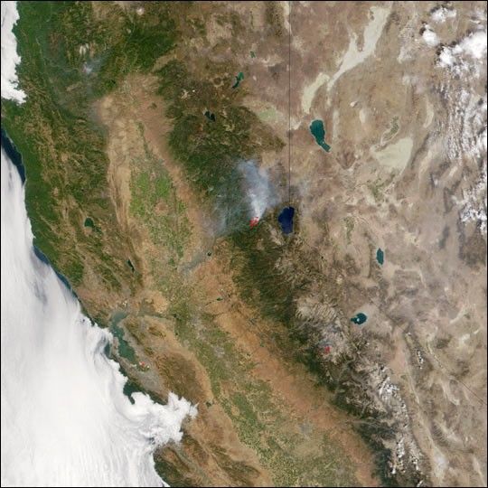
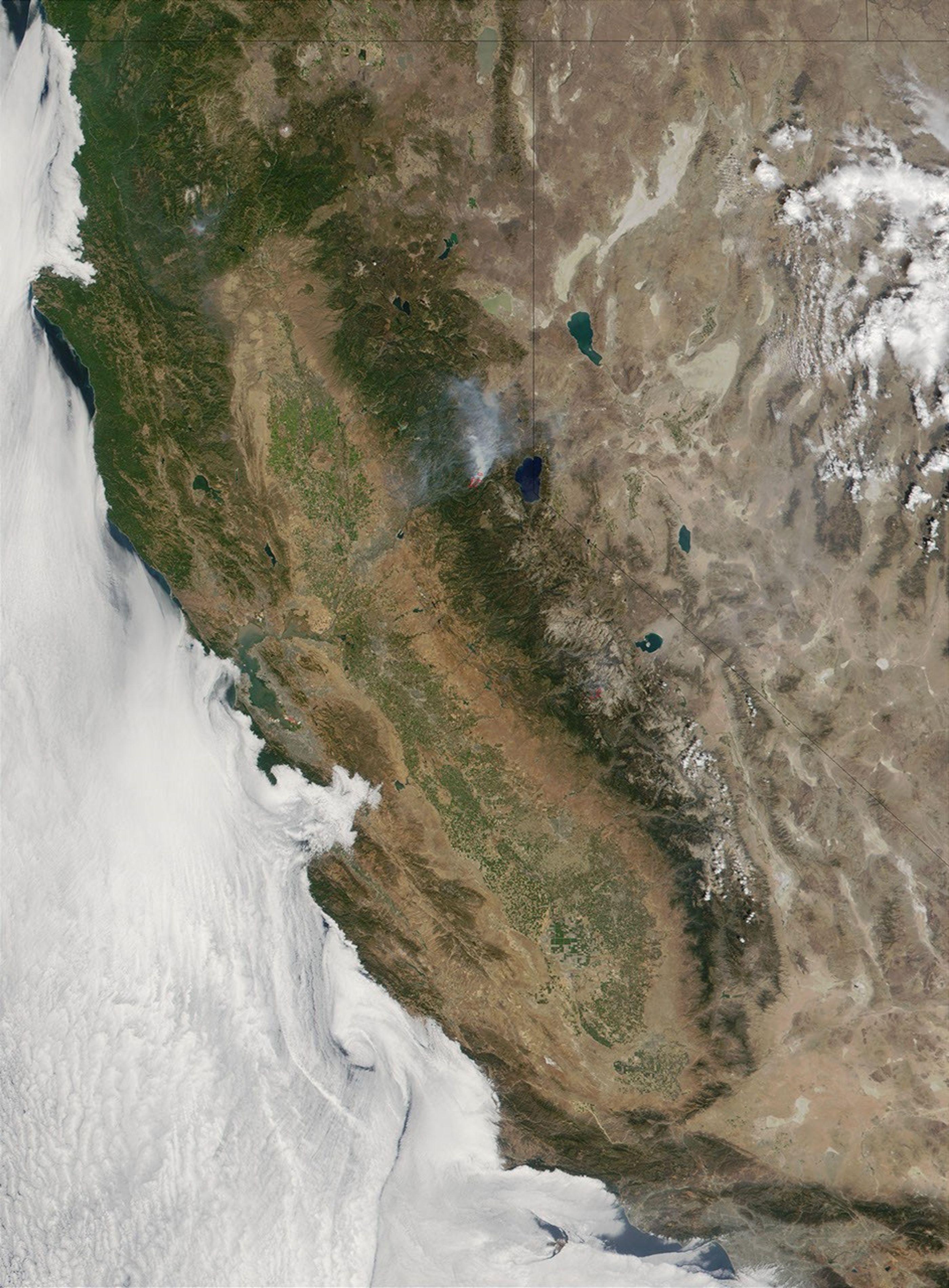
Flying on board NASA’s Terrasatellite, the Moderate-resolution Imaging Spectroradiometer (MODIS)provides daily global coverage of wild fires such as these fires,indicated with red outlines, in California. MODIS detects such a widerange of electromagnetic energy that it can detect the heat from firesas well as make a true-color image of the area, as in this image madefrom data collected on Wednesday, August 29, 2001. The image takes inthe forest-covered Coastal Mountain ranges as well as the Sierra Nevadarange along the California-Nevada border. To the southeast, the mountainsgive way to Death Valley and the Mojave Desert at the lower right.
MODIS’s thermal detectors are so sensitive that they can locate fireseven through a thick shroud of smoke, like that being emitted by the9500-acre Star Fire, burning west of Lake Tahoe in the center of theimage. The Star Fire, which is burning in the El Dorado and TahoeNational Forests, started on the morning of August 25, and has resultedin numerous road and area closures as well as public health advisoriesdue to deteriorating air quality. According to U.S. Forest Servicereports, the cause of the fire—still only about 12 percent contained—is underinvestigation.
Northwest across the Sacramento Valley, whose irrigated lands arebordered by a browner, more arid perimeter, about 1,000 residents of thetown of Weaverville were forced to evacuate early on Wednesday, August29, due to the 1,680-acre Oregon Fire, located in the upper left of theimage. Residents were allowed to return that evening, but at least ninehomes had been destroyed in the blaze, which is currently about 65 percentcontained.
Southeast of the Star Fire, in Yosemite National Park, severallightning-caused fires totaling almost 7,000 acres and known as theHoover Complex, are being allowed to burn in an effort to returnwildland fire to its natural role in Yosemite, according to park reportsfrom August 29.
References & Resources
Image courtesy Jacques Descloitres, MODIS Land Rapid Response Team at NASA GSFC