Suggested Searches

1 min read

Aftermath of World Trade Center Attack


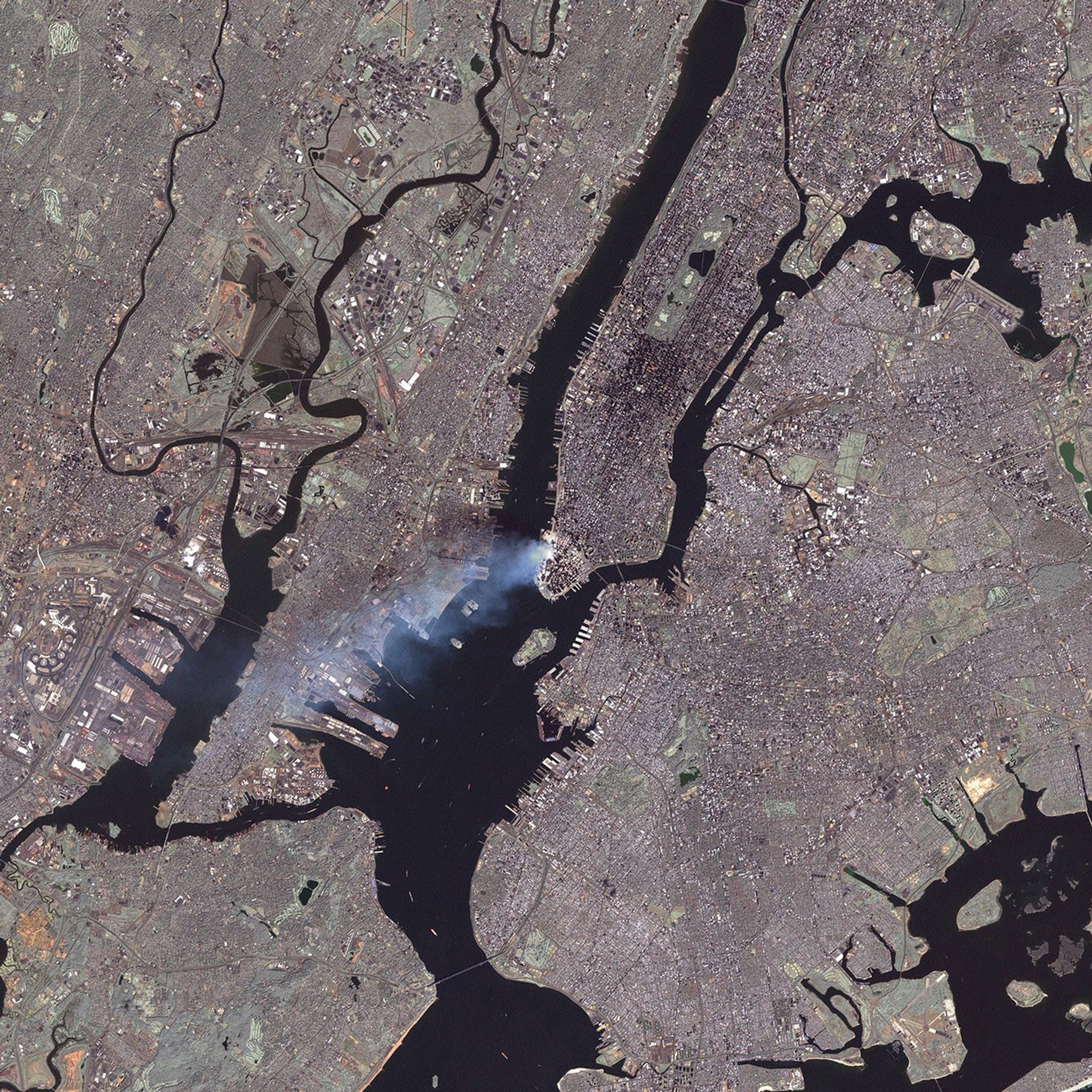
This true-color image was taken by the Enhanced Thematic Mapper Plus (ETM+) aboard the Landsat 7 satellite on September 12, 2001, at roughly 11:30 a.m. Eastern Daylight Savings Time.

<!-- LINK NO LONGER VALIDVisit the USGS Landsat 7 site for additional Landsat imagery,-->Visit the NASA home page for photos from the space station and MODIS, and GlobalSecurity.org for images from other satellites.

References & Resources

Image courtesy USGS Landsat 7 team, at the EROS Data Center.

You may also be interested in:

Stay up-to-date with the latest content from NASA as we explore the universe and discover more about our home planet.

A Full Moon Checkup
3 min read

Once a month during the full Moon, Landsat 9 turns from Earth to image the lunar surface, helping keep the…

Article
A Shift in What’s Shaping U.S. Landscapes
5 min read

Wild disturbances are on the rise, while land disturbed by human activity has been decreasing.

Article
A Fault Line in Full Bloom
5 min read

Plains around the San Andreas Fault and across Carrizo Plain National Monument are awash with yellow as wildflowers bloom.

Article