Suggested Searches

1 min read

Fires in Myanmar

Instruments:
Topics:
2007-03-27 00:00:00
March 27, 2007

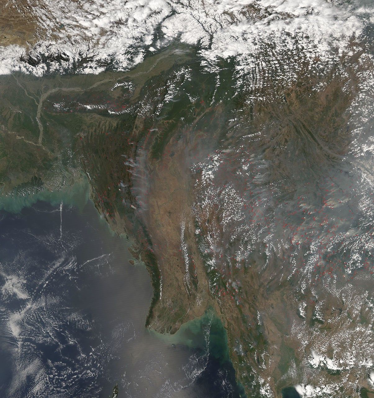
The Moderate Resolution Imaging Spectroradiometer (MODIS) on NASA’s Aqua satellite detected hundreds of actively burning fires (marked in red) when it passed over Southeast Asia on March 27, 2007. Both accidental forest fires and intentional land-use fires (such as fires for clearing brush) are common in the area during the dry season. The smoke from these fires is a health and transportation hazard.

You can download a 250-meter-resolution KMZ file of the Southeast Asia fires for use with Google Earth.

References & Resources

NASA image created by Jesse Allen, using data provided courtesy of the MODIS Rapid Response team.

You may also be interested in:

Stay up-to-date with the latest content from NASA as we explore the universe and discover more about our home planet.

New Timing for Stubble Burning in India
5 min read

Scientists say the seasonal crop fires are burning later in the day than in previous years.

Article
Fires Erupt in South-Central Chile 
2 min read

Tens of thousands of people fled to safety as blazes spread throughout the country’s Biobío and Ñuble regions.

Article
Fires on the Rise in the Far North
3 min read

Satellite-based maps show northern wildland fires becoming more frequent and widespread as temperatures rise and lightning reaches higher latitudes.

Article