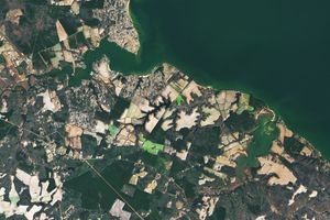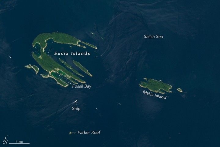
More than a hundred islands comprise the San Juan Islands in the northern reaches of the Salish Sea in the Pacific Northwest. Of these, four are accessible to vehicle and foot traffic via Washington state’s ferry system. The rest, including the Sucia Islands toward the San Juan’s north, require a private or chartered vessel to reach them.
Still, plenty of people make the voyage, especially during the summer. Boats appear as small dots in this satellite image, acquired on July 16, 2024, by the OLI-2 (Operational Land Imager-2) on Landsat 9. Some of the vessels are underway, trailing white wakes, while others are moored or docked within Sucia’s bays and coves. Some adventurers opt to paddle to Sucia from the north side of Orcas Island, about 2 miles (3.5 kilometers) to the south.
The water of the Salish Sea laps at the shores of Sucia’s 10 islands, which together resemble a hand. These islands owe their shape to sedimentary rock that became compressed and folded into a syncline and then tilted. The relatively softer beds of shale have eroded, leaving behind concentric rings of resistant sandstone. Most of the islands are composed of sandstone from the Chuckanut Group, deposited 50 million years ago by an ancient meandering river. The formation commonly contains plant fossils and fossilized wood. (Note that fossil collecting is prohibited across the Sucia Islands, a marine state park.)
The ridge south of Fossil Bay is composed of much older rock of the Nanaimo Group, deposited on the seafloor about 75 million years ago. These rocks contain an array of marine fossils, such as ammonites, snails, and bivalves. In 2012, archaeologists unearthed the fossilized femur of a theropod dinosaur nicknamed Suciasaurus, a relative of Tyrannosaurus rex. It remains the only dinosaur bone ever discovered in Washington state.
References & Resources
- Western Washington University (2015) Sucia Island: The Geologic Story. Accessed December 12, 2024.
- Burke Museum (2015, May 20) Introducing Washington’s first dinosaur. Accessed December 12, 2024.
- SeattleMet (2022, September 20) Introducing Washington’s first dinosaur. Accessed December 12, 2024.
- Washington State Department of Natural Resources Sucia Island. Accessed December 12, 2024.
- Washington State Parks (2024) Sucia Island Marine State Park. Accessed December 12, 2024.
- Washington State Parks Foundation Sucia Island. Accessed December 12, 2024.
NASA Earth Observatory image by Lauren Dauphin, using Landsat data from the U.S. Geological Survey . Story by Kathryn Hansen.