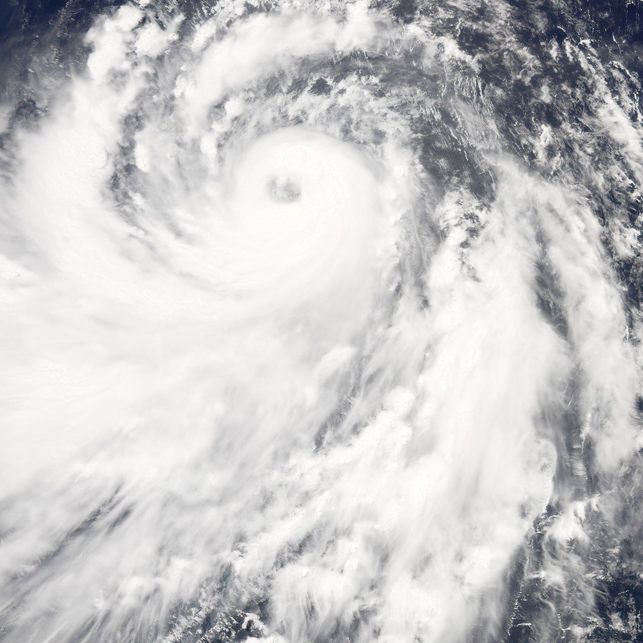
On July 11, 2007, Typhoon Man-Yi, the fourth storm of the Pacific cyclone season, was churning across the western Pacific, gathering strength as it traveled over warm ocean waters. As of July 11, forecasters were calling for Man-Yi to strengthen to Category 4 (Super Typhoon) status, with sustained winds in the storm’s core predicted to reach at least 210 kilometers per hour (131 miles per hour). The storm track prediction held that the storm would possibly reach Toyko around July 15, but be much weaker than Category 4 strength by then.
At 1:15 p.m. local time (04:15 UTC) on July 11, 2007, when the Moderate Resolution Imaging Spectroradiometer (MODIS) on NASA’s Aqua satellite captured this image, Typhoon Man-Yi had a sprawling spiral shape with a distinct, well-formed eye. Sustained peak winds were around 160 km/hr (100 mph) at that time, according to the University of Hawaii’s Tropical Storm Information Center.
References & Resources
NASA image by Jesse Allen, using data provided courtesy of the MODIS Rapid Response team at Goddard Space Flight Center.