


- Surekote Road (2.5 MB)
- Bellaire Drive (3.8 MB)
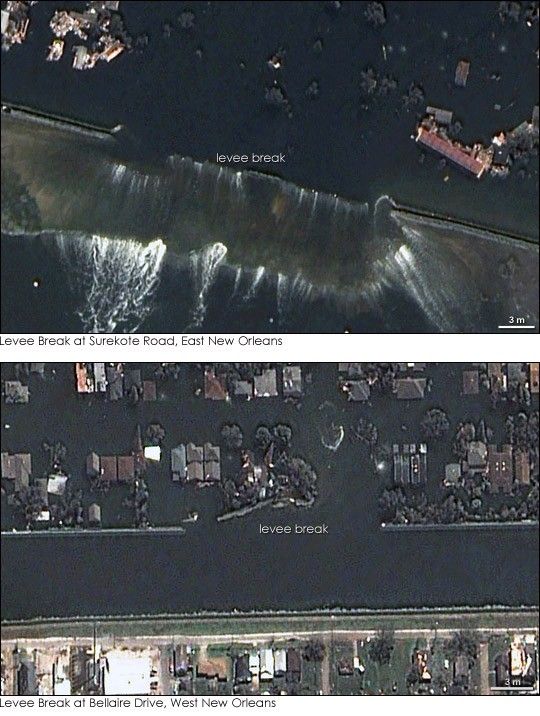
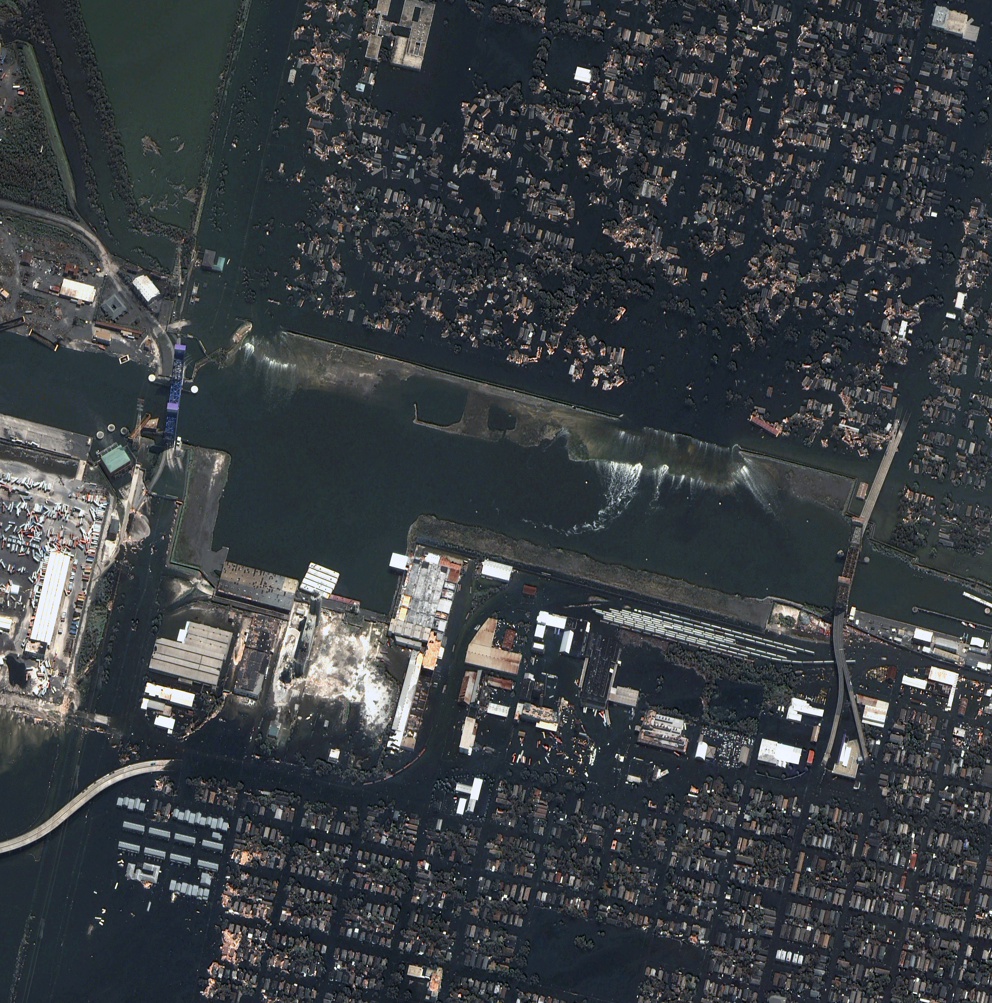
Sections of levees designed to channel canals through New Orleans crumbled under the battering waves and storm surge brought on by Hurricane Katrina. The breaks allowed water to flow from Lake Pontchartrain into New Orleans, 80 percent of which is under water, according to news reports. The QuickBird satellite captured images of two levee breaks on August 31, 2005. The top image shows the approximately 240-meter-long (800-foot-long) break in the levee along Industrial Canal in East New Orleans. Water pours through a break in the canal in the lower half of the image. In the large version of this image, provided in the link above, the streets on the opposite side of Industrial Canal are also flooded because of similar breaches in canals to the west.
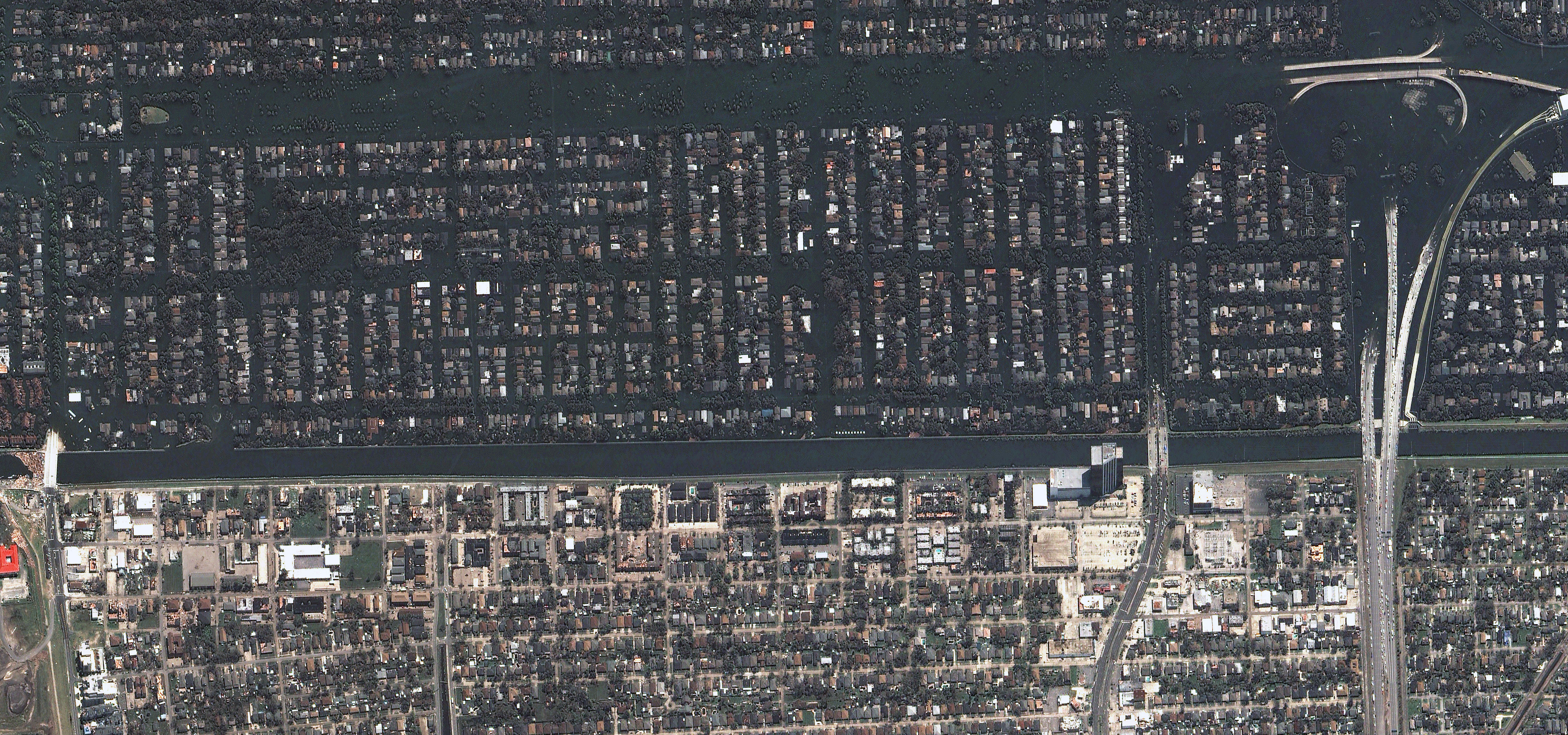
The lower image shows the break in the 17th Street Canal in West New Orleans. This break is approximately 145 meters (475 feet) long. Water floods the neighborhoods on the east side of the canal (top), but the west side remains dry. The large version of this image shows widespread debris scattered across the dry areas. A large mound of debris is piled near a bridge that spans the canal.
References & Resources
Images copyright Digital Globe .


