![Request for Information – Potential [Placeholder for Prize]](https://assets.science.nasa.gov/dynamicimage/assets/science/psd/solar/2023/09/s/solarsystem_0.jpg?w=1024)


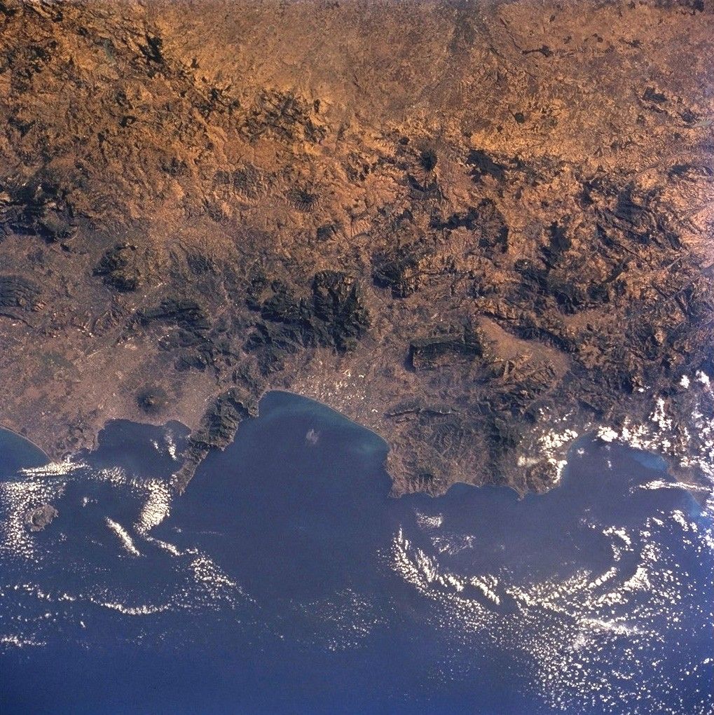
For more than 240 million years the region now known as Italy has been the scene of episodic volcanic activity. East-southeast of Napoli (Naples) stands the imposing cone of Vesuvius, which erupted explosively in 79 A.D. to bury Pompeii and Herculaneum. More recently, when the crew of Space Shuttle mission STS-104 captured this view, Mt. Etna (Sicily, not seen in this image, but photographed the day before) was spewing ash and gas thousands of meters into the air, some of which can be seen as a brownish smear over Isola d’ Ischia and the Tyrrhenian Sea.
The Appenine ranges extend from northern Italy, down the boot of the peninsula and westward into Sicily. This photograph of the Appenino Napoletano is part of an 18-frame stereophoto mapping strip that spans the entire mountain chain. The almost 1200-km-long belt of volcanoes and folded/faulted mountains is a result of the ongoing collision of Africa and Eurasia, accompanied by the progressive closing of the Mediterranean Sea. Using overlapping pairs of stereophotos, and a special viewer, scientists can get a three-dimensional perspective on the ranges that surpasses any image viewed alone.
For more information, see another image of Mt. Vesuvius, taken by the Advanced Spaceborne Thermal Emission and Reflection Radiometer (ASTER).
References & Resources
- Behncke, Boris, 2000, Vesuvio - The eruption of A.D. 79: Italy's Volcanoes - The Cradle of Volcanology [http://www.geo.mtu.edu/~boris/VESUVIO_79.html (accessed 10/18/01)]
- Doglioni, C., and Flores, G., 1997, Italy, in Moores, E. M., and Fairbridge, R. W., editors, Encyclopedia of European and Asian Regional Geology: London, Chapman & Hall, p. 414-435
Shuttle photograph STS104-710-60 was taken 23 July 2001 from the orbiter Atlantis using a Hasselblad camera with 250-mm lens. The image is provided by the Earth Sciences and Image Analysis Laboratory at Johnson Space Center. The entire mapping series (of frames numbered in sequence from 50 through 68) can also be downloaded from the database and printed for stereo viewing and analysis. Searching and viewing of additional images taken by astronauts and cosmonauts is available at the NASA-JSC Gateway to Astronaut Photography of Earth.