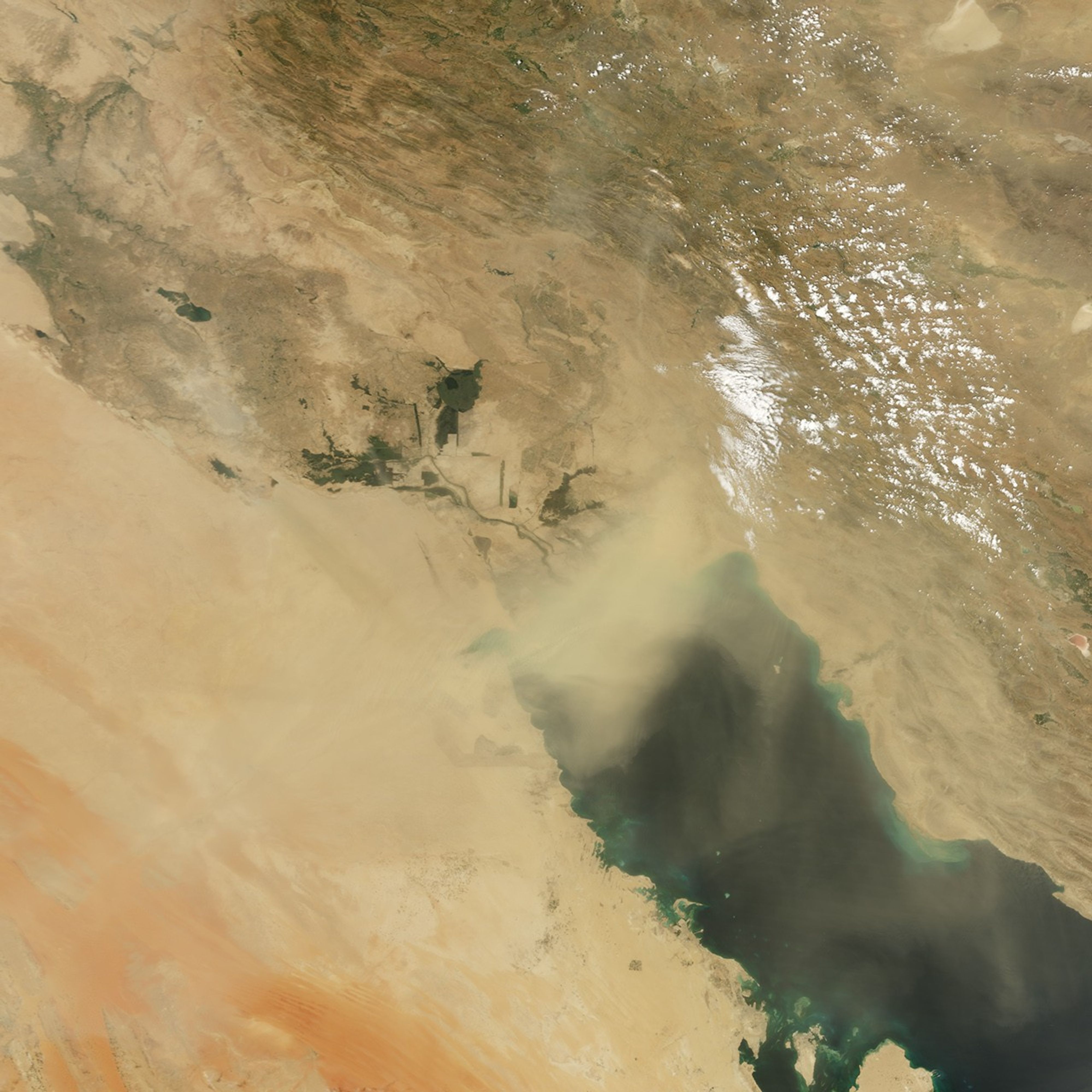






















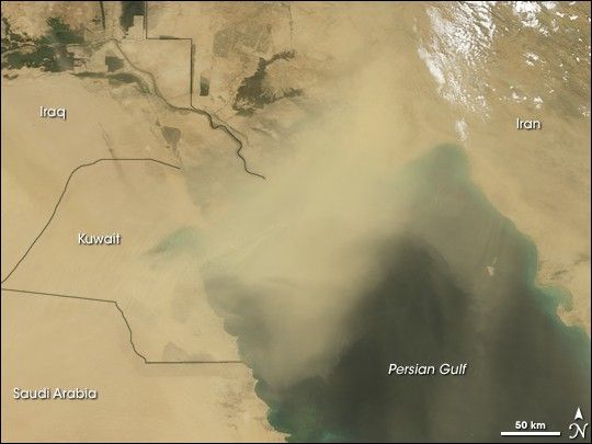
Thick dust hovered over the northern tip of the Persian Gulf on May 7, 2008. The Moderate Resolution Imaging Spectroradiometer (MODIS) on NASA’s Terra satellite took this picture the same day.
In this image, the thickest part of the dust plume appears as an opaque blur of tan that blocks the satellite’s view of the coastline. Thinner plumes appear inland over Kuwait and farther southeast over the Gulf. Aside from isolated clouds over Iran, the skies are otherwise clear.
The same day that MODIS acquired this image, GulfNews.com described increased reports of dust-related illness in the region. Those with asthma and allergies faced the greatest risk of upper respiratory tract infections, due to heat, humidity, and airborne dust.
You can download a 250-meter-resolution KMZ file of the storm suitable for use with Google Earth.
References & Resources
NASA image created by Jesse Allen, using data obtained from the Goddard Land Processes data archives (LAADS). Caption by Michon Scott.