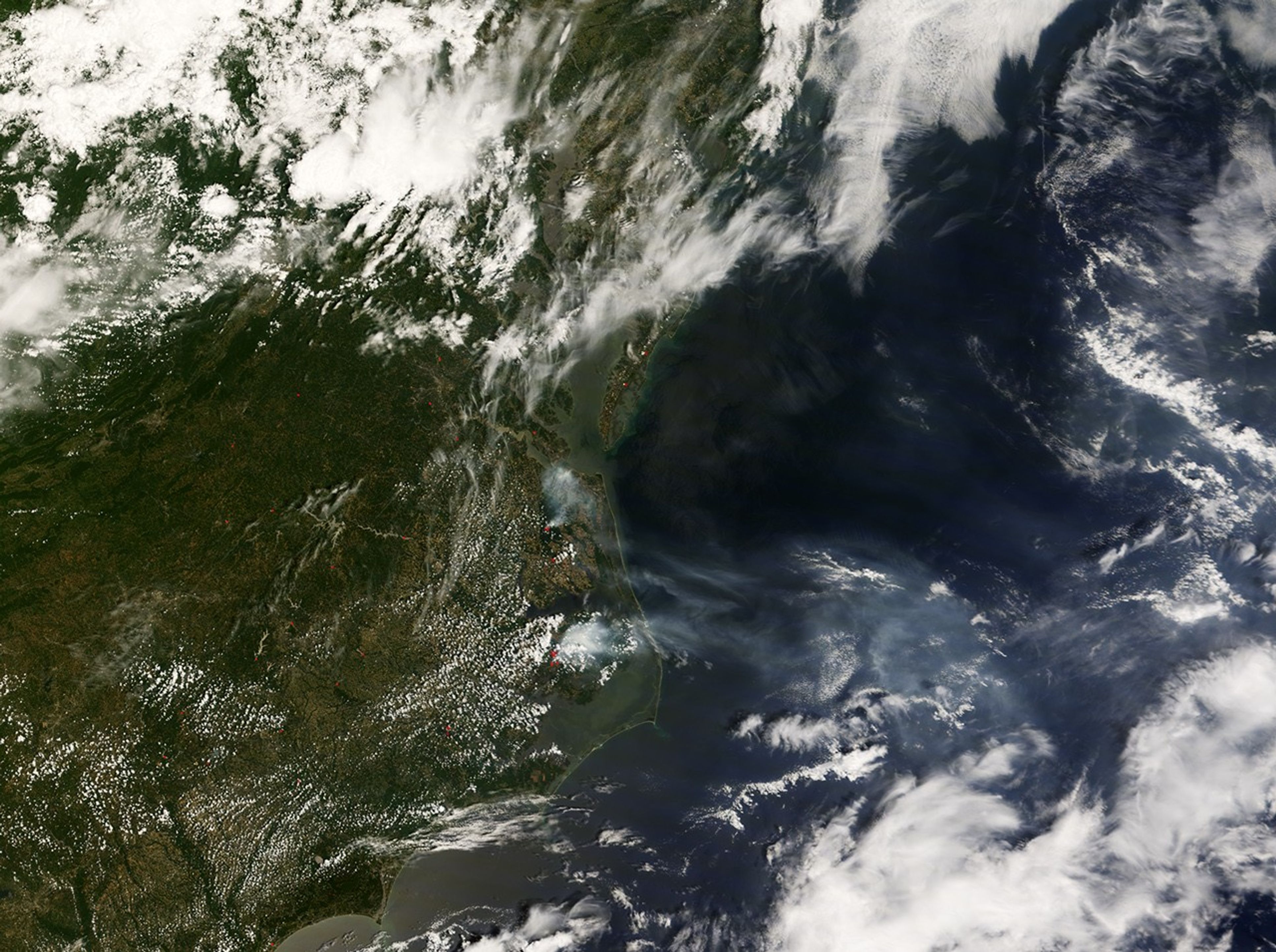
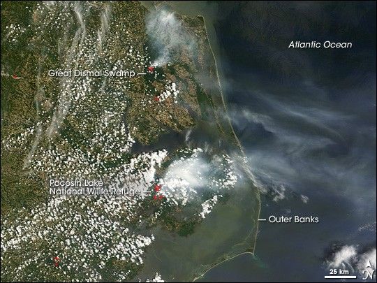
The Evans Road Fire had burned over 41,000 acres of the Pocosin National Wildlife Refuge in North Carolina as of Sunday, June 15, while the South 1 Fire in the Great Dismal Swamp, at the border of North Carolina and Virginia, had burned about 1,500 acres.
This natural-color image of Virginia and North Carolina was captured by the Moderate Resolution Imaging Spectroradiometer (MODIS) on NASA’s Aqua satellite on Monday, June 16, 2008. Places where the sensor detected actively burning fires are outlined in red.
The Evans Road Fire was started by lightning on June 2, while the South 1 Fire appears to have been sparked by machines removing trees downed by Hurricane Isabel. Both fires have the potential to generate lots of smoke because swamps have thick layers of peat—partially decayed vegetation that accumulates in soggy environments. When peat does dry out, it can fuel stubborn fires that smolder for months.
References & Resources
- References
- Forster, D., and Saewitz, M. (2008, June 12). Fire sets back tree revival project in Great Dismal Swamp. The Virginian-Pilot. Accessed June 16, 2008.
NASA image created by Jesse Allen, using data provided courtesy of the MODIS Rapid Response team. Caption by Rebecca Lindsey.