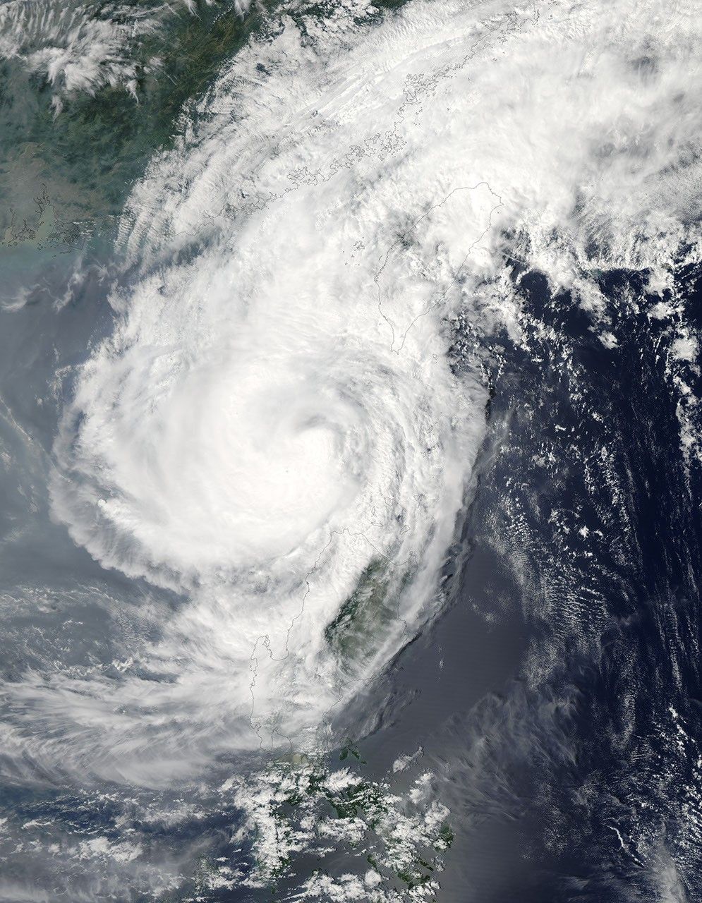
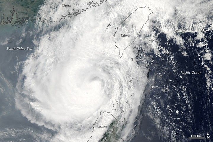
Downgraded to a tropical storm, Parma moved away from the Philippines on October 5, 2009. The Moderate Resolution Imaging Spectroradiometer (MODIS) on NASA’s Aqua satellite captured this true-color image the same day. The center of the storm appears midway between Taiwan and Luzon, but to the west of both islands. The northern margin of the storm skirts the coast of China.
According to a report from the Joint Typhoon Warning Center issued at 15:00 UTC (11:00 p.m. Manila time) on October 5, 2009, Parma was located approximately 330 nautical miles (approximately 610 kilometers) east-southeast of Hong Kong. The storm had sustained winds of 55 knots (roughly 100 kilometers per hour) with gusts up to 70 knots (roughly 130 kilometers per hour).
The high-resolution image provided above is at MODIS’ full spatial resolution (level of detail) of 250 meters per pixel. The MODIS Rapid Response System provides this image at additional resolutions.
References & Resources
- Joint Typhoon Warning Center. (2009, October 5). Tropical Storm 19W (Parma) Warning. U.S. Naval Marine Forecast Center. Accessed October 5, 2009.
NASA image by Jeff Schmaltz, MODIS Rapid Response Team, Goddard Space Flight Center. Caption by Michon Scott.