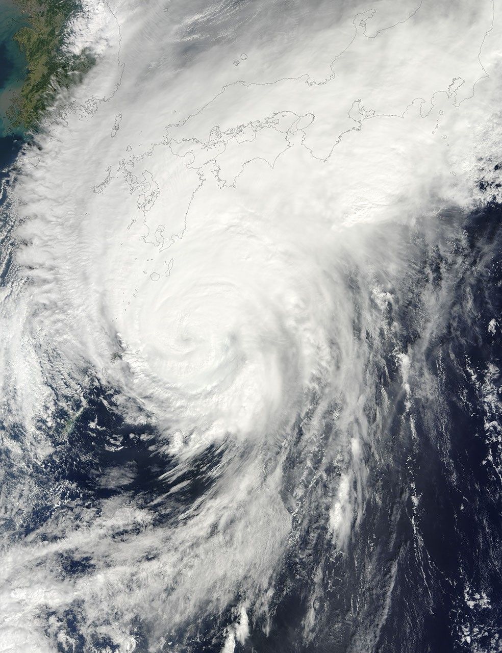
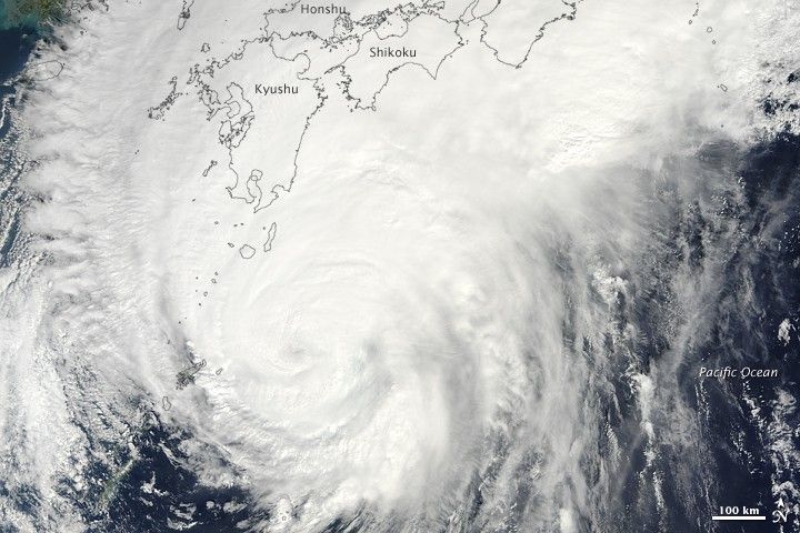
Typhoon Melor was approaching the southernmost islands of Japan when this natural-color image was captured by the Moderate Resolution Imaging Spectroradiometer (MODIS) on NASA’s Terra satellite on October 7, 2009.
The eye of the storm was completely clouded, and the iconic bands of spiraling clouds that characterize strong typhoons appeared to be blending into a more disorganized deck of clouds and thunderstorms, especially in the northern half of the storm. The 3:00 p.m. (Tokyo time) bulletin on Melor from the Joint Typhoon Warning Center warned of sustained winds of 85 knots (98 mph) and gusts up to 105 knots (121 mph) and waves up to 33 feet (10 meters).
The high-resolution image provided above is at MODIS’ full spatial resolution (level of detail) of 250 meters per pixel. The MODIS Rapid Response System provides this image at additional resolutions.
References & Resources
NASA image by Jeff Schmaltz, MODIS Rapid Response Team, Goddard Space Flight Center. Caption by Rebecca Lindsey.