















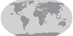

Hurricane Elida formed in the Eastern Pacific Ocean off Central America on July 12, 2008. As it traveled westward over warmer waters, the storm gathered strength, reaching hurricane status by July 14. It peaked as a Category 2 hurricane on July 17, with sustained winds of 165 kilometers per hour (105 miles per hour), according to Unisys Weather. Elida then weakened as it traveled west over open ocean waters. With no significant landfalls in its path, Elida posed no major threat.
This natural-color satellite image, obtained by the Moderate Resolution Imaging Spectroradiometer (MODIS) on NASA’s Terra satellite, shows Hurricane Elida as it appeared at 10:55 p.m. local time (18:55 UTC) on July 17, 2008. Elida has the standard spiral shape of a hurricane here, with winding arms of clouds and a discernable, though cloud-filled central eye.
References & Resources
NASA image created by Jesse Allen, using data obtained from the Goddard Land Processes data archives (LAADS). Caption by Jesse Allen.