


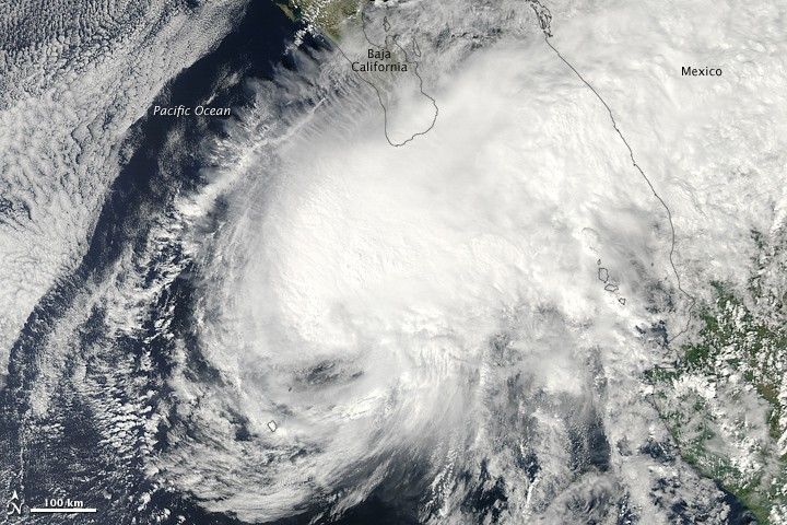
Tropical Storm Rick hovered over the eastern Pacific Ocean, south of the southern tip of Baja California on October 20, 2009. The Moderate Resolution Imaging Spectroradiometer (MODIS) on NASA’s Aqua satellite captured this true-color image at 3:50 p.m. Mexico City time (20:50 UTC) the same day. Compared to an image MODIS acquired on October 17, Rick has a less distinct hurricane-like appearance in this image, with no discernible eye and an elongated shape that stretches over the mainland.
According to tracking information from Unisys Weather, Rick had been downgraded to a tropical storm by the time this image was acquired. According to the U.S. Navy’s Joint Typhoon Warning Center, a tropical storm warning remained in effect for mainland Mexico and southern Baja California on October 21, 2009.
The high-resolution image provided above is at MODIS’ full spatial resolution (level of detail) of 250 meters per pixel. The MODIS Rapid Response System provides this image at additional resolutions.
References & Resources
- Joint Typhoon Warning Center. (2009, October 21). Tropical Storm 20E (Rick) Warning #25. Accessed October 21, 2009.
- Unisys Weather. (2009, October 21). Hurricane-5 Rick. Accessed October 21, 2009.
NASA image by Jeff Schmaltz, MODIS Rapid Response Team, Goddard Space Flight Center. Caption by Michon Scott.


