


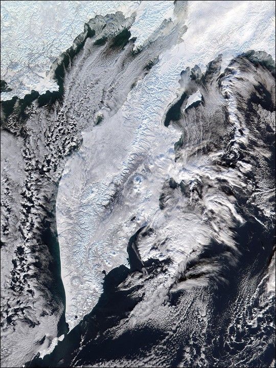
Temperate and green in the summer, the Kamchatka Peninsula in northeastern Russia freezes over completely in the winter. This true-color image of the Kamchatka Peninsula was acquired on December 12, 2001, by the Moderate-resolution Imaging Spectroradiometer (MODIS), flying aboard NASA’s Terra spacecraft. The peninsula is surrounded by the Sea of Okhotsk to the west and by the Bering Sea to the east.
The ice and snow highlight the stunning valleys and tall peaks of the Sredinnyy Khrebet, which is the volcanic mountain range running down the center of the peninsula. The mountains along the range reach heights of over 3500 meters (11,484 feet). Many of the volcanoes are still active, and ash and volcanic rock has turned the snow a dark gray on the eastern side of the range. The light blue latticework of ridges, valleys, and alluvial fans extending from the center of the range were likely carved out by past and present glaciers and by run-off from spring snowmelt. The small island that extends off of the tip of the peninsula is Ostrov Paramushir (Paramushir Island).
References & Resources
Image courtesy Jacques Descloitres, MODIS Land Rapid Response Team at NASA GSFC


