


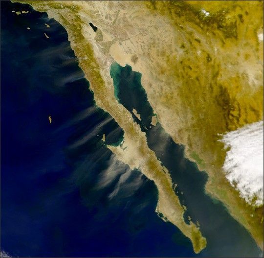

This spectacular Moderate Resolution Imaging Spectroradiometer (MODIS)“blue marble” image is based on the mostdetailed collection of true-color imagery of the entire Earth to date.Using a collection of satellite-based observations, scientists andvisualizers stitched together months of observations of the landsurface, oceans, sea ice, and clouds into a seamless, true-color mosaicof every square kilometer (.386 square mile) of our planet. Most of theinformation contained in this image came from MODIS, illustrating MODIS’outstanding capacity to act as an integrated tool for observing avariety of terrestrial, oceanic, and atmospheric features of the Earth.
The land and coastal ocean portions of this image is based onsurface observations collected from June through September 2001 andcombined, or composited, every eight days to compensate for clouds thatmight block the satellite’s view on any single day. Global oceancolor (or chlorophyll) data was used to simulate the ocean surface.MODIS doesn’t measure 3-Dfeatures of the Earth, so the surface observations were draped overtopographic data provided by the U.S. Geological Survey EROS DataCenter. MODIS observations of polar sea ice were combined withobservations of Antarctica made by the National Oceanic and AtmosphericAdministration’s AVHRR sensor—the Advanced Very High ResolutionRadiometer. The cloud image is a composite of two days of MODIS imagerycollected in visible light wavelengths and a third day of thermalinfra-red imagery over the poles.
A large collection of imagery based on the blue marble in a variety ofsizes and formats, including animations and the full (1 km) resolutionimagery, is available at the Blue Marble page.
References & Resources
Image by Reto Stöckli, Render by Robert Simmon. Based on data from the MODIS Science Team


