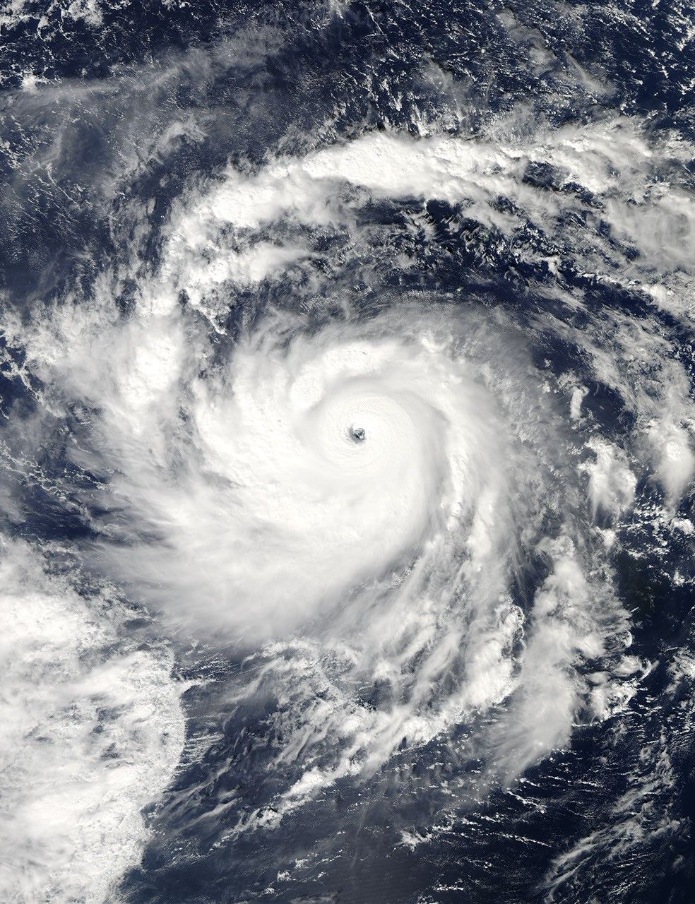

Nida was strengthening to a super typhoon near Guam when the Moderate Resolution Imaging Spectroradiometer (MODIS) on NASA’s Aqua satellite captured this true-color image on November 25, 2009. MODIS acquired this image at 1:55 p.m. local time (03:55 UTC). In the six-hour time span during which this picture was taken, Nida strengthened from a Category 3 typhoon to a Category 4 super typhoon. On November 25, Unisys Weather reported that Nida had maximum sustained winds of 150 knots (280 kilometers per hour), with gusts up to 180 knots (335 kilometers per hour).
High-profile clouds circle a distinct eye in this image. Guam appears near the top edge of the image, and clouds swirl past the island.
References & Resources
- Unisys Weather. (2009, November 25). Super Typhoon Nida. Accessed November 25, 2009.
NASA image by Jeff Schmaltz, MODIS Rapid Response Team, Goddard Space Flight Center. Caption by Michon Scott, NASA Earth Observatory.