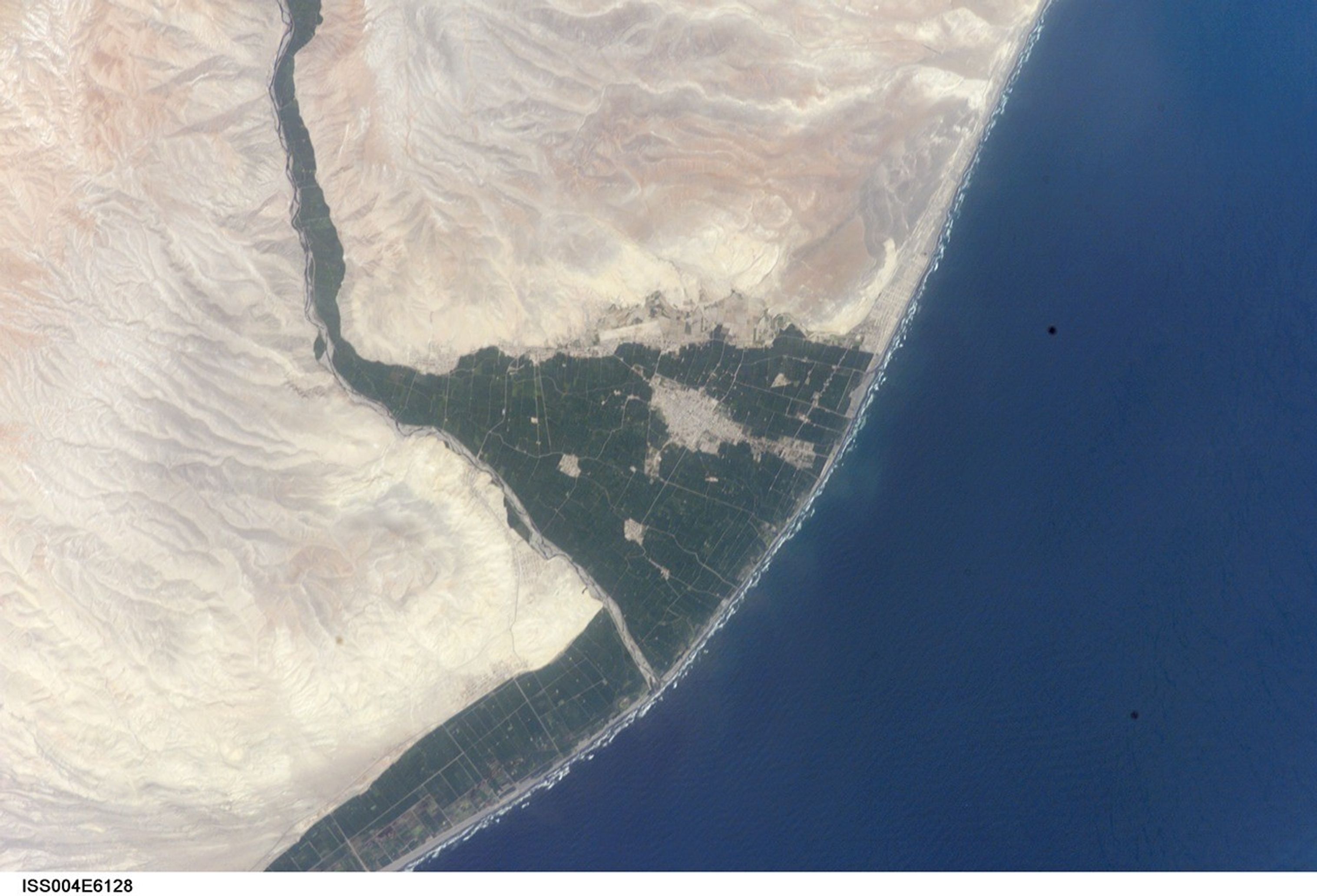


A tsunami washed over the low-lying coastal resort region near Camaná,southern Peru, following a strong earthquake on June 23, 2001. The earthquakewas one of the most powerful of the last 35 years and had a magnitude of 8.4.After the initial quake, coastal residents witnessed a sudden drawdown of theocean and knew a tsunami was imminent. They had less than 20 minutes to reachhigher ground before the tsunami hit. Waves as high as 8 m came in fourdestructive surges reaching as far as 1.2 km inland. The dashed line marks theapproximate area of tsunami inundation. Thousands of buildings were destroyed,and the combined earthquake and tsunami killed as many as 139 people.
This image (ISS004-E-6128) was taken by astronauts onboard the International Space Station on 10January 2002. It shows some of the reasons that the Camaná area was sovulnerable to tsunami damage. The area has a 1 km band of coastal plain that isless than 5 m in elevation. Much of the plain can be seen by the bright greenfields of irrigated agriculture that contrast with the light-colored desert highground. Many of the tsunami-related deaths were workers in the onion fields inthe coastal plain that were unwilling to leave their jobs before the end of theshift. A number of lives were spared because the tsunami occurred during theresort off-season, during the daylight when people could see the ocean drawdown,and during one of the lowest tides of the year.
Information on the Tsunami that hit Camaná can be found in a reports onthe visit by the International Tsunami Survey Teamand the USC Tsunami Research Lab.
Earthquake Epicenter, Peru showsanother image of the area.
References & Resources
Image provided by the Earth Sciences and Image Analysis Laboratory at Johnson Space Center. Additional images taken by astronauts and cosmonauts can be viewed at the NASA-JSC Gateway to Astronaut Photography of Earth.