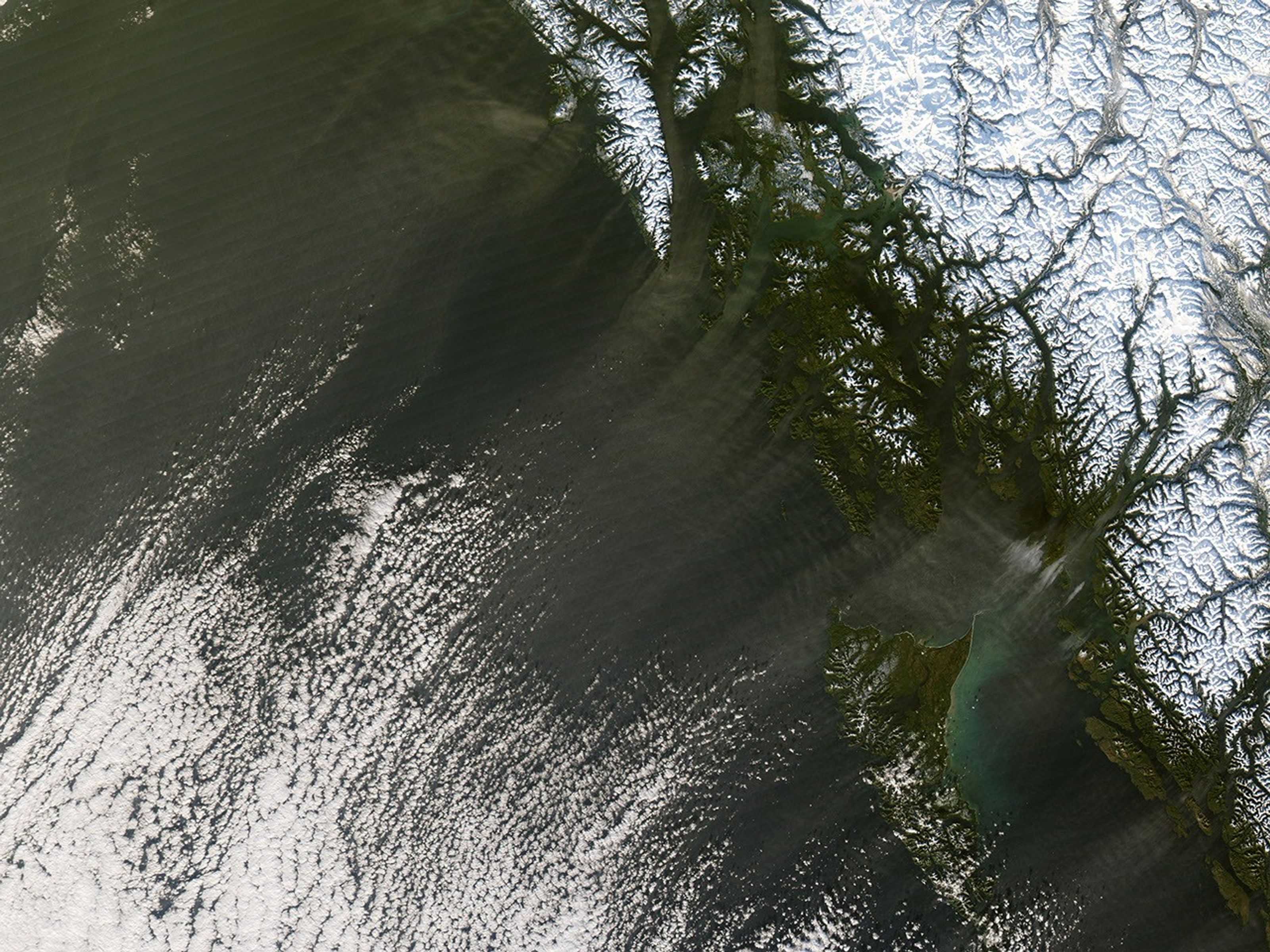






















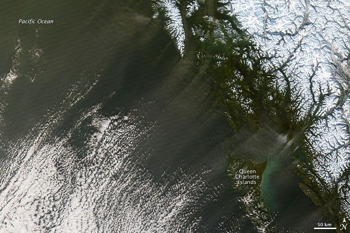
Any mention of dust storms often evokes images of scorching, arid deserts, but such storms occasionally occur at high latitudes. In Alaska, glacial silt, or loess can give rise to dust events. This image, captured by the Moderate Resolution Imaging Spectroradiometer (MODIS) flying onboard NASA’s Aqua satellite, shows dark plumes blowing off the southeastern coast of Alaska. The plumes may be airborne glacial silt or blowing snow shadowed by the low winter light.
In any case, the plumes appear to connect with clouds in the southwest. In fact, a wider-area image from this satellite pass shows that to the south, the clouds form a counter-clockwise swirl. This suggests that the air in this region is moving toward an area of low pressure.
References & Resources
NASA image courtesy Jeff Schmaltz, MODIS Rapid Response Team, Goddard Space Flight Center. Caption by Michon Scott.