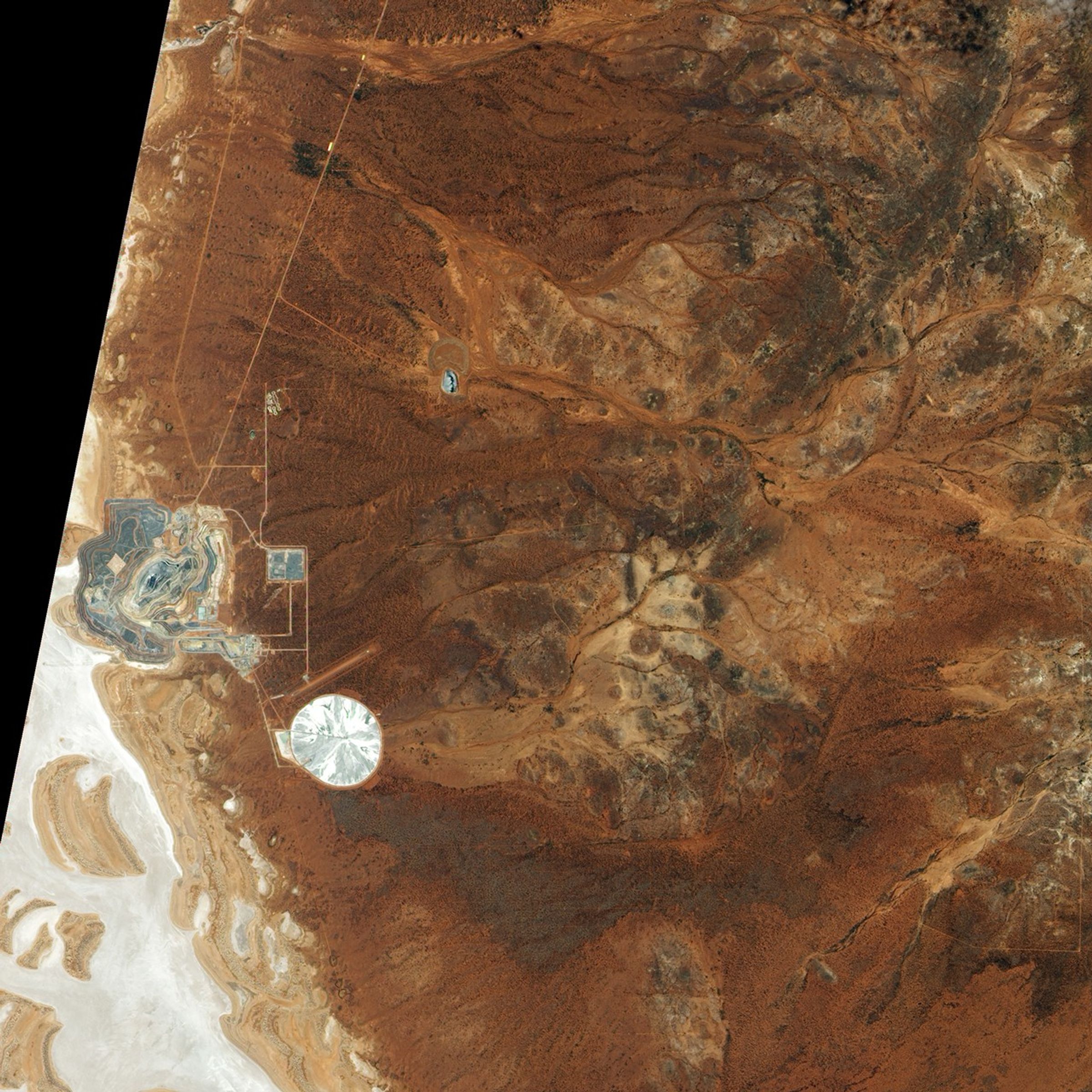
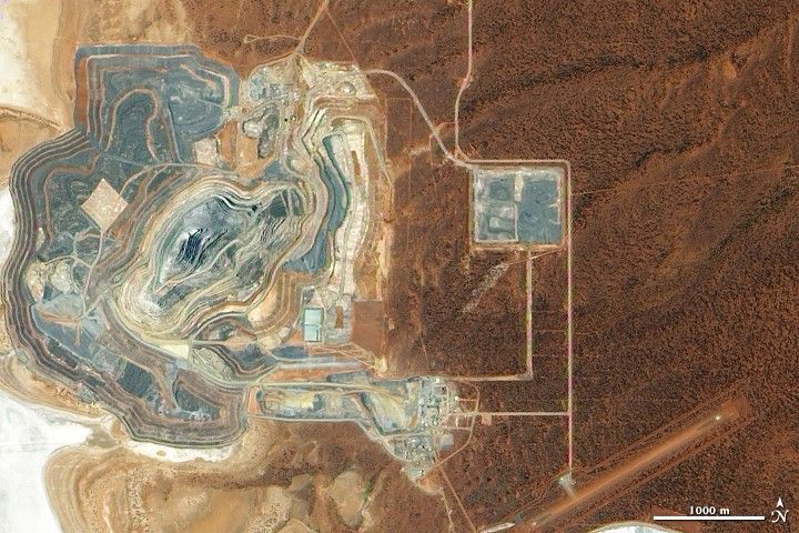
Roughly 55 kilometers (35 miles) south of Laverton, Western Australia, lies the Sunrise Dam Gold Mine. A gold deposit was discovered in the area in 1988, and by 1995, the mine was open for business. Started as an open pit mine, the operation expanded to include underground mining in 2003. The mine produces roughly 460,000 ounces of gold each year, according to AngloGold Ashanti, which operates the mine.
The Advanced Land Imager (ALI) on NASA’s Earth Observing-1 (EO-1) satellite captured this true-color image of the Sunrise Dam Gold Mine on December 4, 2009. The main pit’s terraced landscape appears in shades of gray in the left half of this image, and a mine waste facility appears on the right. In 2008, the central pit at Sunrise Dam reportedly reached a depth of 440 meters (1,445 feet). The straight line running diagonally through the lower right quadrant of the image is probably a landing strip; miners at Sunrise Dam frequently fly in and out of the remote area.
Away from the mining operation, the landscape appears in shades of brown. The physical environment around Sunrise Dam Gold Mine is flat and arid, comprised of sand and gypsum-rich dunes and saltpans. Acacia trees and shrubs well adapted to dry environments make up the vegetation in this warm, dry region.
References & Resources
- AngloGold Ashanti Australia. (PDF file) Accessed December 17, 2009.
- Gray, D.J., Britt, A.F. (2005). Sunrise Dam Gold Deposit, Eastern Goldfields, WA. (PDF file) CRC LEME, CSIRO Exploration and Mining. Accessed December 17, 2009.
- Mindat.org. (2009, November 21). Sunrise Dam Gold Mine, Laverton, Laverton Shire, Western Australia, Australia. Accessed December 17, 2009.
- Wikipedia. (2009, November 14). Sunrise Dam Gold Mine. Accessed December 17, 2009.
NASA Earth Observatory image created by Jesse Allen, using EO-1 ALI data provided courtesy of the NASA EO-1 team. Caption by Michon Scott.