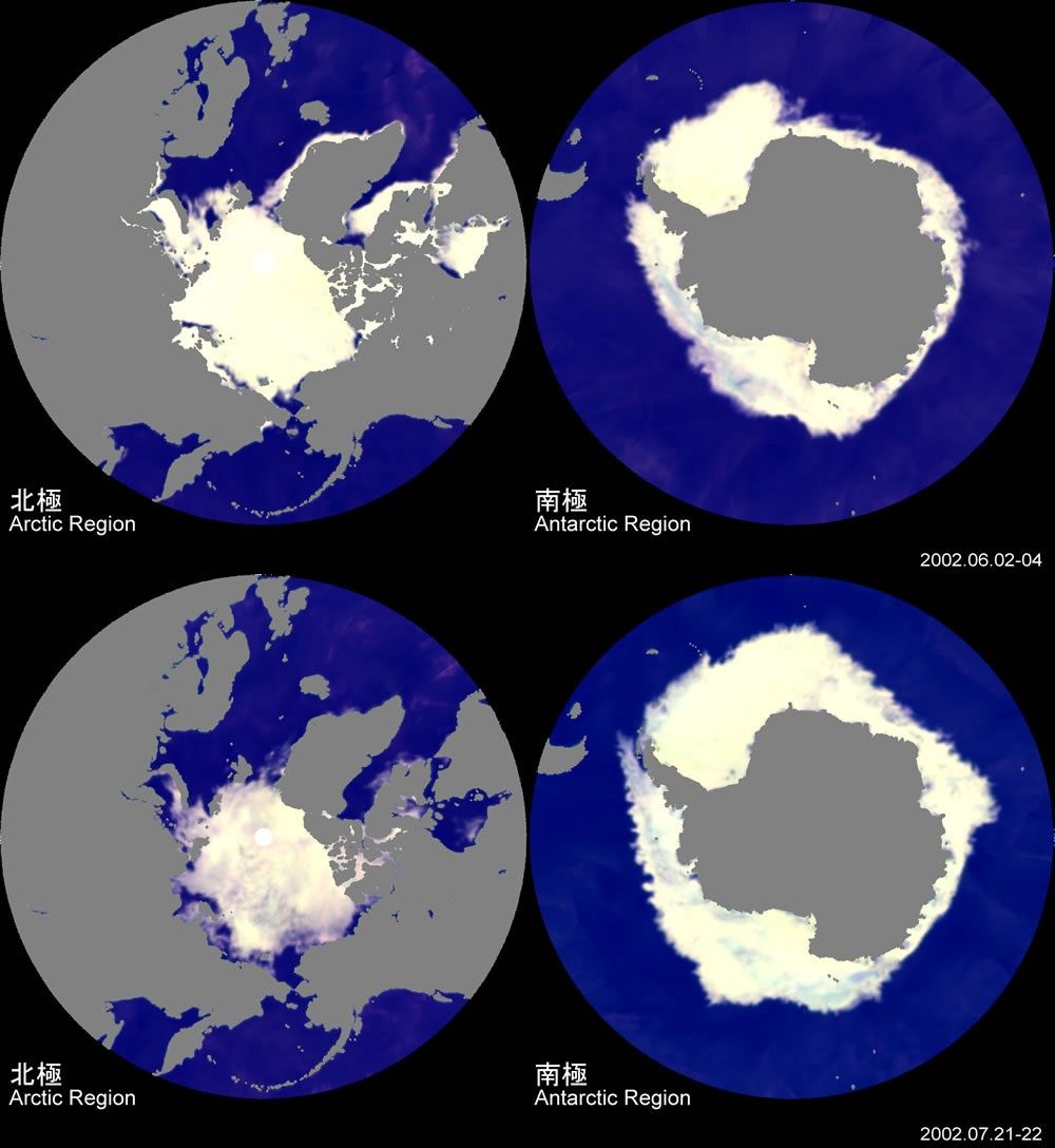
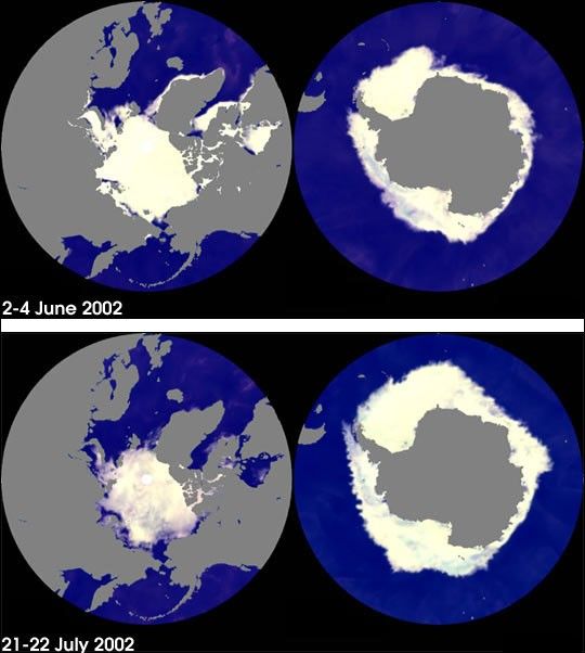
NASA's Earth Observing System (EOS) satellite Aqua, launched on May 4, is dedicated to advancing ourunderstanding of the Earth's water cycle. The National Space Development Agency of Japan's (NASDA's)Advanced Microwave Scanning Radiometer - EOS (AMSR-E) is one of six key Earth-observing instrumentson board Aqua and has recently been used to obtain images of the sea ice covers of both polarregions, showing their changes from the June 2-4 period to the July 21-22 period.
In these images, white indicates the area of sea ice cover and gray indicates land. Because of thetime period covered (late spring to summer in the Northern Hemisphere; late fall to winter in theSouthern Hemisphere), the area of the ice cover in the Arctic region is decreasing while the areaof ice cover in the Antarctic region is increasing, a fact captured very well in the AMSR-E images.Annually, sea ice cover in the Arctic tends to decrease from March through September, then toincrease, while sea ice cover in the Antarctic tends to increase from February through September,then to decrease. The presence of sea ice in the polar regions influences the balance of global heatand radiation, as it restricts heat exchanges between the ocean and atmosphere and reflects much ofthe solar radiation that reaches it.
References & Resources
Images courtesy of NASDA.