


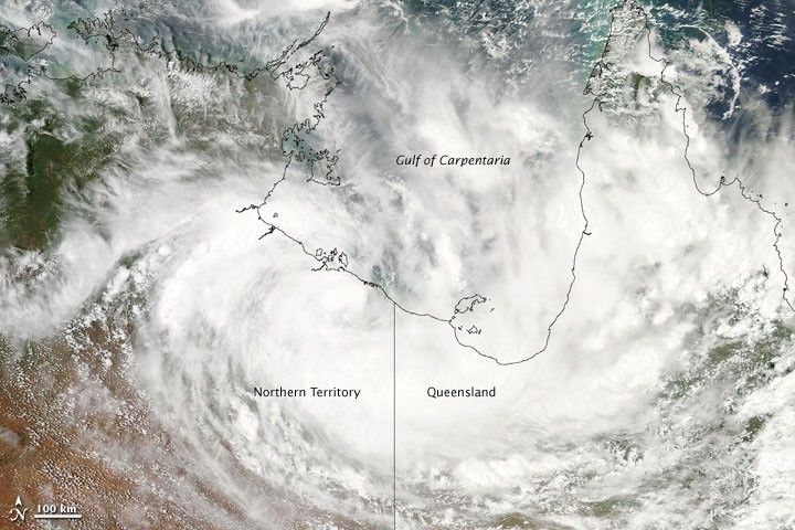
After dissipating on its journey across northern Queensland a few days earlier, Tropical Cyclone Olga restrengthened on January 27, 2010. The U.S. Navy’s Joint Typhoon Warning Center reported that the storm was roughly 550 nautical miles (1,020 kilometers) west of Cairns, Australia, and had remained fairly stationary for several hours. Olga had maximum sustained winds of 35 knots (65 kilometers per hour) and gusts up to 45 knots (85 kilometers per hour), but was expected to intensify over the next 48 hours as it moved offshore.
The Moderate Resolution Imaging Spectroradiometer (MODIS) on NASA’s Aqua satellite captured this true-color image on January 27, 2010. Although Olga lacks a discernible eye, the storm easily spans the Gulf of Carpentaria, casting swirling clouds over Australia’s Northern Territory in the west and northern Queensland in the east.
References & Resources
- Joint Typhoon Warning Center. (2010, January 27). Tropical Cyclone 09P (Olga) Warning. Accessed January 27, 2010.
- Gutro, R., NASA. (2010, January 27). Olga restrengthens into a tropical storm. EurekAlert.
NASA image by Jeff Schmaltz, MODIS Rapid Response Team, Goddard Space Flight Center. Caption by Michon Scott.


