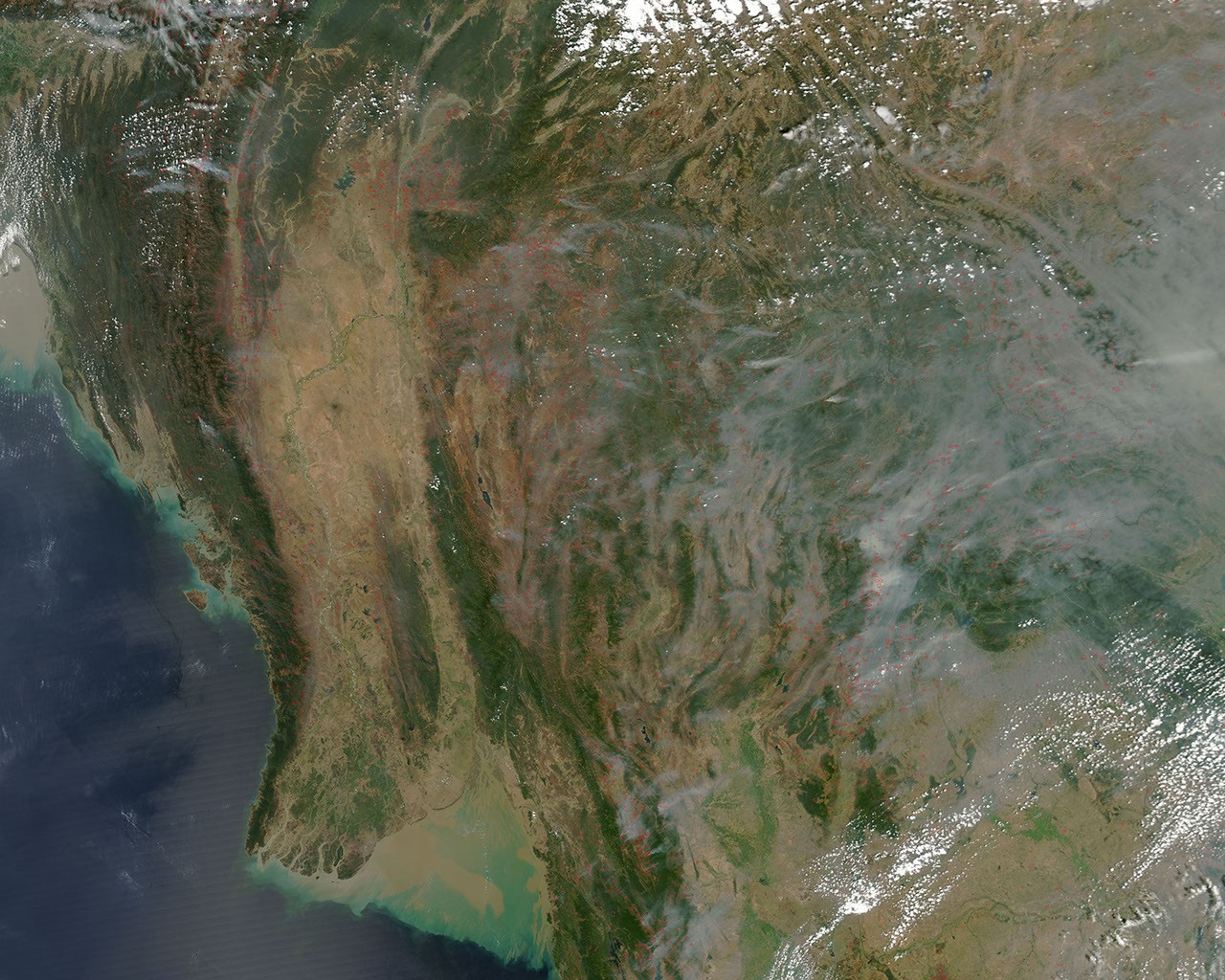
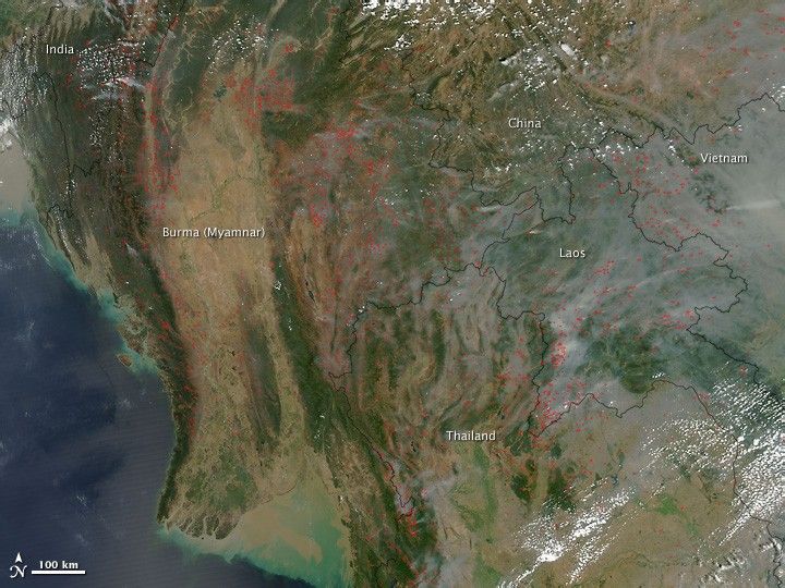
Early March is the late dry season across Southeast Asia, and fires—intentional and accidental—become widespread. People burn leaves, brush, and trash in residential areas, and in permanently cultivated areas (predominantly the lowlands), farmers use fire to clear crop residue and old grass in pastures. In some locations, the fires may be forest clearing for new agricultural land.
This photo-like image was captured by the Moderate Resolution Imaging Spectroradiometer (MODIS) on NASA’s Aqua satellite on March 3, 2010. Places where MODIS detected actively burning fires are marked in red. Hundreds of active fires were burning across the hills and valleys of India, Burma (Myanmar), Thailand, Laos, Vietnam, and southern China.
The fires in this region have been part of the land management practices for hundreds, possibly thousands of years, and they are not necessarily immediately hazardous. But they nevertheless have a big influence on air quality and human health, greenhouse gas emissions and the Earth’s carbon cycle, and biodiversity.
References & Resources
NASA image by Jeff Schmaltz, MODIS Rapid Response Team. Caption by Rebecca Lindsey.