![Request for Information – Potential [Placeholder for Prize]](https://assets.science.nasa.gov/dynamicimage/assets/science/psd/solar/2023/09/s/solarsystem_0.jpg?w=1024)


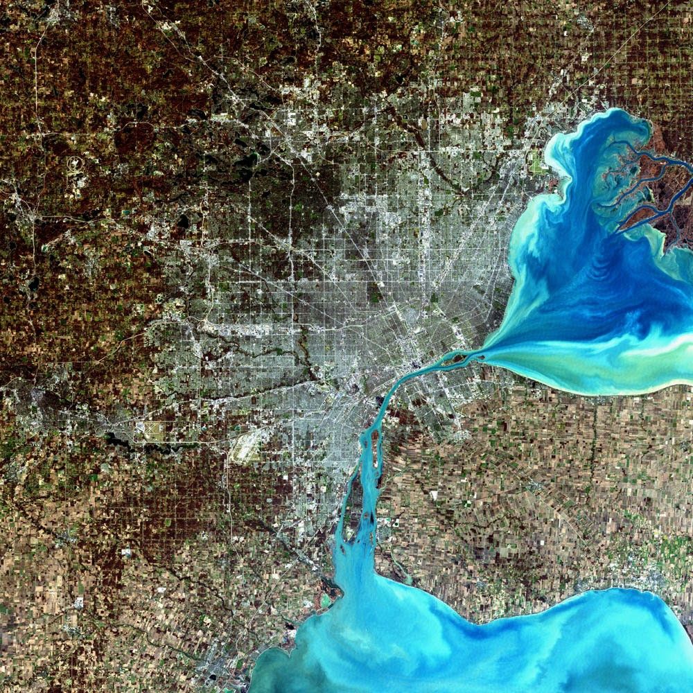
Bordered on its east side by the Detroit River, which connects Lake Saint Clair (east) to Lake Erie (south), Detroit is Michigan’s largest city. In this scene, the blue-gray cluster of pixels shows the greater Detroit area. East of Lake Saint Clair and north of Lake Erie lies the southernmost corner of Canada’s Ontario province. Windsor, Ontario, is the cluster of blue-gray pixels that sits just across the river from Detroit. The dark greens to the northwest are heavily vegetated land surfaces. A mosaic of many square and rectangular patterns indicates the presence of widespread agriculture on the Ontario peninsula to the east, as well as south and west of Detroit.
European settlements in the region began in the 1600s. In the late 17th century, France began establishing a number of forts at key locations around North America in an attempt to prevent the British from claiming new lands west of New England and thus monopolizing trade with the colonies. The lands around Detroit were known by the French as le detroit, or the straits. Antoine Laumet (known at the time as Antoine de la Mothe, Sieur de Cadillac) was a lawyer, a commander in the French army, and a counselor to the King at the Parliament of Toulouse. Cadillac reported that le detroit was an excellent location for a major French military outpost and sent a request to the court in France for authorization to make a settlement there. The river provided for a good defense, he pointed out, and yet was narrow enough for cannon fire to reach the opposite shore. The French court agreed, and so in 1701 Cadillac established his new settlement on the western shore of the Detroit River — Fort Ponchartrain du Detroit. The French maintained control of the fort until 1760; it was one of the few French settlements that could not be taken by force by British and American armies. Fort Ponchartrain du Detroit was peacefully signed over to the British on September 8, 1760, with the signing of the Articles of Capitulation shortly after the British captured Montreal.
Today, Detroit is home to just under 1 million residents. Peaking at more than 1.8 million residents in 1950, its population has actually been shrinking in recent decades.
This enhanced true-color image of Detroit was acquired in the spring of 2001 by the Enhanced Thematic Mapper plus (ETM+) aboard NASA’s Landsat 7 satellite.
References & Resources
Image courtesy Ron Beck, USGS Land Processes Data Center, Satellite Systems Branch