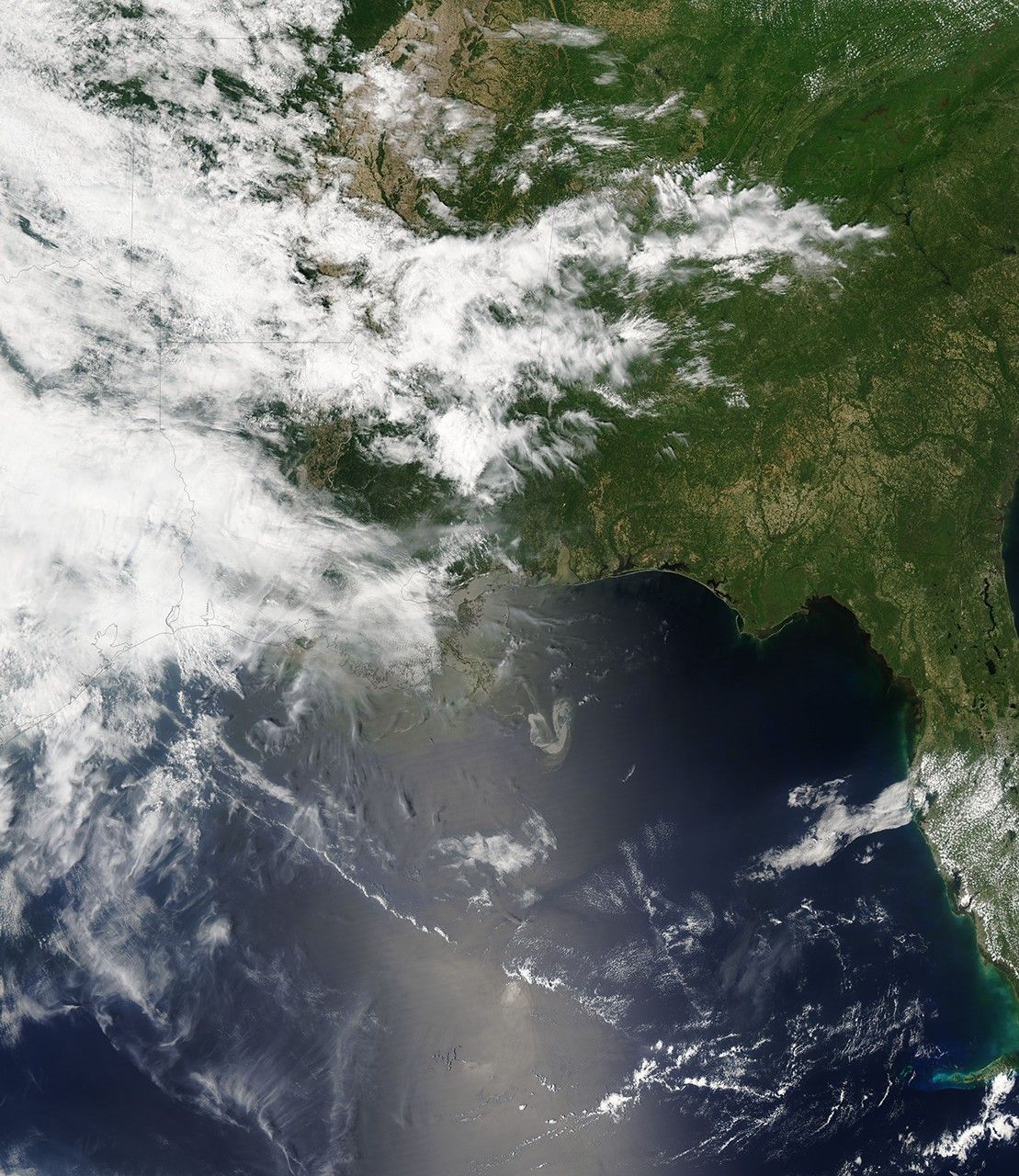
May 9, 2010
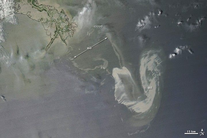
On May 9, 2010, oil continued to flow from a damaged offshore oil well in the Gulf of Mexico. This image from the Moderate Resolution Imaging Spectroradiometer (MODIS) on NASA’s Aqua satellite shows the slick on Sunday afternoon.
The most concentrated part of the slick appears as a silvery, distorted U-shape in the right-hand side of the image. In the north-south direction, the longest part of the U stretches 86 kilometers (53 miles); from east to west, the U is about 54 kilometers (34 miles) wide. Tentacles of oil (faint gray) reach out from the main slick toward the west (52 kilometers, or 32 miles) and north-northwest (46 kilometers, or 29 miles).
Reference
- U.S. Fish and Wildlife Service. (2009, July 20). Breton National Wildlife Refuge. Accessed May 7, 2010.
References & Resources
- U.S. Fish and Wildlife Service. (2009, July 20). Breton National Wildlife Refuge. Accessed May 7, 2010.
NASA image courtesy the MODIS Rapid Response Team. Caption by Rebecca Lindsey.