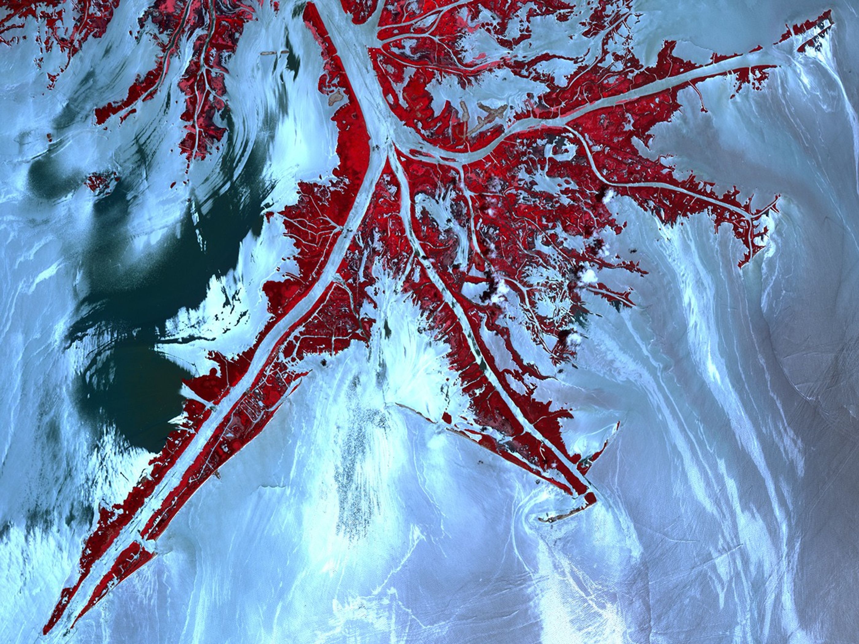
On May 24, 2010, the Advanced Spaceborne Thermal Emission and Reflection Radiometer (ASTER) on NASA’s Terra satellite captured this false-color, high-resolution view of the very tip of the Mississippi River Delta. Ribbons and patches of oil that have leaked from the Deepwater Horizon well offshore are silver against the light blue color of the adjacent water. Vegetation is red.
In the sunglint region of a satellite image—where the mirror-like reflection of the Sun gets blurred into a wide, bright strip—any differences in the texture of the water surface are enhanced. Oil smoothes the water, making it a better “mirror.” Oil-covered waters are very bright in this image, but, depending on the viewing conditions (time of day, satellite viewing angle, slick location), oil-covered water may look darker rather than brighter.
The relative brightness of the oil from place to place is not necessarily an indication of the amount of oil. Any oil located near the precise spot where the Sun’s reflection would appear if the surface of the Gulf were perfectly smooth and calm is going to look very bright in these images.
In addition, not all of bright areas are definitely manmade oil. Detecting a manmade oil slick in coastal areas can be even more complicated than detecting it in the open ocean. When oil slicks are visible in satellite images, it is because they have changed how the water reflects light, either by making the Sun’s reflection brighter or by dampening the scattering of sunlight, which makes the oily area darker. In coastal areas, however, similar changes in reflectivity can occur from differences in salinity (fresh versus salt water) and from naturally produced oils from plants.
The cause of the dark patch of water in the upper left quadrant of the image is unknown. It may indicate the use of chemical dispersants, skimmers, or booms, or it may be the result of natural differences in turbidity, salinity, or organic matter in the coastal waters.
References & Resources
NASA Earth Observatory image created by Jesse Allen, using data provided courtesy of NASA/GSFC/METI/ERSDAC/JAROS, and U.S./Japan ASTER Science Team. Caption by Rebecca Lindsey.