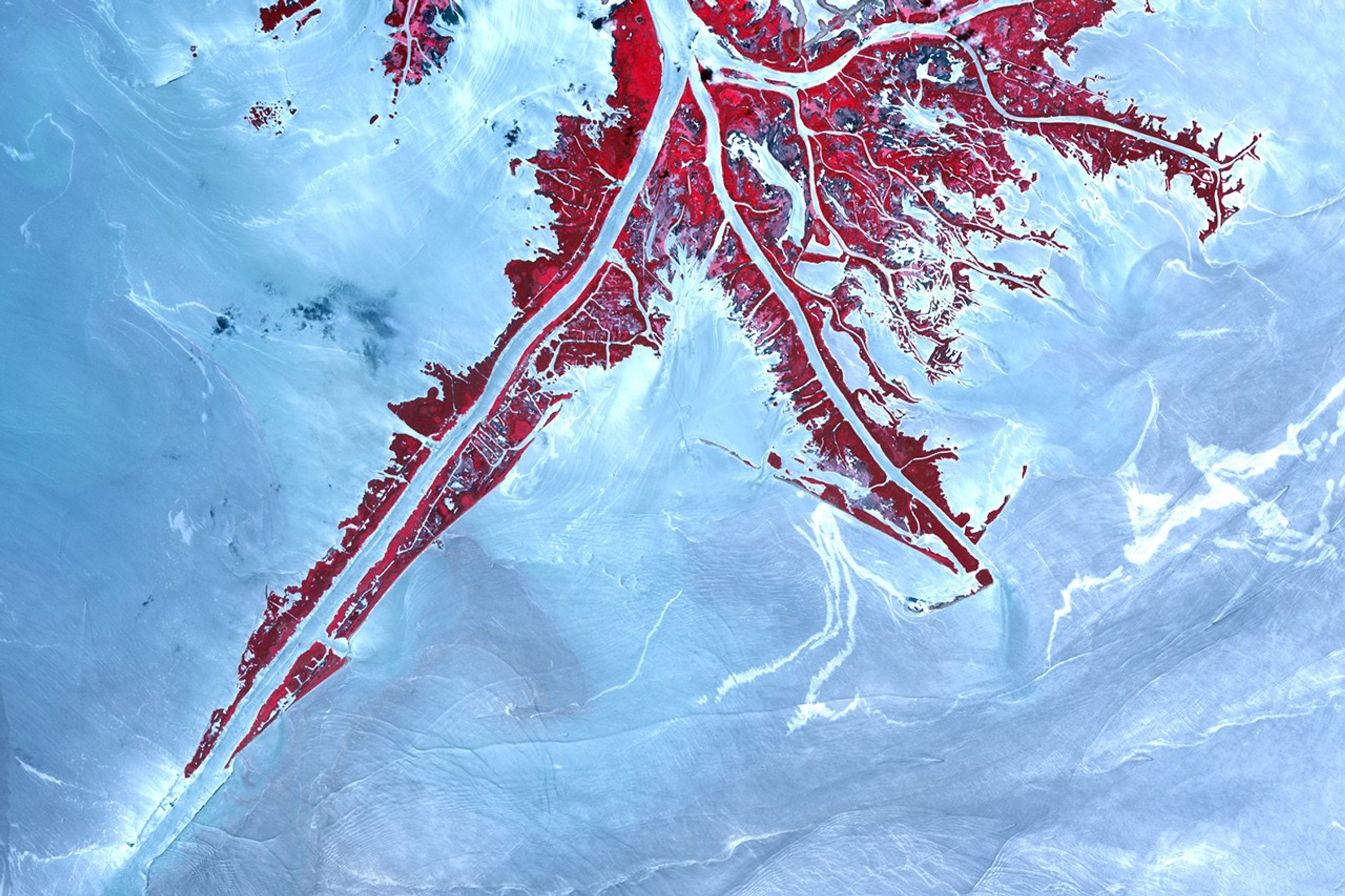
























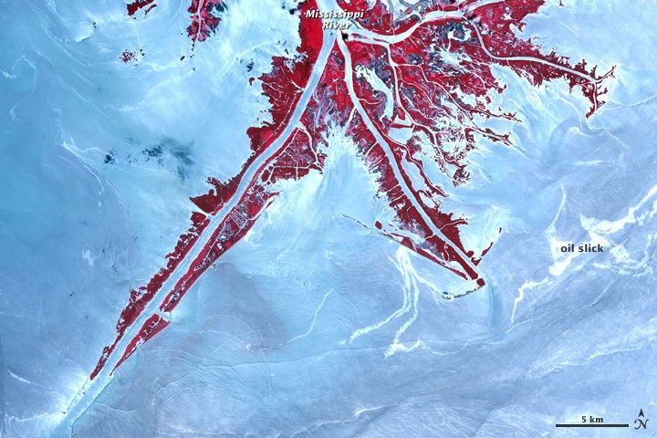
Parts of the oil slick from the Deepwater Horizon rig accident neared the Mississippi Delta in early June 2010. The Advanced Spaceborne Thermal Emission and Reflection Radiometer (ASTER) on NASA’s Terra satellite captured this false-color image of the Delta and nearby ocean water on June 10, 2010. Vegetation appears red and water appears in shades of blue and white.
Sunglint—the mirror-like reflection of sunlight off the sea surface and into the satellite sensor—enhances the visibility of an oil slick, which appears brighter than the surrounding oil-free water in the image. However, the relative brightness of any spot is not a perfect indicator of the oil slick’s location or amount. Not all oil appears bright, and not all bright spots are necessarily oily. Please see the links below for more information.
References & Resources
- Gulf of Mexico Oil Spill Response, the official site of the Deepwater Horizon unified command.
- Current information about the extent of the oil slick is available from the Office of Response and Restoration at the National Oceanic and Atmosphere Administration.
- Information about the impact of the oil slick on wildlife is provided by the U.S. Fish and Wildlife Service.
NASA Earth Observatory image created by Jesse Allen, using data provided courtesy of NASA/GSFC/METI/ERSDAC/JAROS, and U.S./Japan ASTER Science Team. Caption by Michon Scott.