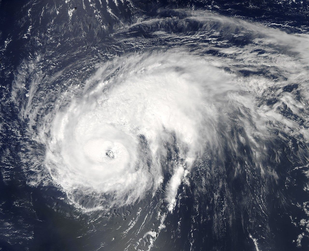


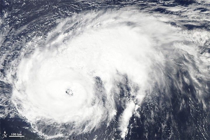
At 11:00 a.m. Atlantic Standard Time (AST) on August 26, 2010, the U.S. National Hurricane Center (NHC) reported that Danielle was a Category 2 hurricane with maximum sustained winds of 105 miles (165 kilometers) per hour. Danielle was located roughly 630 miles (1,015 kilometers) northeast of the Northern Leeward Islands, and roughly 770 miles (1,235 kilometers) southeast of Bermuda. Moving toward the northwest, the storm had the potential to become a major hurricane by late August 26 or early August 27.
The Moderate Resolution Imaging Spectroradiometer (MODIS) on NASA’s Aqua satellite captured this natural-color image of Hurricane Danielle at 12:50 AST (16:50 UTC) on August 26, 2010. Looking like a giant comma turned on its side, Danielle sported a distinct eye. The storm’s longest spiral arms stretched toward the northeast.
Despite its strength, which was forecast to increase over the next 24 to 36 hours, Danielle did not pose any hazards to land as of 11:00 a.m. August 26, 2010, the NHC reported.
References & Resources
- National Hurricane Center. (2010, August 26). Hurricane Danielle Advisory Archive. Accessed August 26, 2010.
NASA image courtesy the MODIS Rapid Response Team at NASA GSFC. Caption by Michon Scott.