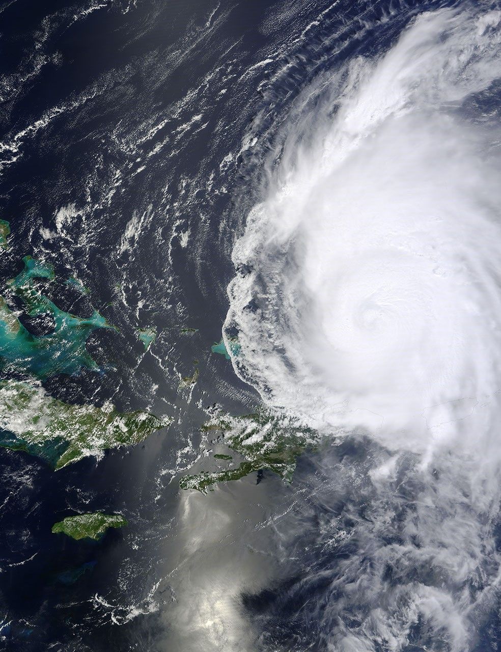


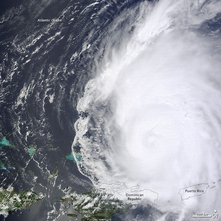
At 15:45 Universal Time (UTC) on August 31, 2010, the Moderate Resolution Imaging Spectroradiometer (MODIS) on NASA’s Terra satellite captured this natural-color image of Hurricane Earl as it passed north of Puerto Rico and the Dominican Republic in the Atlantic Ocean.
The U.S. National Hurricane Center (NHC) reported at 15:00 UTC that day that Earl had maximum sustained winds of 135 miles (215 km) per hour, a category 4 storm on the Saffir-Simpson hurricane wind scale. The hurricane was centered near 21 degrees North latitude, 68 degrees West longitude, and moving west-northwest at 14 miles (22 kilometers) per hour.
Researchers participating in NASA’s GRIP field campaign made six flights through Hurricane Earl on August 30, observing the storm as it intensified from a category 2 to category 4 hurricane. More flights are expected later this week.
NASA image courtesy Jeff Schmaltz, MODIS Rapid Response Team at NASA GSFC. Caption by Michael Carlowicz.