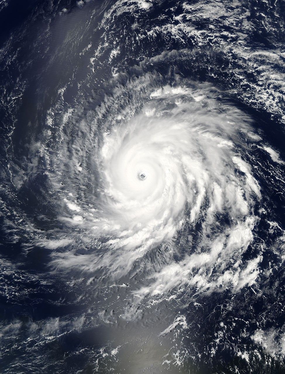


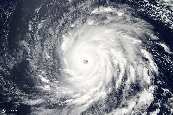
Tropical Storm Igor formed over the far eastern tropical Atlantic Ocean on September 8, 2010, the U.S. National Hurricane Center (NHC) reported. From its genesis locality southeast of Cape Verde, Igor traveled westward. Igor strengthened to a hurricane on September 11, becoming the fourth of the season. By 11:00 a.m. Atlantic Standard Time (AST) on September 13, Igor was a category 4 hurricane, packing maximum sustained winds of 150 miles (240 kilometers) per hour.
The Moderate Resolution Imaging Spectroradiometer (MODIS) on NASA’s Aqua satellite captured this natural-color image of Hurricane Igor at 12:40 p.m. AST (16:40 UTC) on September 13, 2010. Igor shows all the characteristics of a strong hurricane, including a distinct eye and spiral arms spanning hundreds of kilometers.
On September 13, the NHC forecast that Igor would continue moving toward the west at about 10 miles (17 kilometers) per hour. Late in the day on September 13, or early in the day on September 14, Igor was expected to turn toward the west-northwest. Although the storm’s intensity would likely fluctuate over the next 48 hours, it was expected to remain a powerful hurricane.
References & Resources
- National Hurricane Center. (2010, September 13). Hurricane Igor Advisory Archive. Accessed September 13, 2010.
NASA image by Jeff Schmaltz, MODIS Rapid Response Team at NASA GSFC. Caption by Michon Scott.