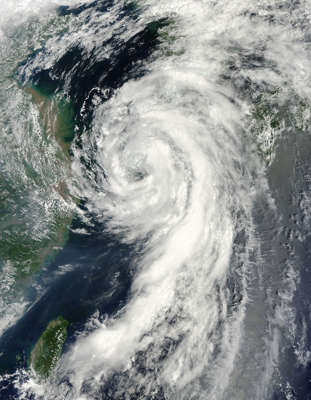
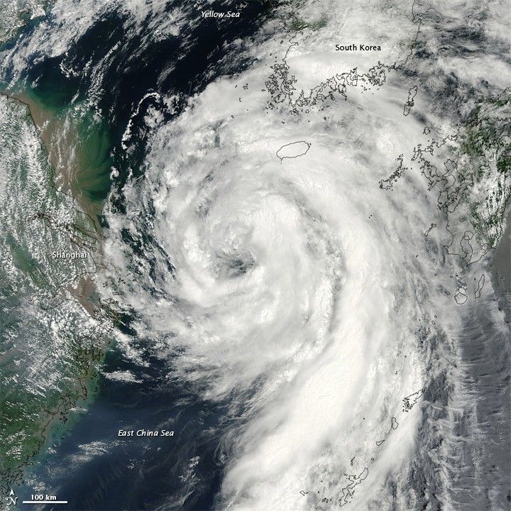
Tropical Storm Dianmu blew over the East China Sea in early August 2010, traveling slowly toward the Korean Peninsula. On August 10, 2010, the U.S. Navy’s Joint Typhoon Warning Center (JTWC) reported that Dianmu had winds of 55 knots (100 kilometers per hour) with gusts up to 70 knots (130 kilometers per hour). JTWC stated that the storm was roughly 270 nautical miles (500 kilometers) south-southwest of Seoul.
The Moderate Resolution Imaging Spectroradiometer (MODIS) on NASA’s Terra satellite captured this natural-color image on August 10. The storm, which sports a distinct eye, stretches primarily north-south, sending spiral clouds hundreds of kilometers southward over the East China Sea. Storm clouds skirt China’s eastern coast.
References & Resources
- Joint Typhoon Warning Center. (2010, August 10). Tropical Storm 05W (Dianmu) Warning. Accessed August 10, 2010.
NASA image by Jeff Schmaltz, MODIS Rapid Response Team at NASA GSFC. Caption by Michon Scott.