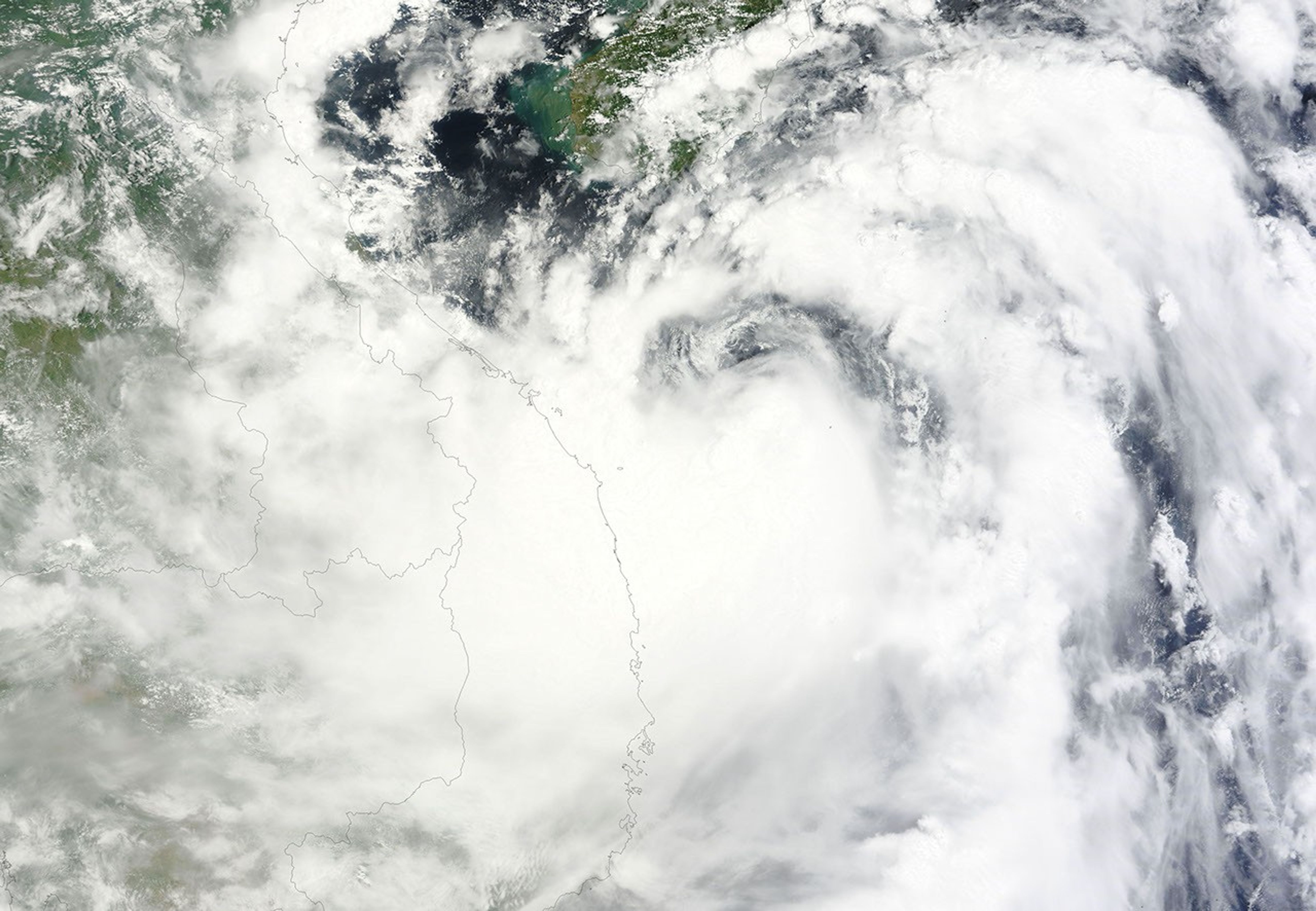
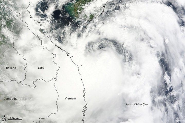
Tropical Storm Mindulle hovered over the South China Sea, off the coast of Vietnam, in late August 2010. On August 23, 2010, the U.S. Navy’s Joint Typhoon Warning Center (JTWC) reported that Mindulle had maximum sustained winds of 50 knots (95 kilometers per hour) with gusts up to 65 knots (120 kilometers per hour). The JTWC stated that Mindulle was located roughly 135 nautical miles (250 kilometers) south-southwest of Hainan, and was expected to continue its path toward the west-northwest.
The Moderate Resolution Imaging Spectroradiometer (MODIS) on NASA’s Terra satellite captured this natural-color image on August 23. Mindulle forms a giant swirl spanning hundreds of kilometers over the South China Sea, and clouds extend as far inland as Thailand.
The projected storm track released by the JTWC showed Mindulle making landfall along the coast of northern Vietnam late August 24 or early August 25, and diminishing over land.
References & Resources
- Joint Typhoon Warning Center. (2010, August 23). Tropical Storm 06W (Mindulle) Warning. Accessed August 23, 2010.
NASA image courtesy the MODIS Rapid Response Team at NASA GSFC. Caption by Michon Scott.