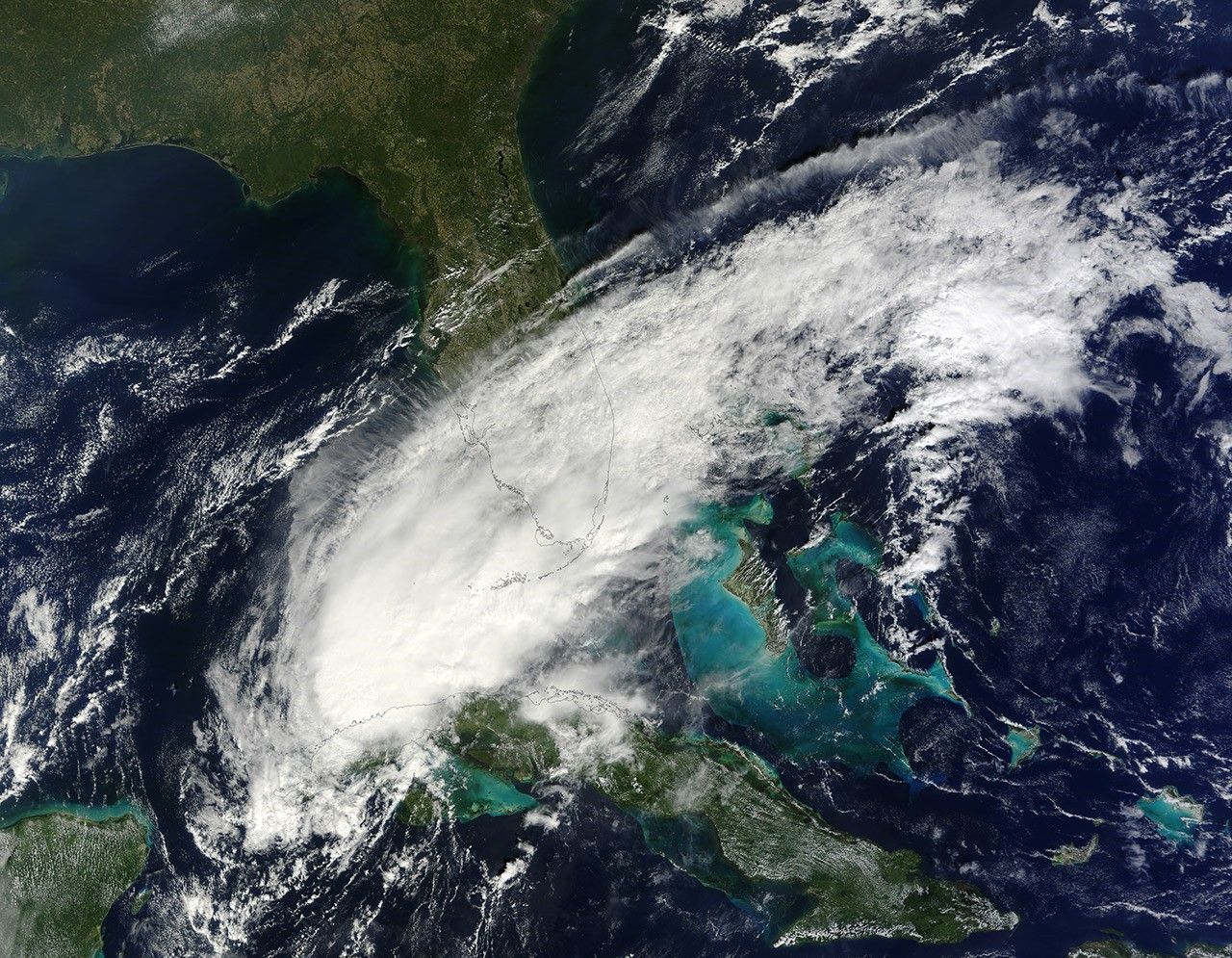
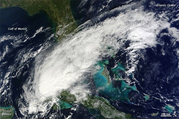
On October 14, 2010, Paula weakened to a tropical storm but still posed significant risks, including high winds, heavy rains, and storm surges. At 11:00 a.m. Eastern Daylight Time (EDT), the U.S. National Hurricane Center (NHC) reported that Paula was located roughly 110 miles (180 kilometers) west-southwest of Havana, Cuba, and had maximum sustained winds of 70 miles (110 kilometers) per hour.
The Moderate Resolution Imaging Spectroradiometer (MODIS) on NASA’s Terra satellite captured this natural-color image of Tropical Storm Paula at 12:05 p.m. EDT (16:05 UTC) on October 14, 2010. The storm stretched from the Gulf of Mexico across southern Florida to the Atlantic Ocean.
The NHC warned that tropical-storm-force winds would likely spread across Cuba, especially along the northern coast. Paula was predicted to produce up to 10 inches (25 centimeters) of rain in some places, with the potential for dangerous flash floods and landslides. In addition, forecasters were calling for a storm surge of 2 to 4 feet (0.6 to 1.2 meters) above normal tide levels.
References & Resources
- National Hurricane Center. (2010, October 14). Hurricane Paula Advisory Archive. Accessed October 14, 2010.
NASA image by Jeff Schmaltz, MODIS Rapid Response Team at NASA GSFC. Caption by Michon Scott.