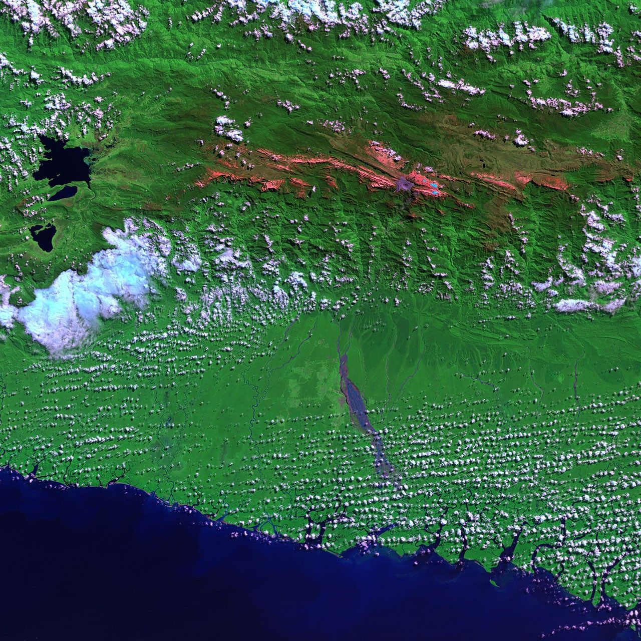
The Seven Summits are the highest peaks on each of the Earth’s seven continents.However, there is some debate about whether to countNew Zealand and Oceania (which adds the Pacific Islands and the Indonesian archipelago) in with Australia. If Oceania is considered as part of the Australian continent, then the tallest peak is Puncak Jaya, also known as Carstenz’s Pyramid. Its 4,884-meter-tall (16,024-foot) summit stands well above both Australia’sMt. Kosciuszkoand New Zealand’sAoraki/Mt. Cook. Located in thePapau province of Indonesia (formerly known as Irian Jaya), the peak is in the midst of the2,500-km-long Pegunungan Maoke, or Central Range, of the island of New Guinea. Itsanglicized name comes from the Dutch navigator Jan Carstenz who first surveyed the peak from the island’s coastline in 1623 on a rare clear day. When Indonesia took control of the province in the1960s, the peak was renamed Puncak Jaya (Victory Peak).
The first recorded climb of the mountain was in 1962 by a team led by the Austrian climber,Heinrich Harrer (of Seven Years in Tibet fame). Since then, particularly since theinterest in the Seven Summits concept,Puncak Jaya has been visited many times. It is a moderately difficult climb on the standard routeup the north face and along the summit ridge, which is all hard rock surface. The area ishighly inaccessible, requiring a 100-km hike from the nearest town with an airport—Timika—to the base camp, which usually takes about four or five days each way. A local band of guerillas, fighting to make the Papau province independent of Indonesia, are somewhat active in the area and the Freeport Copper Mine at Tembagapura is an occasional flashpoint. The guerrillas see the mine as both a sign of imperialism and a source of pollution. Thus, climbers must apply for permission to enter the area from the central government, though visitors are generally considered welcome by local residents.
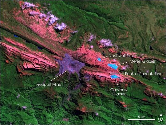
While Puncak Jaya’s peak is free of glaciers, there are several on its slopes, including theCarstensz Glacier, the Meren Glacier, and Northwall Firn (hanging glaciers). Beingequatorial, there is little variation in the mean temperature during the year (around0.5°C) and the glaciers fluctuate on a seasonal basis only slightly. However, analysisof the extent ofthese rare equatorial glaciers from historical records show significant retreat since the1850s, indicating a regional warming of around 0.6° C per century between 1850 and 1972.The glacier top of Puncak Trikora in the Pegunungan Maoke disappeared completely some timebetween 1939 and 1962. Since the 1970s, the extent of the glaciers have been monitored bysatellites, most especially the Landsat series, as the challenges to accessing the area andsurveying from the ground are so high. However, the scene above is a rare satellite acquisition that is reasonably cloud free.
This image was acquired by Landsat 7’s Enhanced Thematic Mapper Plus (ETM+) sensor onMay 29, 2003. This is a false-color image made using shortwave-infrared, near-infrared, andgreen wavelengths (ETM+ bands 7, 4, and 2). In this scheme, snow and ice appears blue whileclouds are white, bare unvegetated land such as the rocky limestone summit ridges appear redor pinkish, the deep purple and grey is the open pit copper mine while the lush rainforestof the lowlands appears green. In the large format image, runoff into the rivers south of the mine shows up in deep purple, much of which is fine debris washed downstream from the mine.
[Editor’s Note: This is the last in a series of Landsat scenes of the world’s Seven Summits.Previous peaks include Asia’sMt. Everest,North America’sDenali/Mt. McKinley,South America’sCerro Aconcugua,Antarctica’sVinson Massif,Australia’sMt. Kosciuszko,New Zealand’sAoraki/Mt. Cook,and Africa’sKilimanjaro.]
References & Resources
Image obtained from the University of Maryland Global Land Cover Facility .