


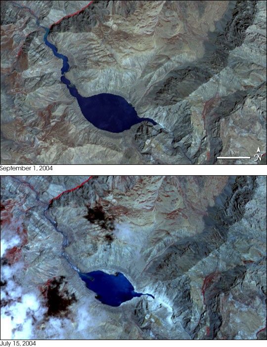
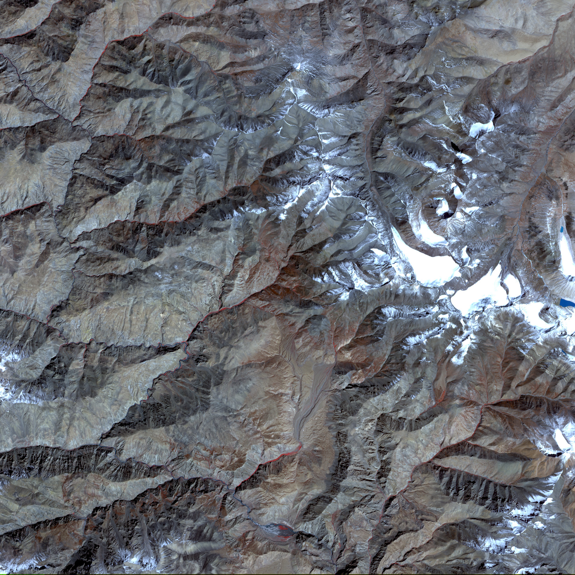
- September 1, 2004 (2.9 Mb)
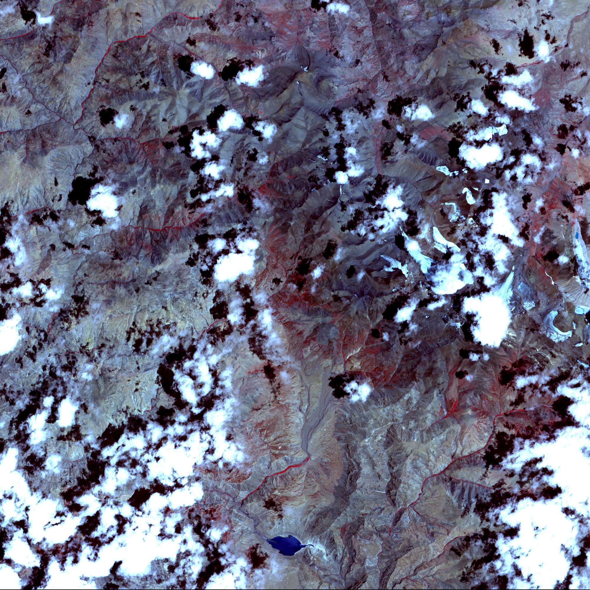
- July 15, 2004 (1.9 Mb)
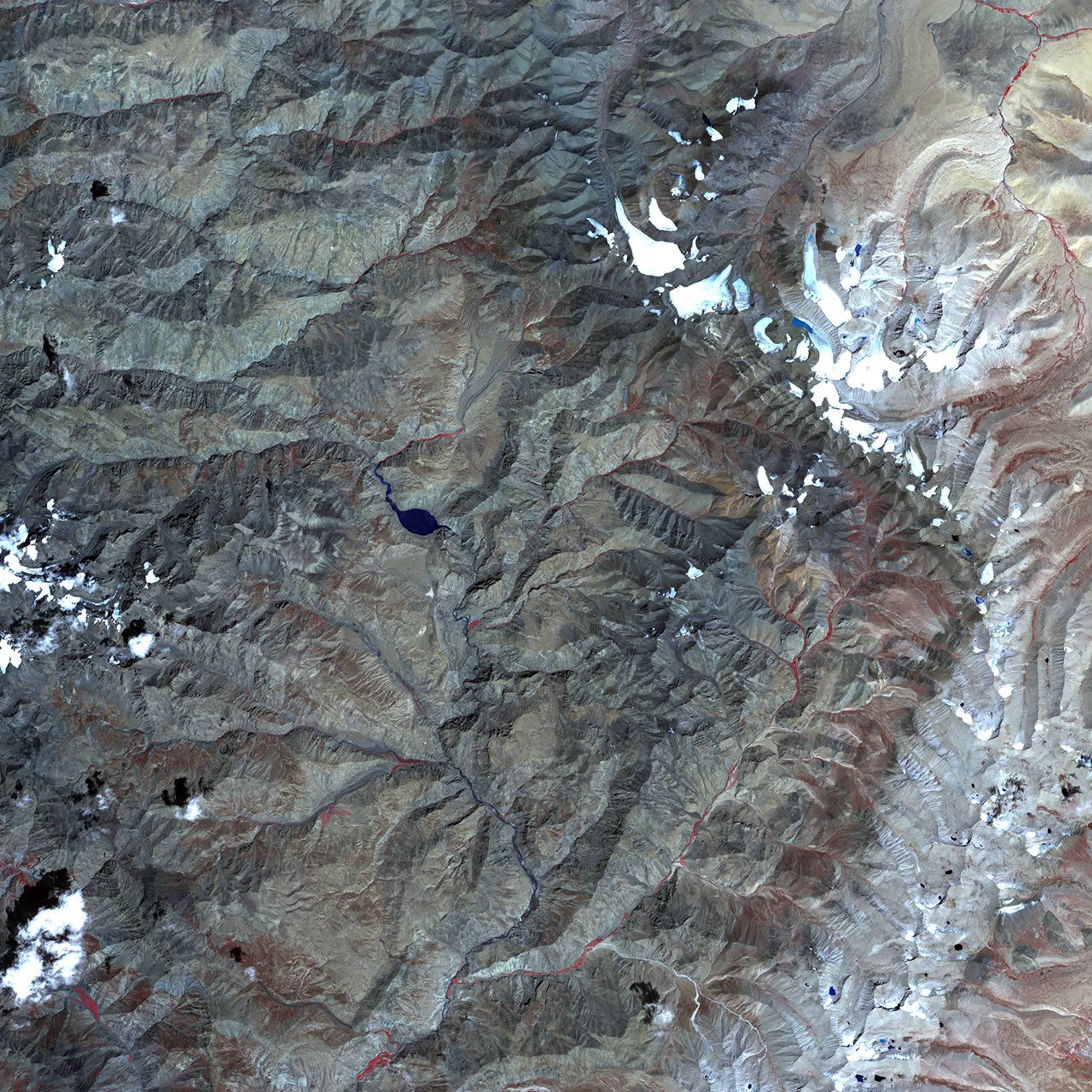
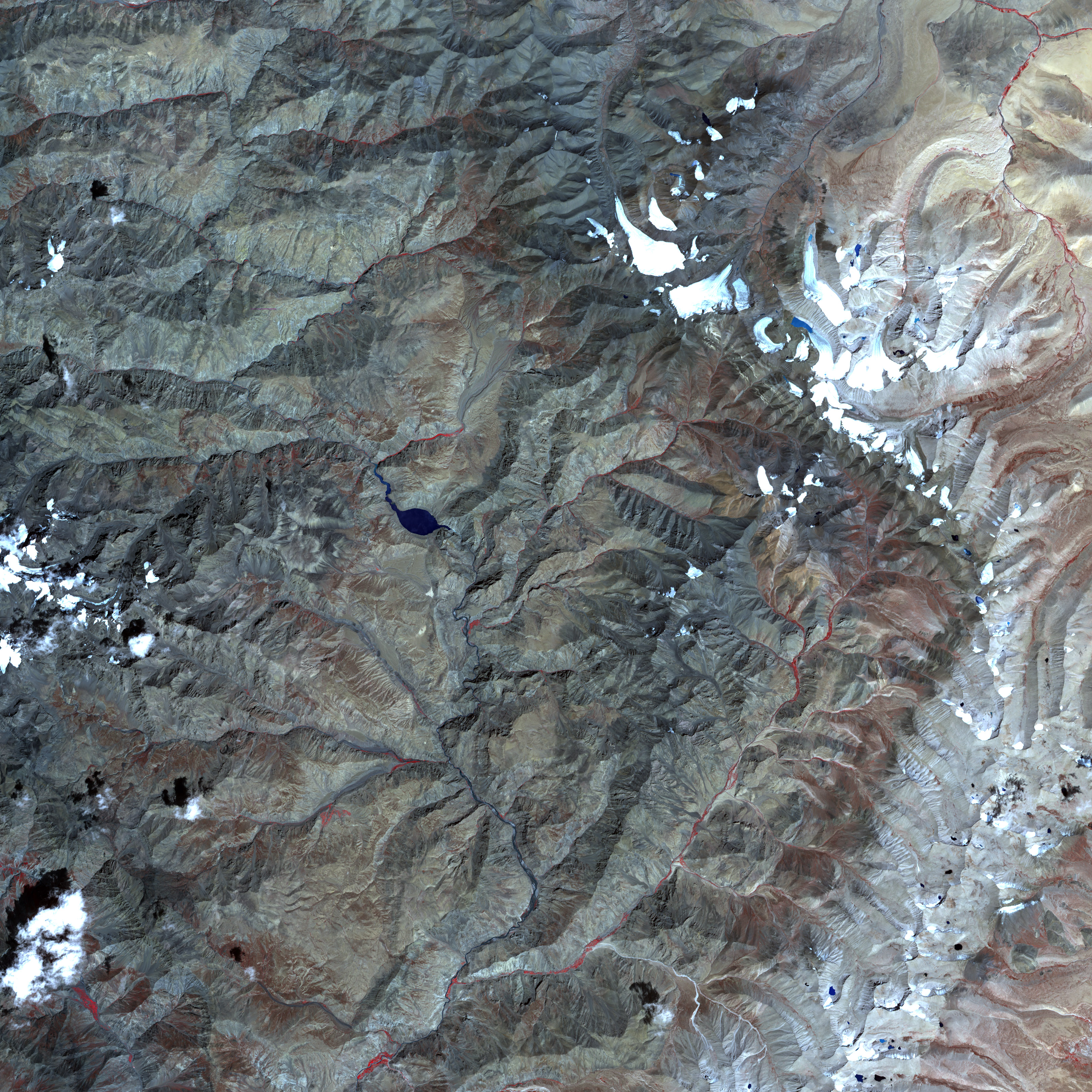
- October 1, 2003 (1.8 Mb)
Water levels in the Pareechu River in Tibet continue to build behind a natural dam, created by a landslide in the early summer. On September 1, 2004, the Advanced Spaceborne Thermal Emission and Reflection Radiometer, (ASTER) on NASA's Terra satellite captured the top image of the new lake. The discolored rings around the basin provide a nice comparison point to see just how much the lake has grown since July 15, when the lower image was taken. The water appears to have filled the basin and is building upriver in the northwest. The new lake poses a threat to communities downstream in northern India, which will be flooded if the landslide-dam bursts.
This false colour composite was created by combining near infrared, red, and green wavelengths (ASTER bands 3, 2, and 1 respectively). Both images show the lake at 15 meters per pixel. The large image acquired on October 1, 2003, shows the river before the lake formed.
References & Resources
NASA image created from data provided courtesy of NASA/GSFC/MITI/ERSDAC/JAROS, and U.S./Japan ASTER Science Team


