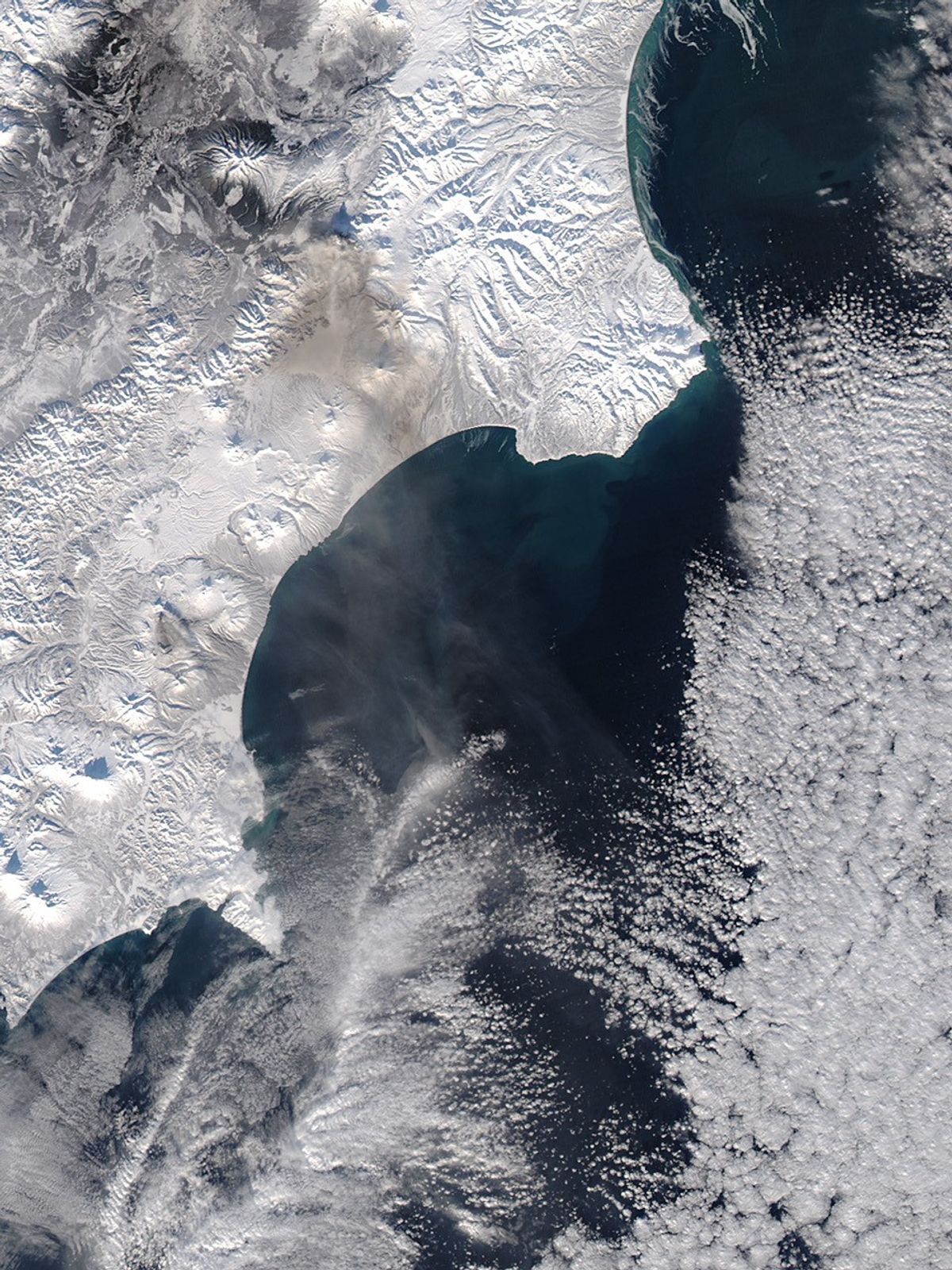
Kizimen Volcano, which erupted for the first time in 81 years in December 2010, continues to emit a steady stream of gas and ash. This natural-color satellite image shows the eruption on the afternoon of January 26, 2011. An ash plume rises directly above the volcano, to an altitude of about 11,000 feet (3,400 meters), according to the U.S. Air Force Weather Agency. The long, dark shadow of the plume points almost directly to the north. Fresh brown ash coats the snow-covered landscape south of Kizimen. Numerous other volcanoes and volcanic calderas, common on the Kamchatka Peninsula, are visible.
The image was acquired by the Moderate Resolution Imaging Spectroradiometer (MODIS) aboard NASA’s Aqua satellite.
Related Reading
- Kamchatkan Volcanic Eruption Response Team: Current Activity of Kizimen Volcano.
References & Resources
- Global Volcanism Program. (2011, January 26). Kizimen. Accessed January 27, 2011.
NASA image courtesy of the MODIS Rapid Response Team, Goddard Space Flight Center. Caption by Robert Simmon.