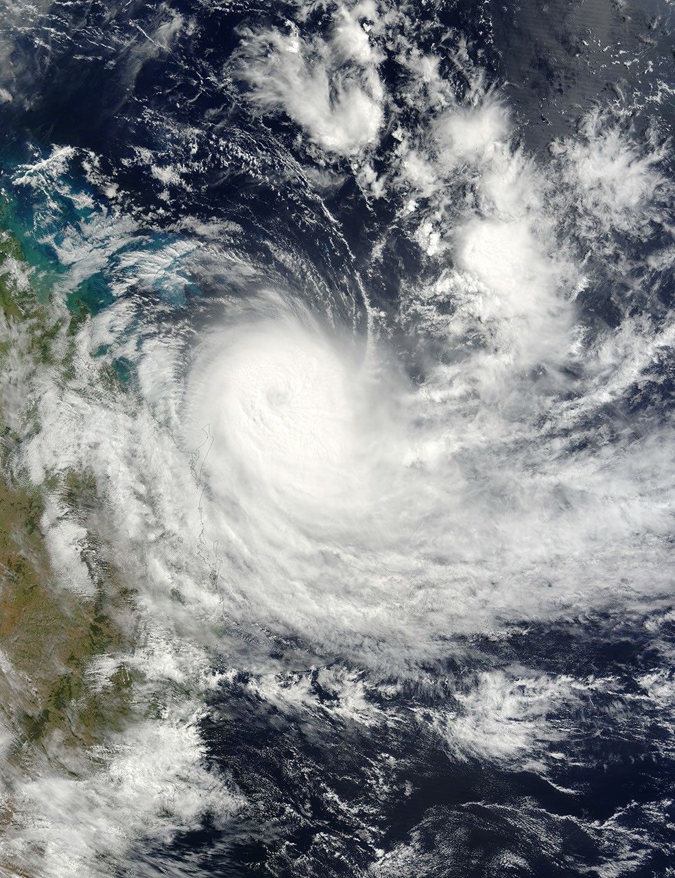
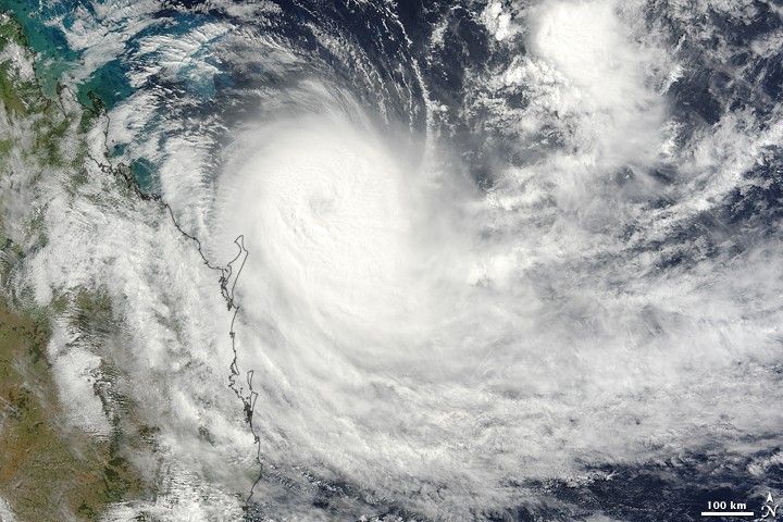
Tropical Cyclone Hamish crept a little farther southeast along the coast of Queensland, Australia, in the time that elapsed between an image of the area captured by NASA’s Aqua satellite on March 9 at 1:30 p.m. local time in Queensland and this image of the storm captured by the Terra satellite the next morning at 9:50 a.m. (March 9, 23:50 UTC). The eye of the storm was northeast of Fraser Island, which is about 300 kilometers north of Queensland’s capital and largest city, Brisbane. At the time the image was taken, Hamish was in the process of weakening from a Category 3 to a Category 2 storm.
The high-resolution image provided above is at MODIS’ full spatial resolution (level of detail) of 250 meters per pixel. The MODIS Rapid Response System provides this image at additional resolutions.
References & Resources
NASA image by Jeff Schmaltz, MODIS Rapid Response Team, Goddard Space Flight Center.