March 18, 2009
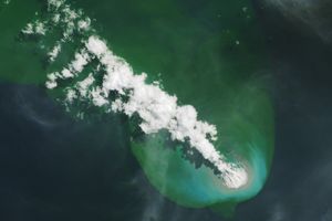
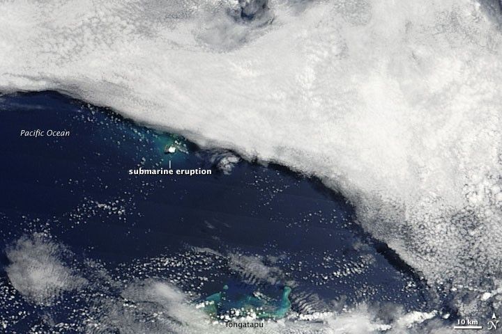
A submarine volcanic eruption in the Tonga Islands remained visible when the Moderate Resolution Imaging Spectroradiometer (MODIS) on NASA’s Terra satellite passed overhead on March 18, 2009. In this image, the eruption appears as a blue-green blur in the ocean water. Overhead, a bright white puff likely results from volcanic vapor. A bank of thick clouds obscures the northeastern portion of the eruption site.
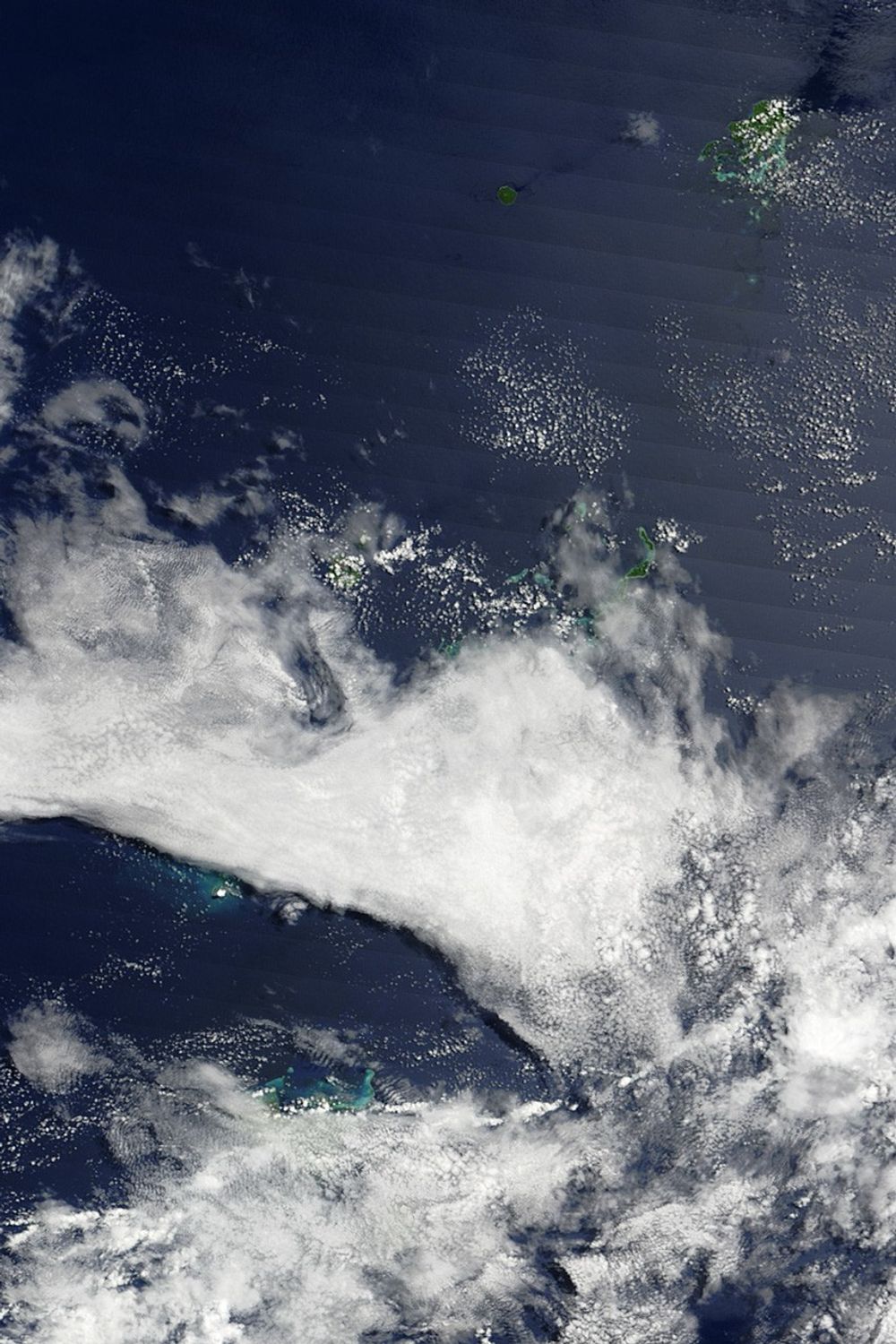
The Tonga Islands occur along the Ring of Fire—a perimeter of heightened volcanic and seismic activity that traces the outline of the Pacific Ocean basin. Undersea eruptions have occurred in this area before, including an eruption in August 2006.
Links
- BBC. (2009, March 20). South Pacific volcano inspected. Accessed March 20, 2009.
References & Resources
- Associated Press. (2009, March 19). Tongan inspectors head to undersea volcano. Accessed March 19, 2009.
- CBS News. (2009, March 19). Undersea volcano making waves in the Pacific. Accessed March 20, 2009.
- The Volcanism Blog. (2009, March 20). Hunga Tonga-Hunga Ha’apai update, 20 March 2009. Accessed March 20, 2009.
NASA images by Jeff Schmaltz, MODIS Rapid Response Team. Caption by Michon Scott.