
As metropolitan areas expand in both physical area and population, they typically aggregate to form economically, politically and, to some extent, socially linked entities known as conurbations. The term “megalopolis” has also been used.
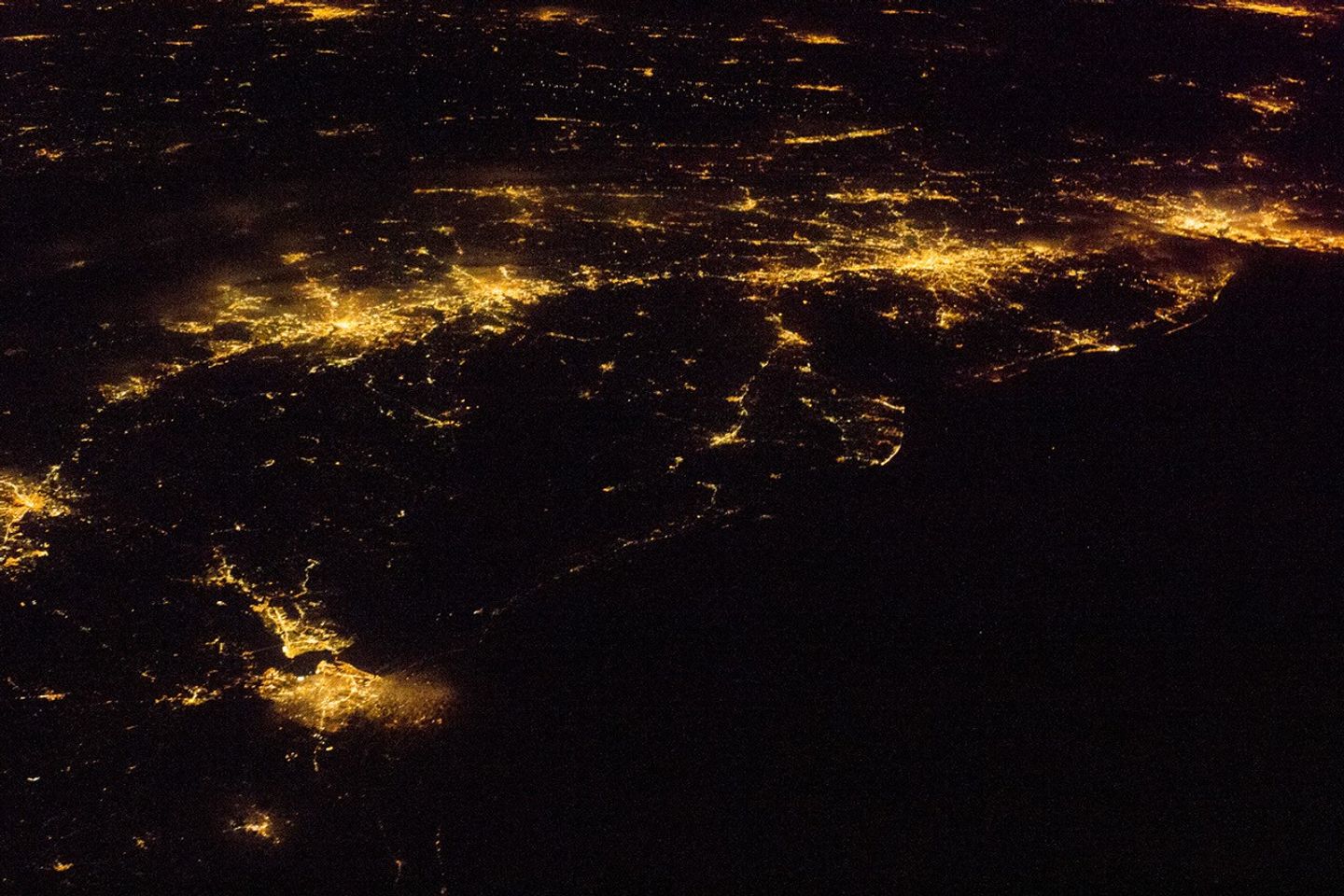
One of the largest conurbations in the world is located along East Coast of the United States, and has been termed the Atlantic Seaboard Conurbation (ASC). The ASC extends over 1,000 kilometers (600 miles) and includes the major economic, governmental, and cultural centers of Boston, Massachusetts; New York, New York; Philadelphia, Pennsylvania; Baltimore, Maryland; and Washington, District of Columbia.
This astronaut photograph includes every metropolitan area in the ASC except for Boston (located off the image to the northeast). This night image highlights the position and extent of each metropolitan area through urban lighting patterns. The establishment and growth of the conurbation was facilitated by transportation networks—railroads, highways, and air travel routes—for the transfer of goods, materials, and population between the cities.
Two other large metropolitan areas are visible in the image—Norfolk and Richmond, Virginia, at image lower left—but neither is considered part of the ASC. In contrast to the city lights along the sea coast and interior, the Atlantic Ocean appears as a featureless dark region filling the lower right quarter of the image.
References & Resources
Astronaut photograph ISS027-E-20129 was acquired on April 6, 2011, with a Nikon D3S digital camera using an 80 mm lens, and is provided by the ISS Crew Earth Observations experiment and Image Science & Analysis Laboratory, Johnson Space Center. The image was taken by the Expedition 27 crew. The image has been cropped and enhanced to improve contrast. Lens artifacts have been removed. The International Space Station Program supports the laboratory as part of the ISS National Lab to help astronauts take pictures of Earth that will be of the greatest value to scientists and the public, and to make those images freely available on the Internet. Additional images taken by astronauts and cosmonauts can be viewed at the NASA/JSC Gateway to Astronaut Photography of Earth. Caption by William L. Stefanov, NASA-JSC.