![Request for Information – Potential [Placeholder for Prize]](https://assets.science.nasa.gov/dynamicimage/assets/science/missions/a-step/FFR_Earth_Background_20251120%20.png?w=1024)


Until last weekend, the Nabro volcano in northeast Africa looked like it does in the image above. Then, on the night of June 12, 2011, the stratovolcano erupted for the first time in recorded history. It spewed ash and large amounts of sulfur dioxide gas—the highest levels ever detected from space, according to preliminary estimates from researchers at NASA's Goddard Space Flight Center.
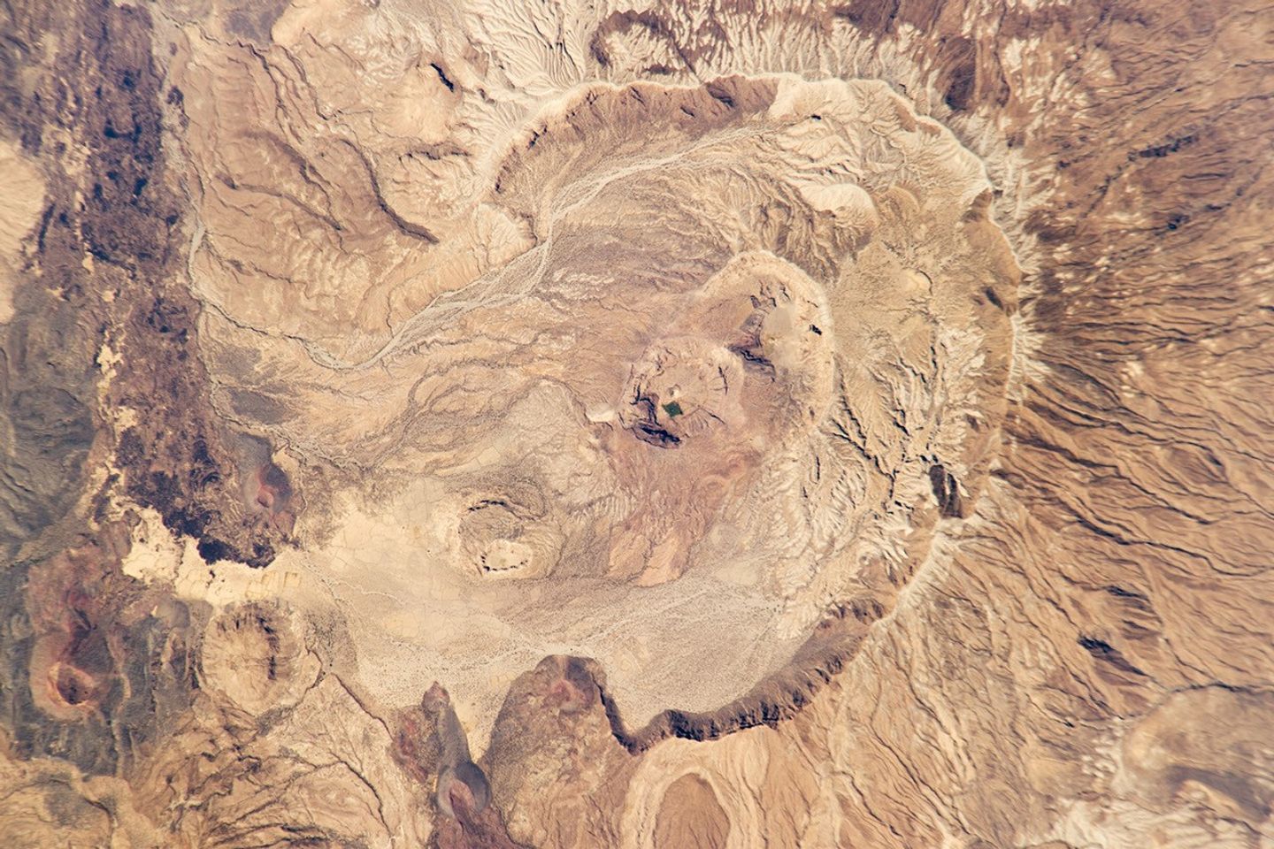
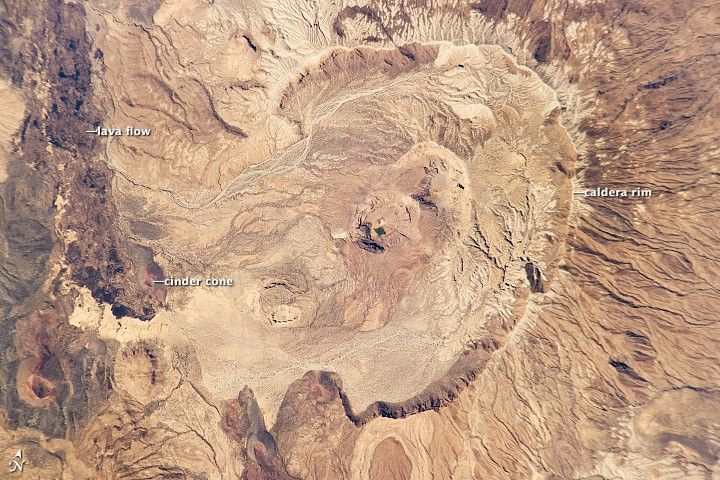
Astronauts on the International Space Station snapped this digital photograph of Nabro in January 2011, when all was still quiet. The horseshoe-shaped caldera stretches 8 kilometers (5 miles) in diameter and opens to the southwest. Two smaller calderas lie within the larger one. Gullies and channels scar the outer flanks, signs of many years of runoff. The inner edge of the caldera has steep cliffs, some as high as 400 meters.
Located in Eritrea near the border with Ethiopia, Nabro is part of larger double-caldera structure with the Mallahle volcano to the southwest. Both volcanoes were built, like Kilimanjaro, from trachyte lavas, and later filled by eruptions of ignimbrite. Research suggests that both calderas may have formed around the same time. The volcanic range has been “virtually undocumented,” according to researchers.
As of June 18, the volcano was still erupting, though less effusively than a week ago. The ash cloud has periodically disrupted air traffic in North Africa and parts of the eastern Mediterranean. Ash plumes were reported as far as the Central African Republic, Israel, and Turkmenistan.
References & Resources
- Global Volcanism Program (n.d.) Nabro. Accessed June 19, 2011.
- Irish Weather Online (2011, June 18) Satellite Image Shows Nabro Volcano Eruption Is Ongoing. Accessed June 19, 2011.
- Wiart, P., and Oppenheimer, C. (2005) Large magnitude silicic volcanism in north Afar: the Nabro Volcanic Range and Ma'alalta volcano. Bulletin of Volcanology, 67:99ââ¬â115.
Astronaut photograph ISS026-E-23526 was acquired on January 30, 2011, with a Nikon D3S digital camera using an 800 mm lens, and is provided by the ISS Crew Earth Observations experiment and Image Science & Analysis Laboratory, Johnson Space Center. The image was taken by the Expedition 26 crew. The image has been cropped and enhanced to improve contrast. Lens artifacts have been removed. The International Space Station Program supports the laboratory as part of the ISS National Lab to help astronauts take pictures of Earth that will be of the greatest value to scientists and the public, and to make those images freely available on the Internet. Additional images taken by astronauts and cosmonauts can be viewed at the NASA/JSC Gateway to Astronaut Photography of Earth. Caption by Michael Carlowicz.