![Request for Information – Potential [Placeholder for Prize]](https://assets.science.nasa.gov/dynamicimage/assets/science/psd/solar/2023/09/s/solarsystem_0.jpg?w=1024)


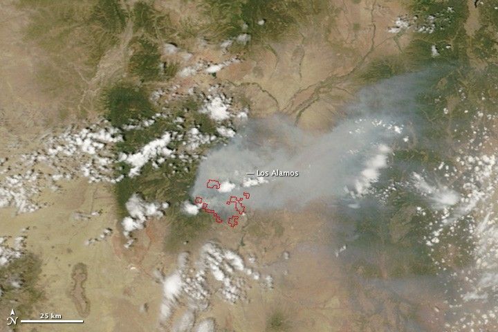
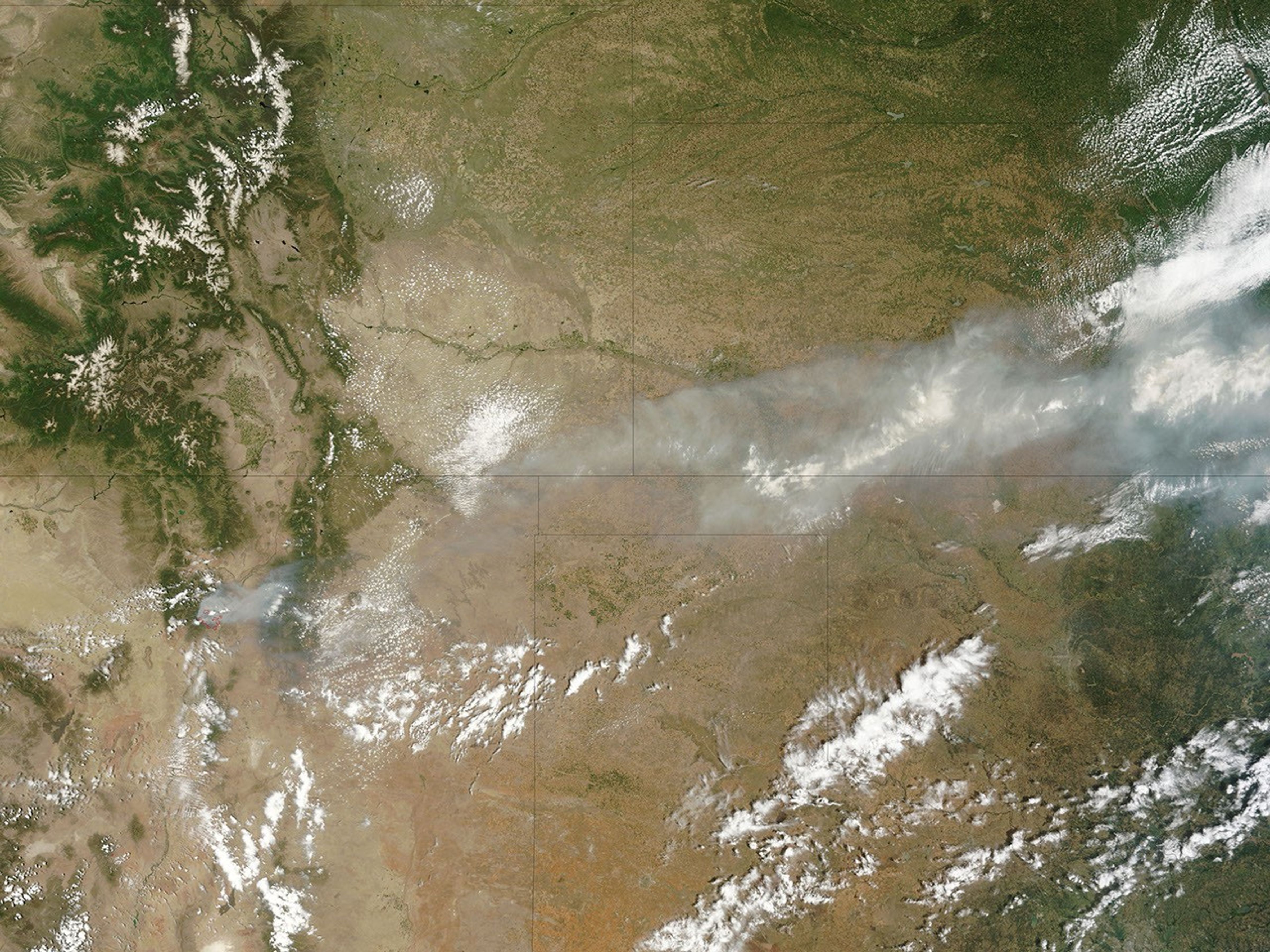
The Las Conchas Fire, burning southwest of Los Alamos, New Mexico, continued to spread on June 27, 2011. The Moderate Resolution Imaging Spectroradiometer (MODIS) on the Terra satellite acquired this image at 11:40 a.m. local time.
Active fire locations are outlined in red. The fire bathed Los Alamos and the Rio Grande Valley to the east with thick smoke. The large image, which includes a wider area, shows the dense smoke extending northeast over Texas and Kansas.
By the end of the day on June 27, the Las Conchas Fire had burned 43,597 acres (17,643 hectares) since starting around 1:00 p.m. on June 26. The fire burned within a mile of the Los Alamos National Laboratory, but had not entered the lab. The lab and nearby Bandelier National Monument are closed, and the city of Los Alamos, Cochiti Mesa, and Las Conchas have been evacuated.
References & Resources
- InciWeb. (2011, June 28). Las Conchas Wildfire. Accessed June 28, 2011.
NASA image courtesy Jeff Schmaltz, MODIS Rapid Response Team at NASA GSFC. Caption by Holli Riebeek.