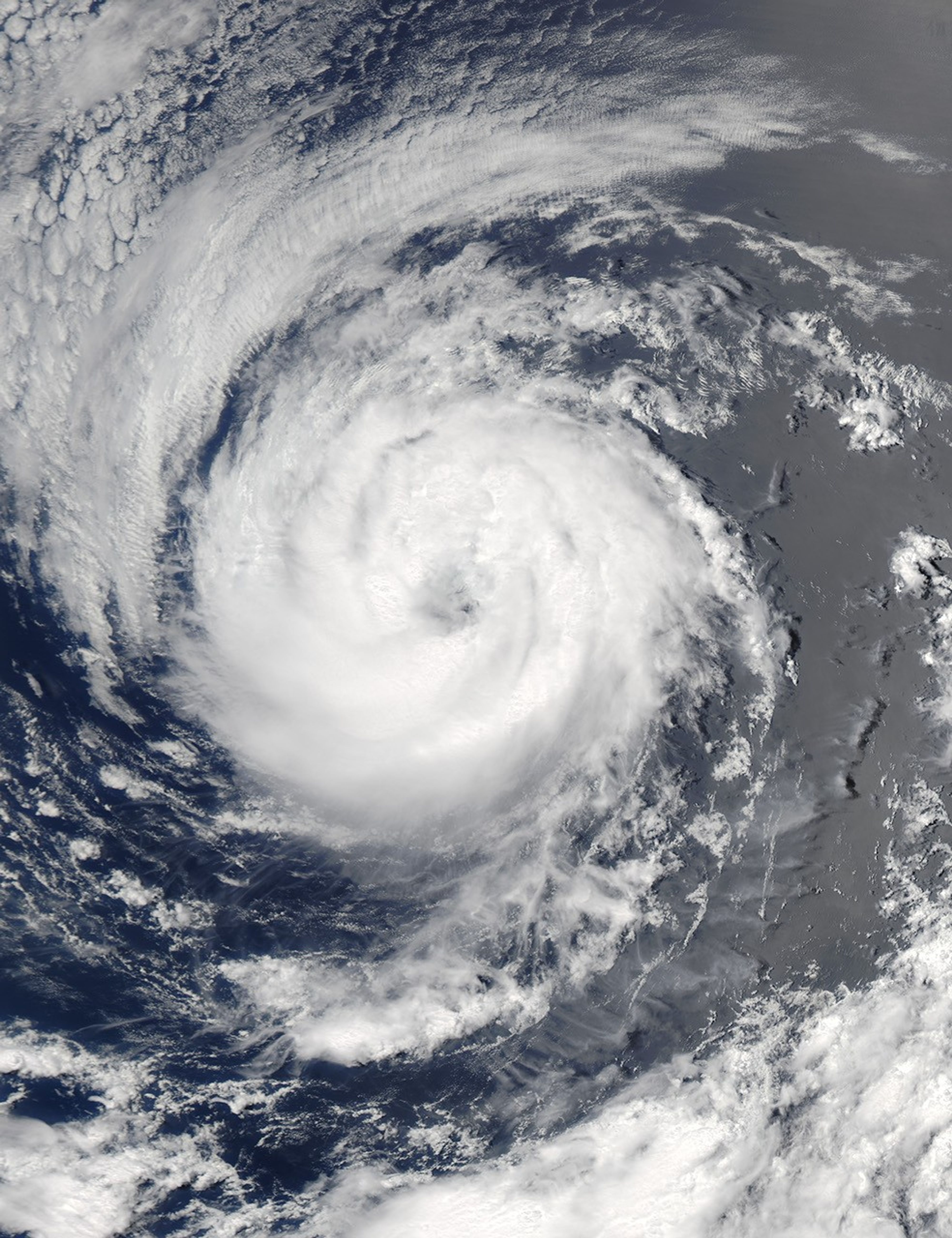


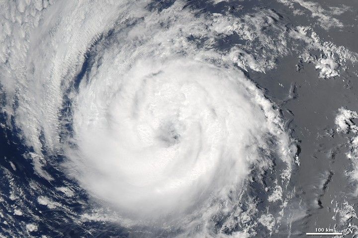
Tropical Storm Guillermo was just under hurricane strength when the Moderate Resolution Imaging Spectroradiometer (MODIS) on NASA’s Aqua satellite captured this image at 2:15 p.m. Pacific Daylight Time (21:15 UTC) on August 13, 2009. Guillermo formed on August 12 about 1,085 kilometers (675 miles) southwest of the southern tip of Baja California over the Pacific Ocean. By late on August 13, when this image was taken, Guillermo had winds of 110 kilometers per hour (70 miles per hour) and was moving west at 24 km/hr (15 mph). The storm reached hurricane status early on August 14, but was forecast to weaken as it continued to move west, said the National Hurricane Center.
The high-resolution image provided above is at MODIS’ full spatial resolution (level of detail) of 250 meters per pixel. The MODIS Rapid Response System provides this image at additional resolutions.
References & Resources
- National Hurricane Center. (2009, August 14). Hurricane Guillermo Advisory Archive. National Ocean and Atmospheric Administration National Weather Service. Accessed August 14, 2009.
NASA image by Jeff Schmaltz, MODIS Rapid Response Team, Goddard Space Flight Center. Caption by Holli Riebeek.