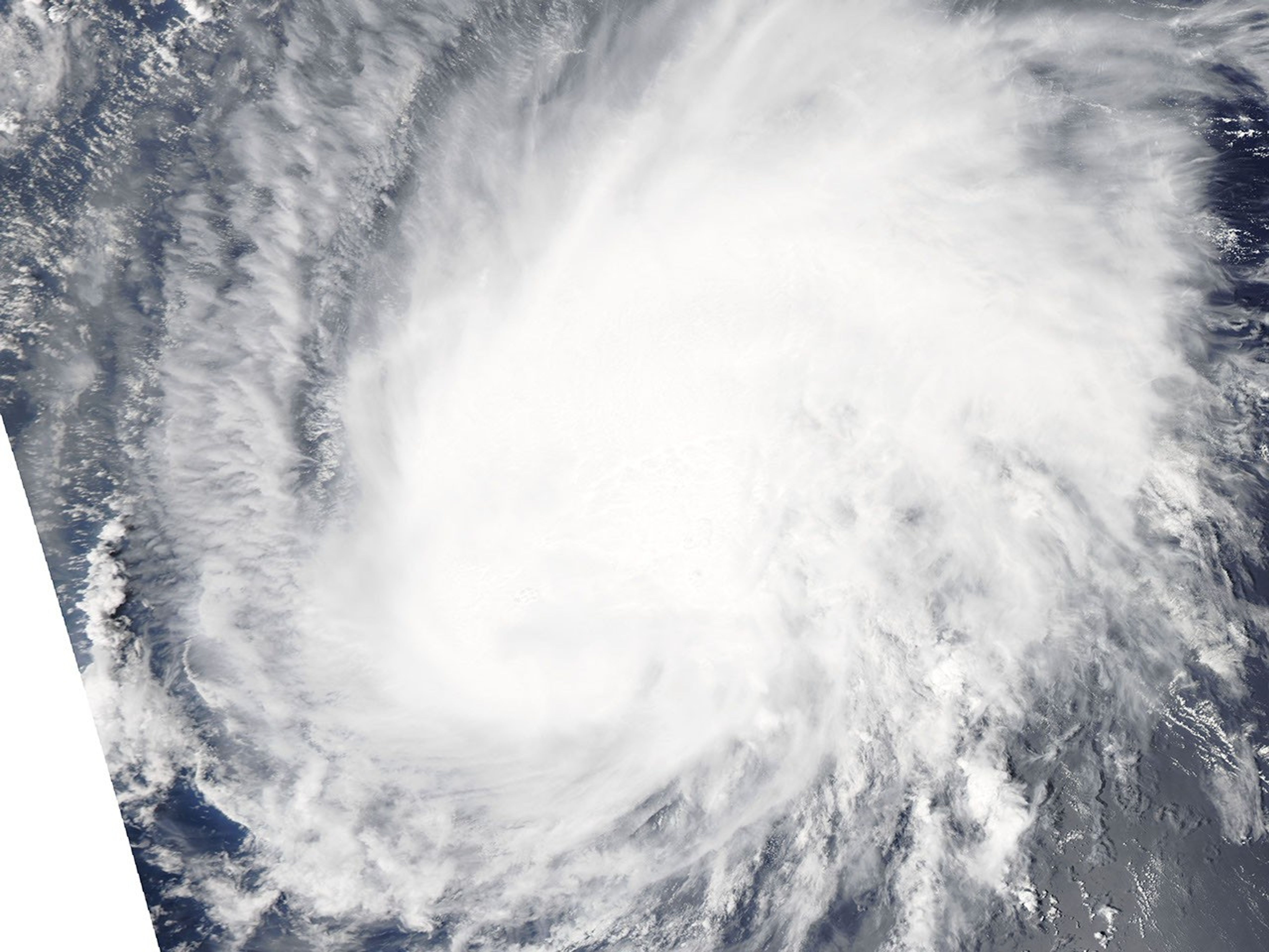
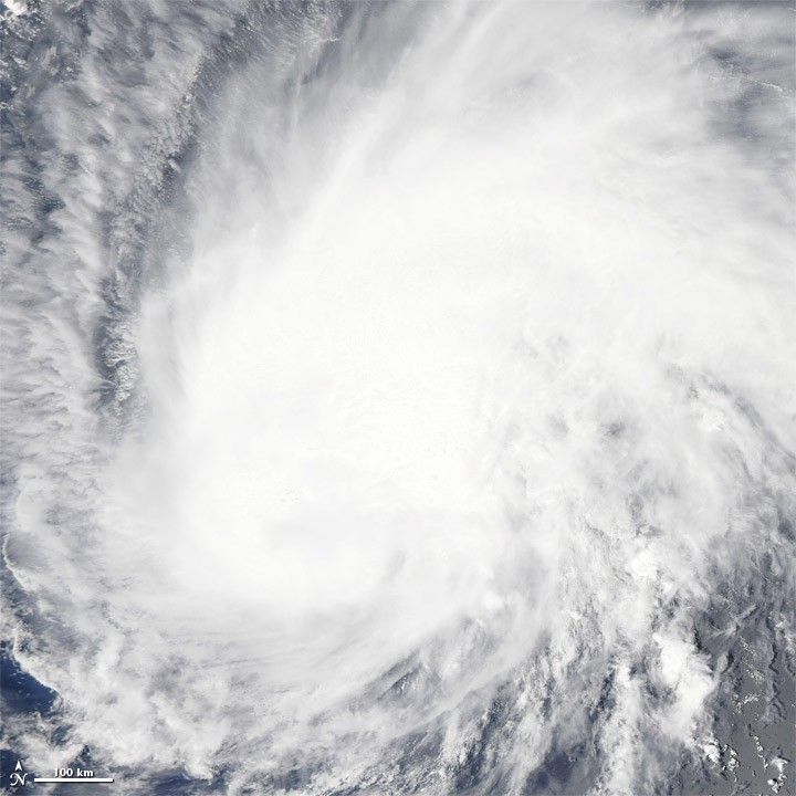
Katia initially formed as Tropical Depression Twelve south of Cape Verde on August 29, 2011. By September 2, 2011, the storm had crossed the Atlantic Ocean and strengthened to a Category 1 hurricane. At 11:00 a.m. Atlantic Standard Time (AST) on September 2, the U.S. National Hurricane Center (NHC) reported that Katia had winds of 75 miles (120 kilometers) per hour with higher gusts.
The Moderate Resolution Imaging Spectroradiometer (MODIS) on NASA’s Aqua satellite captured this natural-color image at 12:25 p.m. AST on September 2. Katia swirls over the water east of the Leeward Islands. Although the hurricane lacks a distinct eye, it sports the spiral shape characteristic of strong storms.
Five-day projections released by the NHC on September 2 showed Katia traveling in the general direction of the U.S. East Coast, which was still recovering from Hurricane Irene.
References & Resources
- National Hurricane Center. (2011, September 2). Hurricane Katia Advisory Archive. Accessed September 2, 2011.
NASA image courtesy MODIS Rapid Response Team, Goddard Space Flight Center. Caption by Michon Scott.