


![Request for Information – Potential [Placeholder for Prize]](https://assets.science.nasa.gov/dynamicimage/assets/science/missions/a-step/FFR_Earth_Background_20251120%20.png?w=1024)


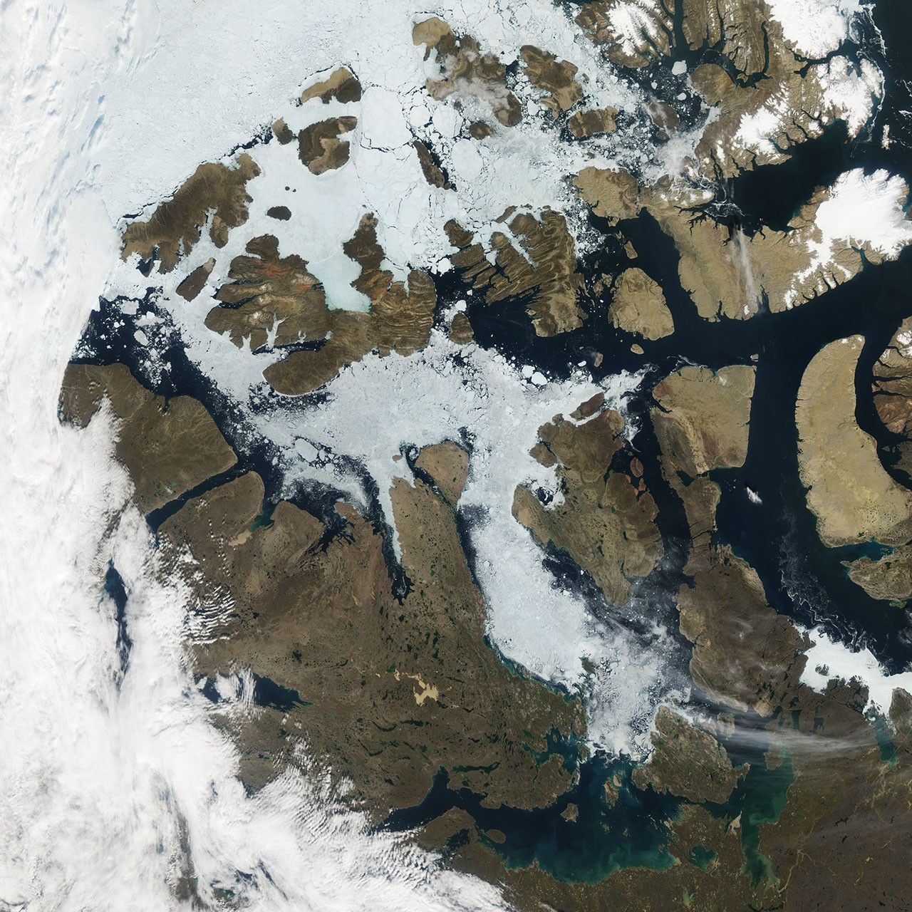
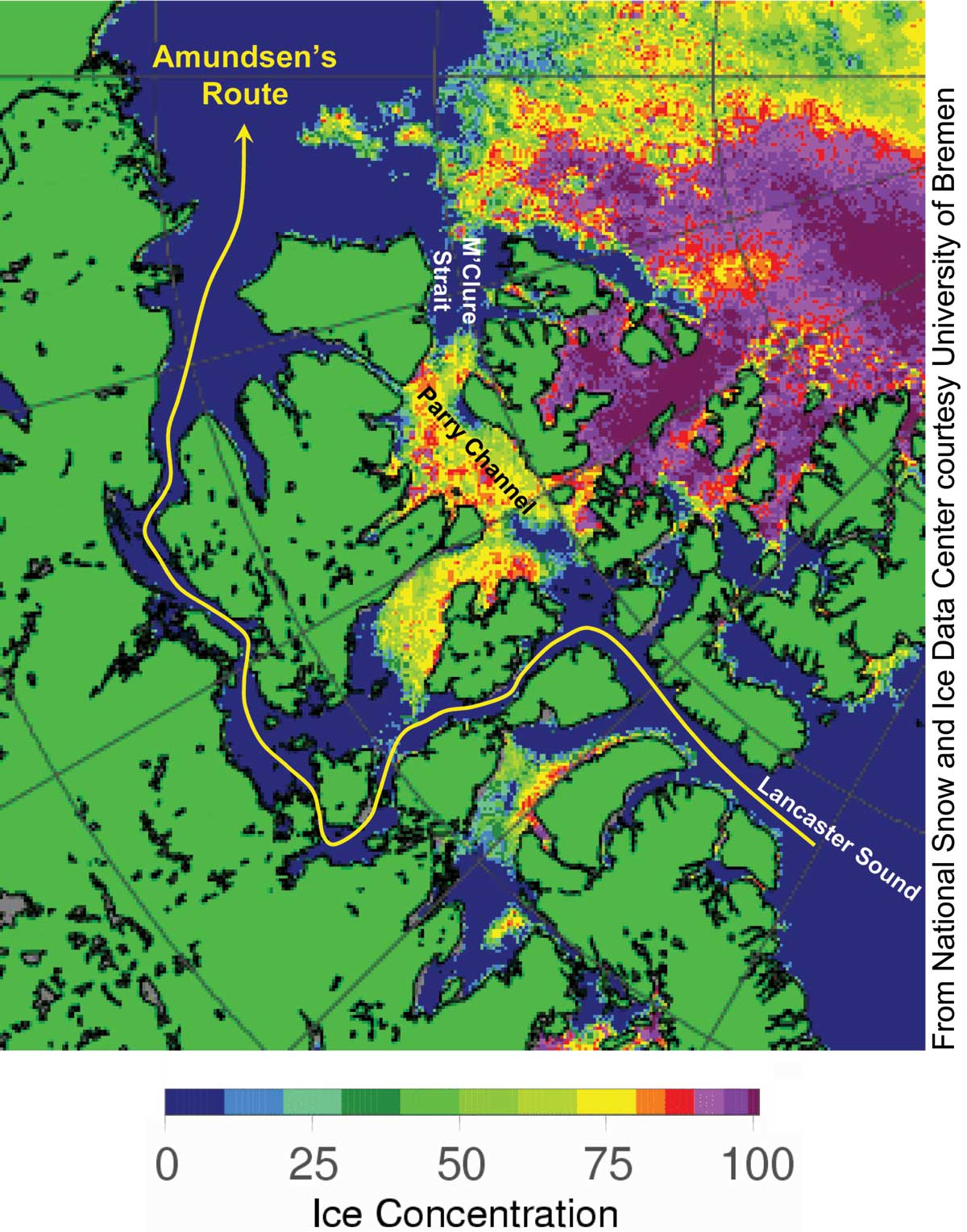
In late August 2009, ice clogged some but not all of the Northwest Passage, and snow had retreated from most of the islands in the Canadian Arctic Archipelago. The Moderate Resolution Imaging Spectroradiometer (MODIS) on NASA’s Aqua satellite caught this rare cloud-free view of the archipelago on August 27, 2009. Although Parry Channel appears partially ice free, especially in the east, sea ice spans most of McClure Strait, blocking the northern, or preferred, route through the Northwest Passage. The southern route, however, which Roald Amundsen followed from 1903 to 1906, appears open. Amundsen navigated around the southern perimeter of King William Island, passing through a narrow strait on his way westward.
Snow-free land surfaces allow a view of the islands’ topography. While the western end of Baffin Island appears flat and almost featureless, dramatic stripes cross Bathurst Island in the northwest. These approximately east-west stripes result from layers of exposed bedrock, likely tilted by a mountain-building event in the mid-Mesozoic Era. Snow-free landmasses vary in color from beige to brown. Cold temperatures, persistent snow cover, and short growing seasons limit tree growth so far north, leaving the islands coated with tundra.
The northern, or preferred, route through the Northwest Passage has been navigable a few times, and it appeared wide open in satellite imagery in 2007. The route that Amundsen followed has opened periodically since the turn of the twenty-first century.
References & Resources
- National Snow and Ice Data Center. (2008, August 11). Sea ice decline accelerates, Amundsen’s Northwest Passage opens. Accessed September 1, 2009.
- Wikipedia. (2009, August 12). Arctic Cordillera. Accessed September 1, 2009.
NASA image created by Jesse Allen, using data provided courtesy of the MODIS Rapid Response team. Caption by Michon Scott based on image interpretation by Walt Meier and Ted Scambos, National Snow and Ice Data Center.


